Property Record
515 N Nellis Blvd, Las Vegas, NV 89110
NEARBY LISTINGS FOR SALE OR LEASE
Property Detail
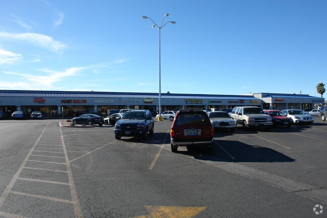
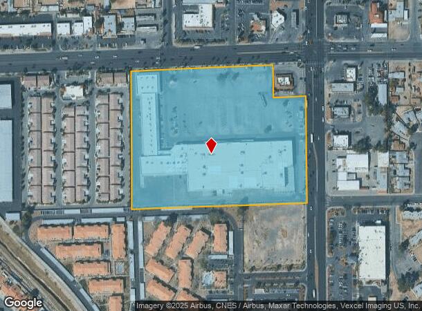
515 N Nellis Blvd
Las Vegas
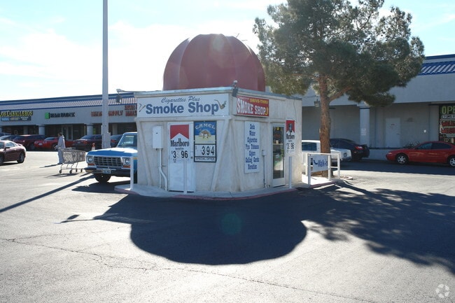
Sunrise Mountain Plaza
Las Vegas-Henderson-Paradise, NV
SUNRISE MOUNTAIN PLAZA PLAT BOOK 169 PAGE 64 LOT 1
140-32-518-001
Clark
Storebuilding
Nevada
2024
1
2025
11.13 AC
000517
Northeast Las Vegas
175,509 SF
DEMOGRAPHICS near 515 N Nellis Blvd
1 Mile
3 Mile
5 Mile
2024 Total Population
25,916
213,925
429,784
2029 Population
27,656
228,447
459,224
Pop Growth 2024-2029
+ 6.71%
+ 6.79%
+ 6.85%
Average Age
34
36
36
2024 Total Households
7,655
68,237
143,324
HH Growth 2024-2029
+ 6.65%
+ 6.79%
+ 6.88%
Median Household Inc
$41,009
$42,699
$42,120
Avg Household Size
3.30
3.00
2.90
2024 Avg HH Vehicles
2.00
2.00
2.00
Median Home Value
$248,017
$241,401
$248,558
Median Year Built
1986
1987
1984
Nearby Places
Map Layers
Map Styles
 Street
 Aerial
- Restaurants
- Banks
- Shops
- Fitness
- Groceries
PUBLIC TRANSPORTATION
AIRPORT
Harry Reid International
DRIVE
WALK
Distance
Harry Reid International
19 min
12.0 mi
Boulder City Municipal
DRIVE
WALK
Distance
Boulder City Municipal
34 min
23.2 mi
Freight Ports
Port of Long Beach
DRIVE
WALK
Distance
Port of Long Beach
325 min
290.3 mi
Nearby Properties
Address
Land Use
TOTAL SIZE
Lot Size
Zoning
Address
Land Use
TOTAL SIZE
Lot Size
Zoning
345,133 SF
27.01 AC
H1
Address
Land Use
TOTAL SIZE
Lot Size
Zoning
35.95 AC
PF
Address
Land Use
TOTAL SIZE
Lot Size
Zoning
67,649 SF
13.42 AC
CV
Address
Land Use
TOTAL SIZE
Lot Size
Zoning
29.35 AC
CV
Address
Land Use
TOTAL SIZE
Lot Size
Zoning
15.95 AC
PF
Address
Land Use
TOTAL SIZE
Lot Size
Zoning
43.25 AC
PF
Address
Land Use
TOTAL SIZE
Lot Size
Zoning
20.91 AC
PF
Address
Land Use
TOTAL SIZE
Lot Size
Zoning
1,008 SF
31.47 AC
PF
Address
Land Use
TOTAL SIZE
Lot Size
Zoning
58,188 SF
20.04 AC
L:C-V
Address
Land Use
TOTAL SIZE
Lot Size
Zoning
339,280 SF
18.19 AC
Address
Land Use
TOTAL SIZE
Lot Size
Zoning
4.34 AC
RE
Address
Land Use
TOTAL SIZE
Lot Size
Zoning
19.30 AC
RE
Address
Land Use
TOTAL SIZE
Lot Size
Zoning
7,908 SF
24.13 AC
R4
Address
Land Use
TOTAL SIZE
Lot Size
Zoning
223,422 SF
18.21 AC
R3
Address
Land Use
TOTAL SIZE
Lot Size
Zoning
9,044 SF
8.62 AC
Address
Land Use
TOTAL SIZE
Lot Size
Zoning
2,926 SF
19.73 AC
R3
Address
Land Use
TOTAL SIZE
Lot Size
Zoning
3,183 SF
18.35 AC
R3
Address
Land Use
TOTAL SIZE
Lot Size
Zoning
307,997 SF
14.01 AC
Address
Land Use
TOTAL SIZE
Lot Size
Zoning
3,424 SF
14.53 AC
R3
Address
Land Use
TOTAL SIZE
Lot Size
Zoning
9.11 AC
PF
Address
Land Use
TOTAL SIZE
Lot Size
Zoning
11.69 AC
CV
Address
Land Use
TOTAL SIZE
Lot Size
Zoning
321,292 SF
16.67 AC
R3
Address
Land Use
TOTAL SIZE
Lot Size
Zoning
8.87 AC
PF
Address
Land Use
TOTAL SIZE
Lot Size
Zoning
231,434 SF
20.31 AC
M
Address
Land Use
TOTAL SIZE
Lot Size
Zoning
8.39 AC
CV
Address
Land Use
TOTAL SIZE
Lot Size
Zoning
11.81 AC
RE
Address
Land Use
TOTAL SIZE
Lot Size
Zoning
4,236 SF
0.61 AC
R4
Address
Land Use
TOTAL SIZE
Lot Size
Zoning
5,425 SF
14.38 AC
C:R-4
Address
Land Use
TOTAL SIZE
Lot Size
Zoning
2,689 SF
11.72 AC
R4
Address
Land Use
TOTAL SIZE
Lot Size
Zoning
3,012 SF
12.80 AC
R3
The World's #1 Commercial Real Estate Marketplace
Connect with us
© 2026 CoStar Group
The information above has been obtained from sources believed reliable. While we do not doubt its accuracy we have not verified it and make no guarantee, warranty or representation about it. It is your responsibility to independently confirm its accuracy and completeness. Any projections, opinions, assumptions, or estimates used are for example only and do not represent the current or future performance of the property. The value of this transaction to you depends on tax and other factors which should be evaluated by your tax, financial, and legal advisors. You and your advisors should conduct a careful, independent investigation of the property to determine to your satisfaction the suitability of the property for your needs.