Property Record
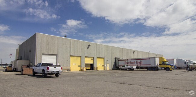
5150 Midland Rd, Billings, MT 59101


NEARBY LISTINGS FOR SALE OR LEASE
Property Detail
5150 Midland Rd
03-0927-17-1-01-01-0000
Pinyon Subd
Industrialgeneral
PINYON SUBD, S17, T01 S, R26 E, BLOCK 1, LOT 1 - 2
X
Yellowstone
30111C1460E
Montana
2024
1-2
2025
7.56 AC
000901
Other Market Areas
93,730 SF
Billings, MT
DEMOGRAPHICS near 5150 Midland Rd
1 Mile
3 Mile
5 Mile
2024 Total Population
3,702
53,225
94,051
2029 Population
4,023
57,587
101,852
Pop Growth 2024-2029
+ 8.67%
+ 8.20%
+ 8.29%
Average Age
37
40
41
2024 Total Households
1,563
23,256
40,722
HH Growth 2024-2029
+ 8.83%
+ 8.37%
+ 8.48%
Median Household Inc
$64,200
$58,666
$65,952
Avg Household Size
2.30
2.20
2.20
2024 Avg HH Vehicles
2.00
2.00
2.00
Median Home Value
$284,465
$242,608
$286,972
Median Year Built
2002
1968
1974
Nearby Places
Map Layers
Map Styles
 Street
 Aerial
- Restaurants
- Banks
- Shops
- Fitness
- Groceries
PUBLIC TRANSPORTATION
AIRPORT
Billings Logan International
DRIVE
WALK
Distance
Billings Logan International
26 min
9.1 mi
Freight Ports
Port of Everett
DRIVE
WALK
Distance
Port of Everett
880 min
838.7 mi
Nearby Properties
Address
Land Use
TOTAL SIZE
Lot Size
Zoning
Address
Land Use
TOTAL SIZE
Lot Size
Zoning
295,400 SF
17 AC
Address
Land Use
TOTAL SIZE
Lot Size
Zoning
136,588 SF
21.01 AC
CI
Address
Land Use
TOTAL SIZE
Lot Size
Zoning
258,977 SF
18.05 AC
CI
Address
Land Use
TOTAL SIZE
Lot Size
Zoning
116,250 SF
9.39 AC
Address
Land Use
TOTAL SIZE
Lot Size
Zoning
213,615 SF
0.96 AC
CBD
Address
Land Use
TOTAL SIZE
Lot Size
Zoning
76,098 SF
0.80 AC
CBD
Address
Land Use
TOTAL SIZE
Lot Size
Zoning
537,468 SF
36.83 AC
CC
Address
Land Use
TOTAL SIZE
Lot Size
Zoning
173,807 SF
11.56 AC
CI
Address
Land Use
TOTAL SIZE
Lot Size
Zoning
218,478 SF
18.19 AC
CI
Address
Land Use
TOTAL SIZE
Lot Size
Zoning
172.22 AC
Address
Land Use
TOTAL SIZE
Lot Size
Zoning
71,600 SF
0.15 AC
CBD
Address
Land Use
TOTAL SIZE
Lot Size
Zoning
177,290 SF
14.59 AC
HC
Address
Land Use
TOTAL SIZE
Lot Size
Zoning
188,907 SF
3.83 AC
CC
Address
Land Use
TOTAL SIZE
Lot Size
Zoning
149,797 SF
12.95 AC
CC
Address
Land Use
TOTAL SIZE
Lot Size
Zoning
118,640 SF
12.55 AC
P
Address
Land Use
TOTAL SIZE
Lot Size
Zoning
1,200 SF
57.17 AC
P
Address
Land Use
TOTAL SIZE
Lot Size
Zoning
409,620 SF
27.42 AC
CI
Address
Land Use
TOTAL SIZE
Lot Size
Zoning
141,186 SF
2.62 AC
CBD
Address
Land Use
TOTAL SIZE
Lot Size
Zoning
111,120 SF
1.91 AC
CBD
Address
Land Use
TOTAL SIZE
Lot Size
Zoning
109,485 SF
8.87 AC
R-96
Address
Land Use
TOTAL SIZE
Lot Size
Zoning
85,198 SF
0.48 AC
CBD
Address
Land Use
TOTAL SIZE
Lot Size
Zoning
155,084 SF
13.78 AC
P
Address
Land Use
TOTAL SIZE
Lot Size
Zoning
167,744 SF
16.45 AC
CI
Address
Land Use
TOTAL SIZE
Lot Size
Zoning
108,563 SF
4.38 AC
CBD
Address
Land Use
TOTAL SIZE
Lot Size
Zoning
20.27 AC
P
Address
Land Use
TOTAL SIZE
Lot Size
Zoning
38,313 SF
3.27 AC
Address
Land Use
TOTAL SIZE
Lot Size
Zoning
74,990 SF
0.59 AC
CBD
Address
Land Use
TOTAL SIZE
Lot Size
Zoning
178,736 SF
11.94 AC
HC
Address
Land Use
TOTAL SIZE
Lot Size
Zoning
169,281 SF
11.41 AC
Address
Land Use
TOTAL SIZE
Lot Size
Zoning
5,670 SF
53.89 AC
P
The World's #1 Commercial Real Estate Marketplace
Connect with us
© 2026 CoStar Group
The information above has been obtained from sources believed reliable. While we do not doubt its accuracy we have not verified it and make no guarantee, warranty or representation about it. It is your responsibility to independently confirm its accuracy and completeness. Any projections, opinions, assumptions, or estimates used are for example only and do not represent the current or future performance of the property. The value of this transaction to you depends on tax and other factors which should be evaluated by your tax, financial, and legal advisors. You and your advisors should conduct a careful, independent investigation of the property to determine to your satisfaction the suitability of the property for your needs.