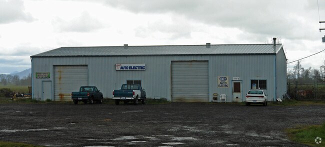
Property Record
5150 Santiam Hwy Se, Albany, OR 97322

NEARBY LISTINGS FOR SALE OR LEASE
Property Detail
5150 Santiam Hwy Se
0111084
11S03W1000
Municipalproperty
Linn
A
Oregon
41003C0125F
3.56 AC
2025
Linn County
2025
Portland
020103
Albany, OR
5,720 SF
DEMOGRAPHICS near 5150 Santiam Hwy Se
1 Mile
3 Mile
5 Mile
2024 Total Population
2,323
39,620
61,170
2029 Population
2,441
41,533
64,062
Pop Growth 2024-2029
+ 5.08%
+ 4.83%
+ 4.73%
Average Age
40
40
40
2024 Total Households
844
15,587
23,955
HH Growth 2024-2029
+ 5.21%
+ 4.95%
+ 4.86%
Median Household Inc
$72,782
$61,383
$69,532
Avg Household Size
2.80
2.40
2.50
2024 Avg HH Vehicles
2.00
2.00
2.00
Median Home Value
$283,396
$296,082
$329,315
Median Year Built
1997
1979
1979
Nearby Places
Map Layers
Map Styles
 Street
 Aerial
- Restaurants
- Banks
- Shops
- Fitness
- Groceries
PUBLIC TRANSPORTATION
COMMUTER RAIL
DRIVE
WALK
Distance
7 min
3.4 mi
AIRPORT
Mahlon Sweet Field
DRIVE
WALK
Distance
Mahlon Sweet Field
63 min
43.7 mi
Nearby Properties
Address
Land Use
TOTAL SIZE
Lot Size
Zoning
Address
Land Use
TOTAL SIZE
Lot Size
Zoning
19.77 AC
RS-5
Address
Land Use
TOTAL SIZE
Lot Size
Zoning
34.91 AC
LI
Address
Land Use
TOTAL SIZE
Lot Size
Zoning
46.43 AC
GI
Address
Land Use
TOTAL SIZE
Lot Size
Zoning
84,415 SF
70.68 AC
RS-6.5
Address
Land Use
TOTAL SIZE
Lot Size
Zoning
2,025 SF
16.52 AC
MUC
Address
Land Use
TOTAL SIZE
Lot Size
Zoning
18.57 AC
RC
Address
Land Use
TOTAL SIZE
Lot Size
Zoning
58,202 SF
5.14 AC
RM
Address
Land Use
TOTAL SIZE
Lot Size
Zoning
13.01 AC
RC
Address
Land Use
TOTAL SIZE
Lot Size
Zoning
67,716 SF
6.90 AC
LI
Address
Land Use
TOTAL SIZE
Lot Size
Zoning
15.63 AC
RM
Address
Land Use
TOTAL SIZE
Lot Size
Zoning
84,000 SF
8.99 AC
RC
Address
Land Use
TOTAL SIZE
Lot Size
Zoning
14.42 AC
RS-5
Address
Land Use
TOTAL SIZE
Lot Size
Zoning
50,648 SF
8.35 AC
RS-6.5
Address
Land Use
TOTAL SIZE
Lot Size
Zoning
11.01 AC
CC
Address
Land Use
TOTAL SIZE
Lot Size
Zoning
666 SF
6.32 AC
RM
Address
Land Use
TOTAL SIZE
Lot Size
Zoning
3,591 SF
2.15 AC
RM
Address
Land Use
TOTAL SIZE
Lot Size
Zoning
15.15 AC
RM
Address
Land Use
TOTAL SIZE
Lot Size
Zoning
19,950 SF
11.11 AC
RC
Address
Land Use
TOTAL SIZE
Lot Size
Zoning
5.27 AC
MUC
Address
Land Use
TOTAL SIZE
Lot Size
Zoning
52,626 SF
5.40 AC
RS-6.5
Address
Land Use
TOTAL SIZE
Lot Size
Zoning
1,795 SF
8.98 AC
RC
Address
Land Use
TOTAL SIZE
Lot Size
Zoning
31,192 SF
8.20 AC
RMA
Address
Land Use
TOTAL SIZE
Lot Size
Zoning
94,070 SF
6.52 AC
RC
Address
Land Use
TOTAL SIZE
Lot Size
Zoning
41,476 SF
17.04 AC
RM
Address
Land Use
TOTAL SIZE
Lot Size
Zoning
40,718 SF
3.15 AC
OP
Address
Land Use
TOTAL SIZE
Lot Size
Zoning
60,176 SF
17.67 AC
RC
Address
Land Use
TOTAL SIZE
Lot Size
Zoning
182.33 AC
RS-6.5
Address
Land Use
TOTAL SIZE
Lot Size
Zoning
58,519 SF
4.90 AC
RC
Address
Land Use
TOTAL SIZE
Lot Size
Zoning
23,500 SF
9.54 AC
RS-6.5
Address
Land Use
TOTAL SIZE
Lot Size
Zoning
61,572 SF
4.47 AC
RC
The World's #1 Commercial Real Estate Marketplace
Connect with us
© 2026 CoStar Group
The information above has been obtained from sources believed reliable. While we do not doubt its accuracy we have not verified it and make no guarantee, warranty or representation about it. It is your responsibility to independently confirm its accuracy and completeness. Any projections, opinions, assumptions, or estimates used are for example only and do not represent the current or future performance of the property. The value of this transaction to you depends on tax and other factors which should be evaluated by your tax, financial, and legal advisors. You and your advisors should conduct a careful, independent investigation of the property to determine to your satisfaction the suitability of the property for your needs.