Property Record
51500 Birch St, New Baltimore, MI 48047


NEARBY LISTINGS FOR SALE OR LEASE
-
-
View all New Baltimore listings for lease on LoopNet.com
Property Detail
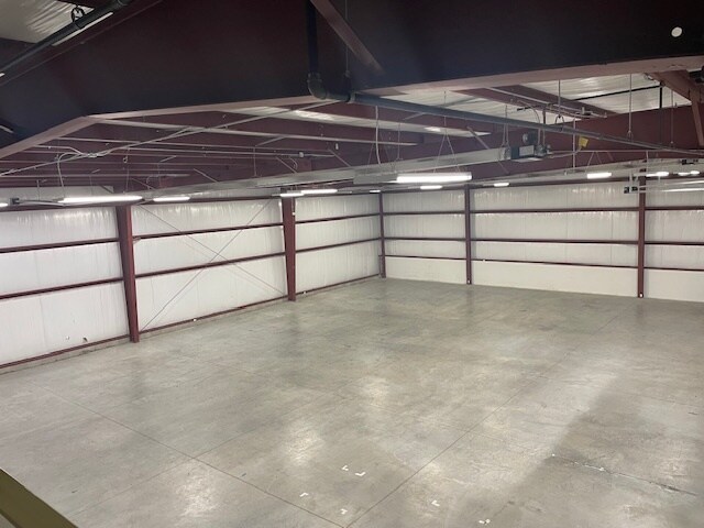
51500 Birch St
Detroit-Warren-Dearborn, MI
Assessors Cricklewood
06-09-13-326-050
ASSESSORS CRICKLEWOOD PLAT (L35, P12); LOTS 54 & 55 AND PART OF LOT 56 TOGETHER DESC AS; BEG AT SW COR LOT 54; TH N00*41?W
Publicstorage
Macomb
X
Michigan
26147C0490E
54-56
2025
2.29 AC
2025
Groesbeck North
220002
Detroit
33,160 SF
DEMOGRAPHICS near 51500 Birch St
1 Mile
3 Mile
5 Mile
2024 Total Population
8,222
34,910
67,194
2029 Population
8,140
34,846
67,066
Pop Growth 2024-2029
(1.00%)
(0.18%)
(0.19%)
Average Age
42
41
40
2024 Total Households
3,376
13,432
25,443
HH Growth 2024-2029
(0.83%)
(0.11%)
(0.17%)
Median Household Inc
$71,772
$86,066
$78,801
Avg Household Size
2.40
2.50
2.50
2024 Avg HH Vehicles
2.00
2.00
2.00
Median Home Value
$281,018
$265,222
$249,866
Median Year Built
1990
1992
1994
Nearby Places
Map Layers
Map Styles
 Street
 Aerial
- Restaurants
- Banks
- Shops
- Fitness
- Groceries
PUBLIC TRANSPORTATION
AIRPORT
Windsor International
DRIVE
WALK
Distance
Windsor International
69 min
44.3 mi
Freight Ports
Port of Toledo
DRIVE
WALK
Distance
Port of Toledo
118 min
94.6 mi
SALE & LEASE HISTORY
LISTING DATE
SALE/LEASE

May 09, 2024
For Lease
Nearby Properties
Address
Land Use
TOTAL SIZE
Lot Size
Zoning
Address
Land Use
TOTAL SIZE
Lot Size
Zoning
808,240 SF
60.31 AC
RM 3 MU
Address
Land Use
TOTAL SIZE
Lot Size
Zoning
115,695 SF
Address
Land Use
TOTAL SIZE
Lot Size
Zoning
459,100 SF
Address
Land Use
TOTAL SIZE
Lot Size
Zoning
147,578 SF
12.84 AC
GC
Address
Land Use
TOTAL SIZE
Lot Size
Zoning
124,902 SF
11.38 AC
RM2 MU
Address
Land Use
TOTAL SIZE
Lot Size
Zoning
210,688 SF
20.13 AC
CG
Address
Land Use
TOTAL SIZE
Lot Size
Zoning
88,183 SF
27.97 AC
RM1 MU
Address
Land Use
TOTAL SIZE
Lot Size
Zoning
112,151 SF
9.31 AC
C3 GEN
Address
Land Use
TOTAL SIZE
Lot Size
Zoning
169,535 SF
12.20 AC
I
Address
Land Use
TOTAL SIZE
Lot Size
Zoning
179,200 SF
10.12 AC
RT TECH
Address
Land Use
TOTAL SIZE
Lot Size
Zoning
276,497 SF
31.19 AC
I-1
Address
Land Use
TOTAL SIZE
Lot Size
Zoning
124,280 SF
11.50 AC
RM-1
Address
Land Use
TOTAL SIZE
Lot Size
Zoning
89,620 SF
17.89 AC
Address
Land Use
TOTAL SIZE
Lot Size
Zoning
7.70 AC
R1A RES
Address
Land Use
TOTAL SIZE
Lot Size
Zoning
74,952 SF
6.05 AC
RM-2
Address
Land Use
TOTAL SIZE
Lot Size
Zoning
50,091 SF
4.80 AC
RM1 MU
Address
Land Use
TOTAL SIZE
Lot Size
Zoning
Address
Land Use
TOTAL SIZE
Lot Size
Zoning
49,600 SF
14.50 AC
I-2
Address
Land Use
TOTAL SIZE
Lot Size
Zoning
22,140 SF
I
Address
Land Use
TOTAL SIZE
Lot Size
Zoning
30,240 SF
3.03 AC
GC
Address
Land Use
TOTAL SIZE
Lot Size
Zoning
15,788 SF
4.28 AC
CG
Address
Land Use
TOTAL SIZE
Lot Size
Zoning
87,747 SF
8.66 AC
GC
Address
Land Use
TOTAL SIZE
Lot Size
Zoning
40,804 SF
3.53 AC
RM-1
Address
Land Use
TOTAL SIZE
Lot Size
Zoning
70,070 SF
21.41 AC
RT TECH
Address
Land Use
TOTAL SIZE
Lot Size
Zoning
53,540 SF
7.99 AC
I
Address
Land Use
TOTAL SIZE
Lot Size
Zoning
21,944 SF
131.37 AC
CG
Address
Land Use
TOTAL SIZE
Lot Size
Zoning
74,542 SF
6.09 AC
RT TECH
Address
Land Use
TOTAL SIZE
Lot Size
Zoning
1,034 SF
36.86 AC
MHP MO
Address
Land Use
TOTAL SIZE
Lot Size
Zoning
Address
Land Use
TOTAL SIZE
Lot Size
Zoning
17,880 SF
4.78 AC
I
The World's #1 Commercial Real Estate Marketplace
Connect with us
© 2025 CoStar Group
The information above has been obtained from sources believed reliable. While we do not doubt its accuracy we have not verified it and make no guarantee, warranty or representation about it. It is your responsibility to independently confirm its accuracy and completeness. Any projections, opinions, assumptions, or estimates used are for example only and do not represent the current or future performance of the property. The value of this transaction to you depends on tax and other factors which should be evaluated by your tax, financial, and legal advisors. You and your advisors should conduct a careful, independent investigation of the property to determine to your satisfaction the suitability of the property for your needs.