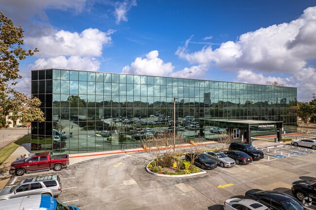
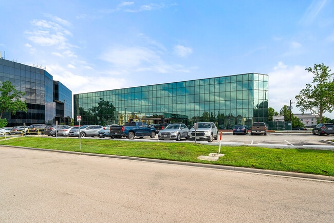
Property Record
5151 Katy Fwy, Houston, TX 77007
Current Lease Availabilities
NEARBY LISTINGS FOR SALE OR LEASE
Property Detail
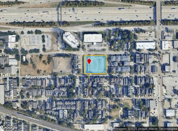
5151 Katy Fwy
Houston-The Woodlands-Sugar Land, TX
Brunner
0072890000001
ALL OF BLK 105 BRUNNER
Commercialnec
Harris
X
Texas
48201C0670M
1.21 AC
2024
Midtown
2025
Houston
510602
DEMOGRAPHICS near 5151 Katy Fwy
1 Mile
3 Mile
5 Mile
2024 Total Population
30,282
184,094
498,060
2029 Population
31,716
192,655
518,609
Pop Growth 2024-2029
+ 4.74%
+ 4.65%
+ 4.13%
Average Age
36
38
38
2024 Total Households
15,577
94,803
234,195
HH Growth 2024-2029
+ 4.76%
+ 4.63%
+ 4.30%
Median Household Inc
$154,453
$117,017
$92,225
Avg Household Size
1.90
1.90
2.00
2024 Avg HH Vehicles
2.00
2.00
2.00
Median Home Value
$460,106
$509,163
$481,128
Median Year Built
2010
2003
1996
Nearby Places
- Restaurants
- Banks
- Shops
- Fitness
- Groceries
PUBLIC TRANSPORTATION
COMMUTER RAIL
Houston (Sunset Limited - Amtrak)
DRIVE
WALK
Distance
Houston (Sunset Limited - Amtrak)
7 min
4.3 mi
AIRPORT
William P Hobby
DRIVE
WALK
Distance
William P Hobby
28 min
16.7 mi
George Bush Intcntl/Houston
DRIVE
WALK
Distance
George Bush Intcntl/Houston
28 min
22.0 mi
Freight Ports
Port of Houston
DRIVE
WALK
Distance
Port of Houston
21 min
13.4 mi
Nearby Properties
Address
Land Use
TOTAL SIZE
Lot Size
Zoning
Address
Land Use
TOTAL SIZE
Lot Size
Zoning
1,871,418 SF
1.44 AC
Address
Land Use
TOTAL SIZE
Lot Size
Zoning
1,232,364 SF
1.49 AC
Address
Land Use
TOTAL SIZE
Lot Size
Zoning
1,436,400 SF
1.44 AC
Address
Land Use
TOTAL SIZE
Lot Size
Zoning
4,169,721 SF
31.23 AC
Address
Land Use
TOTAL SIZE
Lot Size
Zoning
2,005,097 SF
1.44 AC
Address
Land Use
TOTAL SIZE
Lot Size
Zoning
1,374,271 SF
1.44 AC
Address
Land Use
TOTAL SIZE
Lot Size
Zoning
1,150,681 SF
1.17 AC
Address
Land Use
TOTAL SIZE
Lot Size
Zoning
1,282,908 SF
2.74 AC
Address
Land Use
TOTAL SIZE
Lot Size
Zoning
555,351 SF
1.40 AC
Address
Land Use
TOTAL SIZE
Lot Size
Zoning
1,044,305 SF
3.16 AC
Address
Land Use
TOTAL SIZE
Lot Size
Zoning
565,276 SF
1.35 AC
Address
Land Use
TOTAL SIZE
Lot Size
Zoning
644,352 SF
8.05 AC
Address
Land Use
TOTAL SIZE
Lot Size
Zoning
608,233 SF
2.23 AC
Address
Land Use
TOTAL SIZE
Lot Size
Zoning
930,730 SF
1.89 AC
Address
Land Use
TOTAL SIZE
Lot Size
Zoning
567,282 SF
2.40 AC
Address
Land Use
TOTAL SIZE
Lot Size
Zoning
1,075,210 SF
2.26 AC
Address
Land Use
TOTAL SIZE
Lot Size
Zoning
265,878 SF
2.23 AC
Address
Land Use
TOTAL SIZE
Lot Size
Zoning
743,548 SF
3.40 AC
Address
Land Use
TOTAL SIZE
Lot Size
Zoning
408,475 SF
1.05 AC
Address
Land Use
TOTAL SIZE
Lot Size
Zoning
406,032 SF
2.74 AC
Address
Land Use
TOTAL SIZE
Lot Size
Zoning
453,456 SF
3.11 AC
Address
Land Use
TOTAL SIZE
Lot Size
Zoning
1,227,182 SF
4.43 AC
Address
Land Use
TOTAL SIZE
Lot Size
Zoning
432,689 SF
2.84 AC
Address
Land Use
TOTAL SIZE
Lot Size
Zoning
1,087,974 SF
1.18 AC
Address
Land Use
TOTAL SIZE
Lot Size
Zoning
957,961 SF
4.56 AC
Address
Land Use
TOTAL SIZE
Lot Size
Zoning
332,908 SF
0.91 AC
Address
Land Use
TOTAL SIZE
Lot Size
Zoning
709,825 SF
4.92 AC
Address
Land Use
TOTAL SIZE
Lot Size
Zoning
633,358 SF
1.47 AC
Address
Land Use
TOTAL SIZE
Lot Size
Zoning
607,893 SF
3.69 AC
Address
Land Use
TOTAL SIZE
Lot Size
Zoning
649,000 SF
7.35 AC
The World's #1 Commercial Real Estate Marketplace
Connect with us
© 2025 CoStar Group
The information above has been obtained from sources believed reliable. While we do not doubt its accuracy we have not verified it and make no guarantee, warranty or representation about it. It is your responsibility to independently confirm its accuracy and completeness. Any projections, opinions, assumptions, or estimates used are for example only and do not represent the current or future performance of the property. The value of this transaction to you depends on tax and other factors which should be evaluated by your tax, financial, and legal advisors. You and your advisors should conduct a careful, independent investigation of the property to determine to your satisfaction the suitability of the property for your needs.