Property Record
5151 S Federal Blvd, Littleton, CO 80123

NEARBY LISTINGS FOR SALE OR LEASE
Property Detail
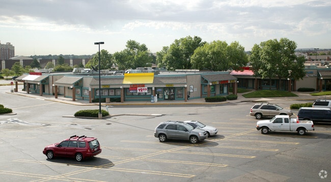
5151 S Federal Blvd
Denver-Aurora-Centennial, CO
Turf Club Centre
2077-17-2-15-018
THAT PT OF LOT 1 COLUMBINE SQUARE DESC AT COMM AT THE NW COR OF SAID LOT TH E 387.89 FT TO THE POB TH 470.55 FT TH SW 48 FT TH S 205 FT TH SE 99 FT TH S 10.02 FT TH E 230.99 FT TH CURVE LEFT 196.55 TH SW 107.60 FT TH SW 162.85 FT TH NW 26.27 FT TH W
Commercialacreage
Arapahoe
X
Colorado
08005C0432N
1
2023
7.29 AC
2025
Southwest
005620
Denver
DEMOGRAPHICS near 5151 S Federal Blvd
1 Mile
3 Mile
5 Mile
2024 Total Population
14,257
97,727
289,885
2029 Population
14,259
97,868
291,096
Pop Growth 2024-2029
+ 0.01%
+ 0.14%
+ 0.42%
Average Age
41
41
41
2024 Total Households
6,345
41,096
118,559
HH Growth 2024-2029
(0.05%)
+ 0.16%
+ 0.58%
Median Household Inc
$85,739
$82,230
$88,574
Avg Household Size
2.20
2.30
2.30
2024 Avg HH Vehicles
2.00
2.00
2.00
Median Home Value
$443,799
$532,249
$530,417
Median Year Built
1977
1973
1976
Nearby Places
Map Layers
Map Styles
 Street
 Aerial
- Restaurants
- Banks
- Shops
- Fitness
- Groceries
PUBLIC TRANSPORTATION
AIRPORT
Denver International
DRIVE
WALK
Distance
Denver International
45 min
33.1 mi
Freight Ports
Tulsa Port Of Catoosa
DRIVE
WALK
Distance
Tulsa Port Of Catoosa
741 min
715.8 mi
SALE & LEASE HISTORY
LISTING DATE
SALE/LEASE

Sep 24, 2016
For Lease
Nearby Properties
Address
Land Use
TOTAL SIZE
Lot Size
Zoning
Address
Land Use
TOTAL SIZE
Lot Size
Zoning
117,535 SF
4.76 AC
Address
Land Use
TOTAL SIZE
Lot Size
Zoning
665,722 SF
615.85 AC
OS-B
Address
Land Use
TOTAL SIZE
Lot Size
Zoning
248,291 SF
128.77 AC
CMP-H2
Address
Land Use
TOTAL SIZE
Lot Size
Zoning
330,776 SF
48.11 AC
CMP-H2
Address
Land Use
TOTAL SIZE
Lot Size
Zoning
251,583 SF
38.03 AC
Address
Land Use
TOTAL SIZE
Lot Size
Zoning
98,523 SF
4.17 AC
Address
Land Use
TOTAL SIZE
Lot Size
Zoning
206,632 SF
33.68 AC
Address
Land Use
TOTAL SIZE
Lot Size
Zoning
250,402 SF
21 AC
Address
Land Use
TOTAL SIZE
Lot Size
Zoning
298,752 SF
73.96 AC
Address
Land Use
TOTAL SIZE
Lot Size
Zoning
14,029 SF
23.97 AC
Address
Land Use
TOTAL SIZE
Lot Size
Zoning
208,529 SF
34.81 AC
R-5
Address
Land Use
TOTAL SIZE
Lot Size
Zoning
38,992 SF
1 AC
Address
Land Use
TOTAL SIZE
Lot Size
Zoning
42,444 SF
1.41 AC
Address
Land Use
TOTAL SIZE
Lot Size
Zoning
58,006 SF
1.80 AC
Address
Land Use
TOTAL SIZE
Lot Size
Zoning
452,193 SF
12.56 AC
Address
Land Use
TOTAL SIZE
Lot Size
Zoning
133,908 SF
9.39 AC
LPD-C
Address
Land Use
TOTAL SIZE
Lot Size
Zoning
391,595 SF
27.94 AC
Address
Land Use
TOTAL SIZE
Lot Size
Zoning
221,025 SF
8.45 AC
PUD
Address
Land Use
TOTAL SIZE
Lot Size
Zoning
47.24 AC
Address
Land Use
TOTAL SIZE
Lot Size
Zoning
107,159 SF
26.40 AC
Address
Land Use
TOTAL SIZE
Lot Size
Zoning
63,347 SF
20.70 AC
Address
Land Use
TOTAL SIZE
Lot Size
Zoning
137,526 SF
11.35 AC
Address
Land Use
TOTAL SIZE
Lot Size
Zoning
296,034 SF
14.26 AC
R-2-A
Address
Land Use
TOTAL SIZE
Lot Size
Zoning
229,830 SF
11.33 AC
Address
Land Use
TOTAL SIZE
Lot Size
Zoning
8,502 SF
3.32 AC
Address
Land Use
TOTAL SIZE
Lot Size
Zoning
90,350 SF
11.44 AC
Address
Land Use
TOTAL SIZE
Lot Size
Zoning
39.44 AC
Address
Land Use
TOTAL SIZE
Lot Size
Zoning
63,732 SF
1.58 AC
Address
Land Use
TOTAL SIZE
Lot Size
Zoning
10,260 SF
49.33 AC
CMP-H2
Address
Land Use
TOTAL SIZE
Lot Size
Zoning
189,672 SF
16.74 AC
PD
The World's #1 Commercial Real Estate Marketplace
Connect with us
© 2026 CoStar Group
The information above has been obtained from sources believed reliable. While we do not doubt its accuracy we have not verified it and make no guarantee, warranty or representation about it. It is your responsibility to independently confirm its accuracy and completeness. Any projections, opinions, assumptions, or estimates used are for example only and do not represent the current or future performance of the property. The value of this transaction to you depends on tax and other factors which should be evaluated by your tax, financial, and legal advisors. You and your advisors should conduct a careful, independent investigation of the property to determine to your satisfaction the suitability of the property for your needs.