Property Record
5153 Wellington Rd, Gainesville, VA 20155
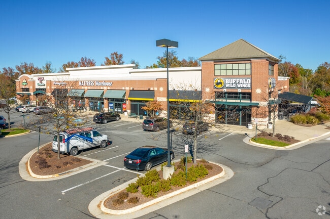

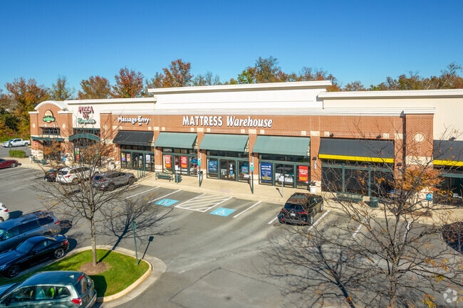
Property Detail
5153 Wellington Rd
7397-72-6389
VIRGINIA GATEWAY PH 4 L-06
Regionalshoppingcenterormallwithanchorstore
PRINCE WILLIAM
MIXED
Virginia
B and X Area of moderate flood hazard, usually the area between the limits of the 100-year and 500-year floods.
06
2024
19.78 AC
2025
Route 29/I-66 Corridor
901507
Washington, DC
125,653 SF
Washington-Arlington-Alexandria, DC-VA-MD-WV
NEARBY LISTINGS FOR SALE OR LEASE
DEMOGRAPHICS near 5153 Wellington Rd
1 mile
3 mile
5 mile
2025 Total Population
4,984
53,107
115,248
2030 Population
5,093
54,533
118,533
Pop Growth 2025-2030
+ 2.19%
+ 2.69%
+ 2.85%
Average Age
44
39
38
2025 Total Households
1,811
16,727
37,336
HH Growth 2025-2030
+ 2.32%
+ 2.64%
+ 2.80%
Median Household Inc
$145,267
$167,650
$157,297
Avg Household Size
2.70
3.10
3.00
2025 Avg HH Vehicles
2.00
2.00
2.00
Median Home Value
$688,372
$689,669
$676,056
Median Year Built
2002
2004
2003
Nearby Places
Map Layers
Map Styles
 Street
 Aerial
Layers
 Traffic
 Biking
Places
Listings with unknown addresses are not visible on the map
- Restaurants
- Banks
- Shops
- Fitness
- Groceries
PUBLIC TRANSPORTATION
COMMUTER RAIL
Drive
Walk
Distance
17 min
8.1 mi
Drive
Walk
Distance
18 min
8.7 mi
AIRPORT
Washington Dulles International
Drive
Walk
Distance
Washington Dulles International
35 min
22.1 mi
Ronald Reagan Washington Ntl
Drive
Walk
Distance
Ronald Reagan Washington Ntl
49 min
36.7 mi
Nearby Properties
Address
Land Use
TOTAL SIZE
Lot Size
Zoning
Address
Land Use
TOTAL SIZE
Lot Size
Zoning
866,820 SF
253.92 AC
M2
Address
Land Use
TOTAL SIZE
Lot Size
Zoning
482,223 SF
28.10 AC
PBD
Address
Land Use
TOTAL SIZE
Lot Size
Zoning
453,174 SF
38.50 AC
PBD
Address
Land Use
TOTAL SIZE
Lot Size
Zoning
560,942 SF
90.90 AC
B1
Address
Land Use
TOTAL SIZE
Lot Size
Zoning
181.29 AC
M1
Address
Land Use
TOTAL SIZE
Lot Size
Zoning
117.22 AC
M1
Address
Land Use
TOTAL SIZE
Lot Size
Zoning
252,966 SF
10.54 AC
PMD
Address
Land Use
TOTAL SIZE
Lot Size
Zoning
112.48 AC
M2
Address
Land Use
TOTAL SIZE
Lot Size
Zoning
312,931 SF
83 AC
M2
Address
Land Use
TOTAL SIZE
Lot Size
Zoning
258,716 SF
58.54 AC
M1
Address
Land Use
TOTAL SIZE
Lot Size
Zoning
350,906 SF
83.51 AC
M1
Address
Land Use
TOTAL SIZE
Lot Size
Zoning
67.20 AC
M2
Address
Land Use
TOTAL SIZE
Lot Size
Zoning
227,465 SF
31.91 AC
M1
Address
Land Use
TOTAL SIZE
Lot Size
Zoning
311,198 SF
23.50 AC
M2
Address
Land Use
TOTAL SIZE
Lot Size
Zoning
58.30 AC
M1
Address
Land Use
TOTAL SIZE
Lot Size
Zoning
52.69 AC
M2
Address
Land Use
TOTAL SIZE
Lot Size
Zoning
482,200 SF
29.18 AC
PBD
Address
Land Use
TOTAL SIZE
Lot Size
Zoning
220,552 SF
30.95 AC
PMD
Address
Land Use
TOTAL SIZE
Lot Size
Zoning
236,082 SF
28.27 AC
M2
Address
Land Use
TOTAL SIZE
Lot Size
Zoning
161.28 AC
PBD
Address
Land Use
TOTAL SIZE
Lot Size
Zoning
119.30 AC
M2
Address
Land Use
TOTAL SIZE
Lot Size
Zoning
298,474 SF
11.60 AC
PMR
Address
Land Use
TOTAL SIZE
Lot Size
Zoning
217,934 SF
10.17 AC
M2
Address
Land Use
TOTAL SIZE
Lot Size
Zoning
333,737 SF
37.06 AC
RPC
Address
Land Use
TOTAL SIZE
Lot Size
Zoning
28.38 AC
PBD
Address
Land Use
TOTAL SIZE
Lot Size
Zoning
420,634 SF
29.54 AC
M1
Address
Land Use
TOTAL SIZE
Lot Size
Zoning
85.01 AC
M2
Address
Land Use
TOTAL SIZE
Lot Size
Zoning
147,877 SF
39.51 AC
MIXED
Address
Land Use
TOTAL SIZE
Lot Size
Zoning
75,317 SF
13.68 AC
R16
Address
Land Use
TOTAL SIZE
Lot Size
Zoning
175,260 SF
30.39 AC
MT
The World's #1 Commercial Real Estate Marketplace
Connect with us
© 2026 CoStar Group
The information above has been obtained from sources believed reliable. While we do not doubt its accuracy we have not verified it and make no guarantee, warranty or representation about it. It is your responsibility to independently confirm its accuracy and completeness. Any projections, opinions, assumptions, or estimates used are for example only and do not represent the current or future performance of the property. The value of this transaction to you depends on tax and other factors which should be evaluated by your tax, financial, and legal advisors. You and your advisors should conduct a careful, independent investigation of the property to determine to your satisfaction the suitability of the property for your needs.