Property Record
5155 Arden Way, Carmichael, CA 95608
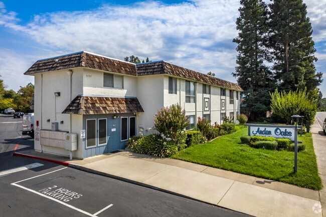

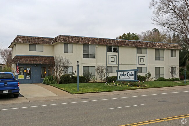

Property Detail
5155 Arden Way
283-0252-005
POR OF LOT 95 CARMICHAEL COL NO 2 DESC AS BEG ATA PT ON N LINE OF LOT 95 LOC S 83%33'E 440 FT FR NW COR OF LOT 95 TH CONTINUING S 83%33'E 177.40 FT TH S 33%52'W 385.6 FT TH S 89%02'30W 110 FT TH N 23%29'30E 373.01 FT TO POB CONTG 1.1 AC
Apartment
Sacramento
RD-20
California
B and X Area of moderate flood hazard, usually the area between the limits of the 100-year and 500-year floods.
95
2024
1.02 AC
2025
Outer Carmichael/Citrus Heights
007702
Sacramento
26,287 SF
Sacramento-Roseville-Folsom, CA
NEARBY LISTINGS FOR SALE OR LEASE
DEMOGRAPHICS near 5155 Arden Way
1 mile
3 mile
5 mile
2025 Total Population
11,852
140,909
326,664
2030 Population
12,013
142,102
330,270
Pop Growth 2025-2030
+ 1.36%
+ 0.85%
+ 1.10%
Average Age
46
41
40
2025 Total Households
4,752
54,405
128,089
HH Growth 2025-2030
+ 1.43%
+ 0.86%
+ 1.14%
Median Household Inc
$138,255
$89,108
$80,526
Avg Household Size
2.40
2.50
2.50
2025 Avg HH Vehicles
2.00
2.00
2.00
Median Home Value
$742,158
$521,989
$499,568
Median Year Built
1970
1970
1972
Nearby Places
Map Layers
Map Styles
 Street
 Aerial
Layers
 Traffic
 Biking
Places
Listings with unknown addresses are not visible on the map
- Restaurants
- Banks
- Shops
- Fitness
- Groceries
PUBLIC TRANSPORTATION
COMMUTER RAIL
Drive
Walk
Distance
16 min
9.8 mi
AIRPORT
Sacramento International
Drive
Walk
Distance
Sacramento International
28 min
18.1 mi
SALE & LEASE HISTORY
LISTING DATE
SALE/LEASE

Jun 10, 2019
For Sale
Nearby Properties
Address
Land Use
TOTAL SIZE
Lot Size
Zoning
Address
Land Use
TOTAL SIZE
Lot Size
Zoning
512,630 SF
37.68 AC
SPA (NPA)
Address
Land Use
TOTAL SIZE
Lot Size
Zoning
266,841 SF
47.29 AC
RD-5
Address
Land Use
TOTAL SIZE
Lot Size
Zoning
223,046 SF
10.99 AC
RD 20
Address
Land Use
TOTAL SIZE
Lot Size
Zoning
420,421 SF
25.39 AC
BP
Address
Land Use
TOTAL SIZE
Lot Size
Zoning
1,281 SF
0.42 AC
RD-20
Address
Land Use
TOTAL SIZE
Lot Size
Zoning
181,573 SF
12.10 AC
SPA (MFSPA
Address
Land Use
TOTAL SIZE
Lot Size
Zoning
137,520 SF
10.37 AC
BP (PC)(PD
Address
Land Use
TOTAL SIZE
Lot Size
Zoning
387,136 SF
8.85 AC
RD-30
Address
Land Use
TOTAL SIZE
Lot Size
Zoning
168,846 SF
7.58 AC
RD-30 (PC)
Address
Land Use
TOTAL SIZE
Lot Size
Zoning
139,500 SF
5.21 AC
MP
Address
Land Use
TOTAL SIZE
Lot Size
Zoning
119,824 SF
7.64 AC
RD-30 (PC)
Address
Land Use
TOTAL SIZE
Lot Size
Zoning
278,877 SF
13.17 AC
RD-30
Address
Land Use
TOTAL SIZE
Lot Size
Zoning
0.21 AC
RD-5
Address
Land Use
TOTAL SIZE
Lot Size
Zoning
221,337 SF
12.19 AC
RD 25
Address
Land Use
TOTAL SIZE
Lot Size
Zoning
156,032 SF
9.31 AC
OPMU
Address
Land Use
TOTAL SIZE
Lot Size
Zoning
169,618 SF
10.44 AC
RD-4
Address
Land Use
TOTAL SIZE
Lot Size
Zoning
198,413 SF
9.24 AC
RD 30
Address
Land Use
TOTAL SIZE
Lot Size
Zoning
138,263 SF
9.92 AC
SC
Address
Land Use
TOTAL SIZE
Lot Size
Zoning
12.47 AC
RD 30
Address
Land Use
TOTAL SIZE
Lot Size
Zoning
457,088 SF
12.50 AC
RD 30
Address
Land Use
TOTAL SIZE
Lot Size
Zoning
89,098 SF
4.93 AC
RD-40
Address
Land Use
TOTAL SIZE
Lot Size
Zoning
302,966 SF
15.94 AC
RD 30
Address
Land Use
TOTAL SIZE
Lot Size
Zoning
258,819 SF
13.47 AC
RD 30
Address
Land Use
TOTAL SIZE
Lot Size
Zoning
101,301 SF
9.35 AC
SC
Address
Land Use
TOTAL SIZE
Lot Size
Zoning
72,119 SF
2.38 AC
BP (NPA)
Address
Land Use
TOTAL SIZE
Lot Size
Zoning
387,136 SF
10.21 AC
RD-30
Address
Land Use
TOTAL SIZE
Lot Size
Zoning
110,960 SF
6.62 AC
SPA (MFSPA
Address
Land Use
TOTAL SIZE
Lot Size
Zoning
185,550 SF
8.67 AC
SC
Address
Land Use
TOTAL SIZE
Lot Size
Zoning
90,972 SF
2.36 AC
RD-40
Address
Land Use
TOTAL SIZE
Lot Size
Zoning
100,162 SF
7.42 AC
SC LC
The World's #1 Commercial Real Estate Marketplace
Connect with us
© 2026 CoStar Group
The information above has been obtained from sources believed reliable. While we do not doubt its accuracy we have not verified it and make no guarantee, warranty or representation about it. It is your responsibility to independently confirm its accuracy and completeness. Any projections, opinions, assumptions, or estimates used are for example only and do not represent the current or future performance of the property. The value of this transaction to you depends on tax and other factors which should be evaluated by your tax, financial, and legal advisors. You and your advisors should conduct a careful, independent investigation of the property to determine to your satisfaction the suitability of the property for your needs.