Property Record
5159 Sycamore Trl, Buford, GA 30518

NEARBY LISTINGS FOR SALE OR LEASE
Property Detail
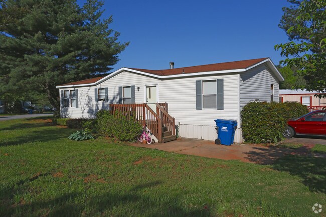
5159 Sycamore Trl
08-00157-00-005A
4802 FRIENDSHIP ROAD
Commercialnec
Hall
X
Georgia
13139C0289G
115.42 AC
2025
Oakwood/Flowery Branch
2025
Atlanta
001607
Gainesville, GA
2,513 SF
DEMOGRAPHICS near 5159 Sycamore Trl
1 Mile
3 Mile
5 Mile
2024 Total Population
3,657
30,146
93,214
2029 Population
3,979
32,819
101,012
Pop Growth 2024-2029
+ 8.81%
+ 8.87%
+ 8.37%
Average Age
37
39
39
2024 Total Households
1,192
9,909
31,223
HH Growth 2024-2029
+ 8.89%
+ 9.02%
+ 8.63%
Median Household Inc
$60,690
$87,348
$85,169
Avg Household Size
3.10
3.00
2.90
2024 Avg HH Vehicles
2.00
2.00
2.00
Median Home Value
$289,253
$342,881
$329,395
Median Year Built
1998
2001
2002
Nearby Places
Map Layers
Map Styles
 Street
 Aerial
- Restaurants
- Banks
- Shops
- Fitness
- Groceries
Nearby Properties
Address
Land Use
TOTAL SIZE
Lot Size
Zoning
Address
Land Use
TOTAL SIZE
Lot Size
Zoning
629,478 SF
1.54 AC
BG
Address
Land Use
TOTAL SIZE
Lot Size
Zoning
488,895 SF
7.50 AC
OI
Address
Land Use
TOTAL SIZE
Lot Size
Zoning
286,520 SF
21.60 AC
P
Address
Land Use
TOTAL SIZE
Lot Size
Zoning
368,594 SF
2 AC
Address
Land Use
TOTAL SIZE
Lot Size
Zoning
384,000 SF
23.08 AC
BG
Address
Land Use
TOTAL SIZE
Lot Size
Zoning
431,273 SF
11.68 AC
BG
Address
Land Use
TOTAL SIZE
Lot Size
Zoning
521,231 SF
46.16 AC
HM1
Address
Land Use
TOTAL SIZE
Lot Size
Zoning
151,663 SF
42.77 AC
BG
Address
Land Use
TOTAL SIZE
Lot Size
Zoning
313,869 SF
12.19 AC
RM24
Address
Land Use
TOTAL SIZE
Lot Size
Zoning
461,700 SF
43.77 AC
C2
Address
Land Use
TOTAL SIZE
Lot Size
Zoning
367,756 SF
12.04 AC
RM
Address
Land Use
TOTAL SIZE
Lot Size
Zoning
144,000 SF
21.13 AC
RM
Address
Land Use
TOTAL SIZE
Lot Size
Zoning
113,271 SF
78.32 AC
C2
Address
Land Use
TOTAL SIZE
Lot Size
Zoning
204,436 SF
16.28 AC
BG2
Address
Land Use
TOTAL SIZE
Lot Size
Zoning
496,608 SF
29.68 AC
C2
Address
Land Use
TOTAL SIZE
Lot Size
Zoning
379,104 SF
20 AC
OI
Address
Land Use
TOTAL SIZE
Lot Size
Zoning
652,710 SF
40.90 AC
M1
Address
Land Use
TOTAL SIZE
Lot Size
Zoning
440,904 SF
37.84 AC
M1
Address
Land Use
TOTAL SIZE
Lot Size
Zoning
150,591 SF
24.39 AC
P
Address
Land Use
TOTAL SIZE
Lot Size
Zoning
641,180 SF
57.04 AC
M1
Address
Land Use
TOTAL SIZE
Lot Size
Zoning
875,180 SF
58.69 AC
C1
Address
Land Use
TOTAL SIZE
Lot Size
Zoning
573,750 SF
43.94 AC
C1
Address
Land Use
TOTAL SIZE
Lot Size
Zoning
3,232 SF
66.63 AC
OI
Address
Land Use
TOTAL SIZE
Lot Size
Zoning
274,018 SF
25.57 AC
M1
Address
Land Use
TOTAL SIZE
Lot Size
Zoning
544,900 SF
46.95 AC
M1
Address
Land Use
TOTAL SIZE
Lot Size
Zoning
119,188 SF
5.28 AC
BG
Address
Land Use
TOTAL SIZE
Lot Size
Zoning
506,870 SF
21.60 AC
M1
Address
Land Use
TOTAL SIZE
Lot Size
Zoning
488,890 SF
59.62 AC
M1
Address
Land Use
TOTAL SIZE
Lot Size
Zoning
143,754 SF
2.73 AC
BG
Address
Land Use
TOTAL SIZE
Lot Size
Zoning
225,851 SF
34.35 AC
R75
The World's #1 Commercial Real Estate Marketplace
Connect with us
© 2025 CoStar Group
The information above has been obtained from sources believed reliable. While we do not doubt its accuracy we have not verified it and make no guarantee, warranty or representation about it. It is your responsibility to independently confirm its accuracy and completeness. Any projections, opinions, assumptions, or estimates used are for example only and do not represent the current or future performance of the property. The value of this transaction to you depends on tax and other factors which should be evaluated by your tax, financial, and legal advisors. You and your advisors should conduct a careful, independent investigation of the property to determine to your satisfaction the suitability of the property for your needs.