Property Record
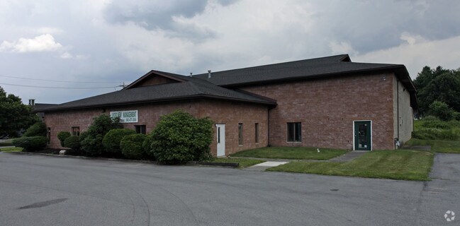
516 Route 6 And 209, Milford, PA 18337


NEARBY LISTINGS FOR SALE OR LEASE
Property Detail
516 Route 6 And 209
100548
1.840 ACS WAREHOUSE/OFFICES W/ADDITION
Commercialnec
Pike
X
Pennsylvania
34037C0009E
1.84 AC
2024
Pike County
2025
Northern New Jersey
950606
Newark, NJ-PA
10,300 SF
DEMOGRAPHICS near 516 Route 6 And 209
1 Mile
3 Mile
5 Mile
2024 Total Population
687
5,032
12,072
2029 Population
725
5,170
12,472
Pop Growth 2024-2029
+ 5.53%
+ 2.74%
+ 3.31%
Average Age
50
46
46
2024 Total Households
308
2,213
5,100
HH Growth 2024-2029
+ 5.52%
+ 2.85%
+ 3.35%
Median Household Inc
$65,625
$71,401
$78,301
Avg Household Size
2.20
2.20
2.30
2024 Avg HH Vehicles
2.00
2.00
2.00
Median Home Value
$259,658
$262,456
$248,375
Median Year Built
1988
1979
1980
Nearby Places
Map Layers
Map Styles
 Street
 Aerial
- Restaurants
- Banks
- Shops
- Fitness
- Groceries
PUBLIC TRANSPORTATION
COMMUTER RAIL
Port Jervis (Bergen County/Port Jervis Line - NJ Transit Commuter Rail (NJ Transit), Main/Port Jervis Line - NJ Transit Commuter Rail (NJ Transit))
DRIVE
WALK
Distance
Port Jervis (Bergen County/Port Jervis Line - NJ Transit Commuter Rail (NJ Transit), Main/Port Jervis Line - NJ Transit Commuter Rail (NJ Transit))
15 min
5.9 mi
Freight Ports
Maher Terminal
DRIVE
WALK
Distance
Maher Terminal
104 min
68.7 mi
SALE & LEASE HISTORY
LISTING DATE
SALE/LEASE

Nov 11, 2019
For Lease
Nearby Properties
Address
Land Use
TOTAL SIZE
Lot Size
Zoning
Address
Land Use
TOTAL SIZE
Lot Size
Zoning
Address
Land Use
TOTAL SIZE
Lot Size
Zoning
336,976 SF
105.33 AC
Address
Land Use
TOTAL SIZE
Lot Size
Zoning
12.40 AC
R-1
Address
Land Use
TOTAL SIZE
Lot Size
Zoning
3,884 SF
518.94 AC
CD
Address
Land Use
TOTAL SIZE
Lot Size
Zoning
215,446 SF
23.85 AC
Address
Land Use
TOTAL SIZE
Lot Size
Zoning
17.20 AC
R-1
Address
Land Use
TOTAL SIZE
Lot Size
Zoning
205.69 AC
CD
Address
Land Use
TOTAL SIZE
Lot Size
Zoning
5.07 AC
C-2
Address
Land Use
TOTAL SIZE
Lot Size
Zoning
6.47 AC
R-4
Address
Land Use
TOTAL SIZE
Lot Size
Zoning
5 AC
MC
Address
Land Use
TOTAL SIZE
Lot Size
Zoning
1.90 AC
206C
Address
Land Use
TOTAL SIZE
Lot Size
Zoning
189,132 SF
27.19 AC
Address
Land Use
TOTAL SIZE
Lot Size
Zoning
3.91 AC
C-2
Address
Land Use
TOTAL SIZE
Lot Size
Zoning
736 SF
26 AC
R-1
Address
Land Use
TOTAL SIZE
Lot Size
Zoning
6.50 AC
R-1
Address
Land Use
TOTAL SIZE
Lot Size
Zoning
37,089 SF
0.95 AC
Address
Land Use
TOTAL SIZE
Lot Size
Zoning
44,840 SF
5.75 AC
Address
Land Use
TOTAL SIZE
Lot Size
Zoning
191.08 AC
CD
Address
Land Use
TOTAL SIZE
Lot Size
Zoning
161.28 AC
R-1
Address
Land Use
TOTAL SIZE
Lot Size
Zoning
1,864 SF
27.30 AC
R-1
Address
Land Use
TOTAL SIZE
Lot Size
Zoning
1.03 AC
C-2
Address
Land Use
TOTAL SIZE
Lot Size
Zoning
5,568 SF
4.70 AC
R-1
Address
Land Use
TOTAL SIZE
Lot Size
Zoning
Address
Land Use
TOTAL SIZE
Lot Size
Zoning
32,016 SF
14.46 AC
Address
Land Use
TOTAL SIZE
Lot Size
Zoning
5.39 AC
C-2
Address
Land Use
TOTAL SIZE
Lot Size
Zoning
162.10 AC
CD
Address
Land Use
TOTAL SIZE
Lot Size
Zoning
4,160 SF
1 AC
R-4
Address
Land Use
TOTAL SIZE
Lot Size
Zoning
5,112 SF
1 AC
R-1
Address
Land Use
TOTAL SIZE
Lot Size
Zoning
5,040 SF
0.46 AC
C-2
Address
Land Use
TOTAL SIZE
Lot Size
Zoning
58,533 SF
0.68 AC
The World's #1 Commercial Real Estate Marketplace
Connect with us
© 2026 CoStar Group
The information above has been obtained from sources believed reliable. While we do not doubt its accuracy we have not verified it and make no guarantee, warranty or representation about it. It is your responsibility to independently confirm its accuracy and completeness. Any projections, opinions, assumptions, or estimates used are for example only and do not represent the current or future performance of the property. The value of this transaction to you depends on tax and other factors which should be evaluated by your tax, financial, and legal advisors. You and your advisors should conduct a careful, independent investigation of the property to determine to your satisfaction the suitability of the property for your needs.