No Photo
Property Record
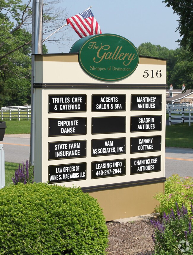
516 Washington St, Chagrin Falls, OH 44022


NEARBY LISTINGS FOR SALE OR LEASE
Property Detail
516 Washington St
29-073800
Rtb Geauga Ltd
Stripcommercialcenter
S/L 1 RTB GEAUGA LTD SUB
X
Geauga
39055C0211D
Ohio
2025
1.39 AC
2024
Geauga County
311600
Cleveland
15,918 SF
Cleveland-Elyria, OH
DEMOGRAPHICS near 516 Washington St
1 mile
3 mile
5 mile
2024 Total Population
4,453
20,090
47,785
2029 Population
4,445
20,027
47,328
Pop Growth 2024-2029
(0.18%)
(0.31%)
(0.96%)
Average Age
46
46
45
2024 Total Households
1,892
7,621
17,960
HH Growth 2024-2029
(0.37%)
(0.43%)
(1.05%)
Median Household Inc
$97,236
$133,074
$124,787
Avg Household Size
2.30
2.50
2.60
2024 Avg HH Vehicles
2.00
2.00
2.00
Median Home Value
$404,473
$426,332
$406,163
Median Year Built
1964
1969
1973
Nearby Places
Map Layers
Map Styles
 Street
 Aerial
Transit
 Traffic
 Biking
Places
Listings with unknown addresses are not visible on the map
- Restaurants
- Banks
- Shops
- Fitness
- Groceries
PUBLIC TRANSPORTATION
AIRPORT
Cleveland-Hopkins International
Drive
Walk
Distance
Cleveland-Hopkins International
45 min
27.0 mi
SALE & LEASE HISTORY
LISTING DATE
SALE/LEASE

Oct 14, 2016
For Lease
May 08, 2025
For Lease
Mar 07, 2019
For Lease
Nearby Properties
Address
Land Use
TOTAL SIZE
Lot Size
Zoning
Address
Land Use
TOTAL SIZE
Lot Size
Zoning
7,531 SF
85.32 AC
R3A
Address
Land Use
TOTAL SIZE
Lot Size
Zoning
255.11 AC
U-1
Address
Land Use
TOTAL SIZE
Lot Size
Zoning
225,206 SF
55.30 AC
PI
Address
Land Use
TOTAL SIZE
Lot Size
Zoning
18,614 SF
45.79 AC
R3A
Address
Land Use
TOTAL SIZE
Lot Size
Zoning
441.72 AC
1F-2
Address
Land Use
TOTAL SIZE
Lot Size
Zoning
176.15 AC
U1
Address
Land Use
TOTAL SIZE
Lot Size
Zoning
2,620 SF
15.81 AC
R5A
Address
Land Use
TOTAL SIZE
Lot Size
Zoning
93,610 SF
4.45 AC
RL
Address
Land Use
TOTAL SIZE
Lot Size
Zoning
77,296 SF
3.33 AC
RB
Address
Land Use
TOTAL SIZE
Lot Size
Zoning
67,861 SF
24.84 AC
R1A
Address
Land Use
TOTAL SIZE
Lot Size
Zoning
76.89 AC
U-1
Address
Land Use
TOTAL SIZE
Lot Size
Zoning
2,042 SF
310.34 AC
U-1
Address
Land Use
TOTAL SIZE
Lot Size
Zoning
48.36 AC
Address
Land Use
TOTAL SIZE
Lot Size
Zoning
86,896 SF
1.55 AC
PI
Address
Land Use
TOTAL SIZE
Lot Size
Zoning
58,075 SF
10.63 AC
PI
Address
Land Use
TOTAL SIZE
Lot Size
Zoning
125,740 SF
33.72 AC
RL
Address
Land Use
TOTAL SIZE
Lot Size
Zoning
11,702 SF
12.40 AC
1F-2
Address
Land Use
TOTAL SIZE
Lot Size
Zoning
36,827 SF
6.54 AC
R5A
Address
Land Use
TOTAL SIZE
Lot Size
Zoning
13,086 SF
0.82 AC
R1-60
Address
Land Use
TOTAL SIZE
Lot Size
Zoning
13,375 SF
10.40 AC
R5
Address
Land Use
TOTAL SIZE
Lot Size
Zoning
43,221 SF
14.17 AC
LIR
Address
Land Use
TOTAL SIZE
Lot Size
Zoning
9,548 SF
5 AC
R5
Address
Land Use
TOTAL SIZE
Lot Size
Zoning
13,691 SF
14.15 AC
U-1
Address
Land Use
TOTAL SIZE
Lot Size
Zoning
46.33 AC
U-1
Address
Land Use
TOTAL SIZE
Lot Size
Zoning
6,100 SF
62.90 AC
1F-2
Address
Land Use
TOTAL SIZE
Lot Size
Zoning
34,354 SF
1.04 AC
PI
Address
Land Use
TOTAL SIZE
Lot Size
Zoning
51,653 SF
5.76 AC
CB
Address
Land Use
TOTAL SIZE
Lot Size
Zoning
56,518 SF
5.86 AC
RMF-10
Address
Land Use
TOTAL SIZE
Lot Size
Zoning
73.85 AC
C
Address
Land Use
TOTAL SIZE
Lot Size
Zoning
21,960 SF
0.42 AC
CS
The World's #1 Commercial Real Estate Marketplace
Connect with us
© 2026 CoStar Group
The information above has been obtained from sources believed reliable. While we do not doubt its accuracy we have not verified it and make no guarantee, warranty or representation about it. It is your responsibility to independently confirm its accuracy and completeness. Any projections, opinions, assumptions, or estimates used are for example only and do not represent the current or future performance of the property. The value of this transaction to you depends on tax and other factors which should be evaluated by your tax, financial, and legal advisors. You and your advisors should conduct a careful, independent investigation of the property to determine to your satisfaction the suitability of the property for your needs.