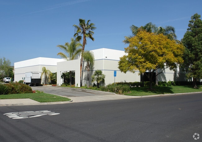
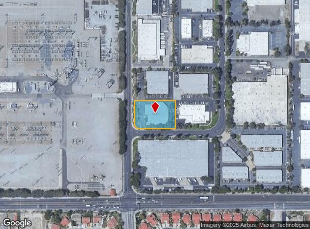
Property Record
5160 Gabbert Rd, Moorpark, CA 93021

Property Detail
5160 Gabbert Rd
511-0-061-075
LOT: 6 REF: 031PM 060
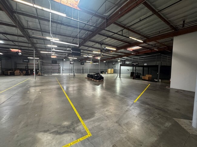
Lightindustrial
Ventura
X
California
06111C0819E
6
2024
1.06 AC
2025
Moorpark/Simi Val
007611
Los Angeles
19,309 SF
Oxnard-Thousand Oaks-Ventura, CA
NEARBY LISTINGS FOR SALE OR LEASE
DEMOGRAPHICS near 5160 Gabbert Rd
1 mile
3 mile
5 mile
2024 Total Population
6,008
33,673
60,074
2029 Population
5,909
32,974
58,943
Pop Growth 2024-2029
(1.65%)
(2.08%)
(1.88%)
Average Age
39
40
42
2024 Total Households
1,875
10,590
19,518
HH Growth 2024-2029
(1.87%)
(2.29%)
(2.00%)
Median Household Inc
$115,222
$131,725
$125,827
Avg Household Size
3.10
3.10
2.90
2024 Avg HH Vehicles
2.00
3.00
2.00
Median Home Value
$724,791
$794,951
$784,492
Median Year Built
1985
1985
1982
Nearby Places
Map Layers
Map Styles
 Street
 Aerial
Transit
 Traffic
 Biking
Places
Listings with unknown addresses are not visible on the map
- Restaurants
- Banks
- Shops
- Fitness
- Groceries
PUBLIC TRANSPORTATION
COMMUTER RAIL
Moorpark (Ventura County Line - Southern California Regional Rail Authority (Metrolink))
Drive
Walk
Distance
Moorpark (Ventura County Line - Southern California Regional Rail Authority (Metrolink))
5 min
1.8 mi
Camarillo (Ventura County Line - Southern California Regional Rail Authority (Metrolink))
Drive
Walk
Distance
Camarillo (Ventura County Line - Southern California Regional Rail Authority (Metrolink))
17 min
9.8 mi
AIRPORT
Bob Hope
Drive
Walk
Distance
Bob Hope
45 min
35.7 mi
SALE & LEASE HISTORY
LISTING DATE
SALE/LEASE

Mar 06, 2025
For Lease
Jun 28, 2023
For Sale
Jan 26, 2022
For Lease
Jan 10, 2023
For Lease
Nearby Properties
Address
Land Use
TOTAL SIZE
Lot Size
Zoning
Address
Land Use
TOTAL SIZE
Lot Size
Zoning
321,174 SF
14.21 AC
Address
Land Use
TOTAL SIZE
Lot Size
Zoning
68,205 SF
11.95 AC
M1
Address
Land Use
TOTAL SIZE
Lot Size
Zoning
152,456 SF
7.89 AC
RPD15
Address
Land Use
TOTAL SIZE
Lot Size
Zoning
134,520 SF
6.50 AC
RPD15
Address
Land Use
TOTAL SIZE
Lot Size
Zoning
62,274 SF
11.78 AC
M-1
Address
Land Use
TOTAL SIZE
Lot Size
Zoning
Address
Land Use
TOTAL SIZE
Lot Size
Zoning
Address
Land Use
TOTAL SIZE
Lot Size
Zoning
17,165 SF
11.52 AC
Address
Land Use
TOTAL SIZE
Lot Size
Zoning
127,176 SF
6.87 AC
Address
Land Use
TOTAL SIZE
Lot Size
Zoning
160,008 SF
40.68 AC
Address
Land Use
TOTAL SIZE
Lot Size
Zoning
134,726 SF
6.01 AC
M1
Address
Land Use
TOTAL SIZE
Lot Size
Zoning
1,332 SF
6.08 AC
Address
Land Use
TOTAL SIZE
Lot Size
Zoning
162,556 SF
6.21 AC
M1
Address
Land Use
TOTAL SIZE
Lot Size
Zoning
14,708 SF
16.08 AC
M-1
Address
Land Use
TOTAL SIZE
Lot Size
Zoning
12,748 SF
6.42 AC
Address
Land Use
TOTAL SIZE
Lot Size
Zoning
12,507 SF
9.05 AC
Address
Land Use
TOTAL SIZE
Lot Size
Zoning
44,840 SF
1.98 AC
RPD15
Address
Land Use
TOTAL SIZE
Lot Size
Zoning
52,547 SF
10.83 AC
Address
Land Use
TOTAL SIZE
Lot Size
Zoning
43,525 SF
3.13 AC
RPD1
Address
Land Use
TOTAL SIZE
Lot Size
Zoning
24,849 SF
7.22 AC
Address
Land Use
TOTAL SIZE
Lot Size
Zoning
Address
Land Use
TOTAL SIZE
Lot Size
Zoning
143 SF
7.84 AC
RPD15
Address
Land Use
TOTAL SIZE
Lot Size
Zoning
95,711 SF
7.24 AC
Address
Land Use
TOTAL SIZE
Lot Size
Zoning
11,736 SF
4.08 AC
RPD5
Address
Land Use
TOTAL SIZE
Lot Size
Zoning
129,541 SF
6.08 AC
Address
Land Use
TOTAL SIZE
Lot Size
Zoning
48,586 SF
5.15 AC
Address
Land Use
TOTAL SIZE
Lot Size
Zoning
7,102 SF
4.98 AC
MULT
Address
Land Use
TOTAL SIZE
Lot Size
Zoning
14,618 SF
1.27 AC
Address
Land Use
TOTAL SIZE
Lot Size
Zoning
31,751 SF
9.96 AC
Address
Land Use
TOTAL SIZE
Lot Size
Zoning
10.01 AC
The World's #1 Commercial Real Estate Marketplace
Connect with us
© 2026 CoStar Group
The information above has been obtained from sources believed reliable. While we do not doubt its accuracy we have not verified it and make no guarantee, warranty or representation about it. It is your responsibility to independently confirm its accuracy and completeness. Any projections, opinions, assumptions, or estimates used are for example only and do not represent the current or future performance of the property. The value of this transaction to you depends on tax and other factors which should be evaluated by your tax, financial, and legal advisors. You and your advisors should conduct a careful, independent investigation of the property to determine to your satisfaction the suitability of the property for your needs.