Property Record
5161 B Dr S, Battle Creek, MI 49015

This Property Is For Sale
Current Lease Availabilities
NEARBY LISTINGS FOR SALE OR LEASE
Property Detail
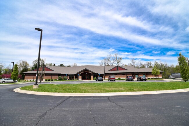
5161 B Dr S
14-011-024-00
LEROY TWP. SEC.1 T3S R8W E 726 FT OF W 1188 FT OF S 330 FT OF SW1/4 SW1/4 LYING W OF M-66 R/W
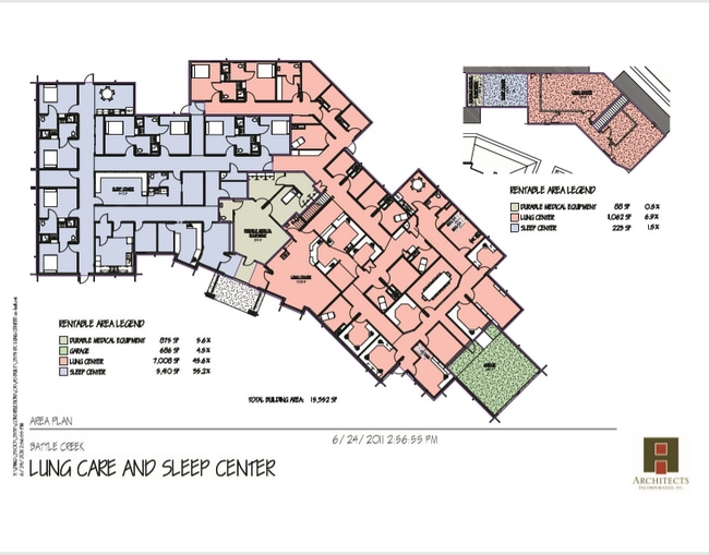
Medicalbuilding
Calhoun
X
Michigan
26025C0330C
4.13 AC
2024
Battle Crk/W Calhoun Cnty
2025
West Michigan
002700
Battle Creek, MI
14,181 SF
DEMOGRAPHICS near 5161 B Dr S
1 Mile
3 Mile
5 Mile
2024 Total Population
964
10,695
27,727
2029 Population
951
10,547
27,248
Pop Growth 2024-2029
(1.35%)
(1.38%)
(1.73%)
Average Age
47
41
42
2024 Total Households
418
4,605
11,433
HH Growth 2024-2029
(1.20%)
(1.22%)
(1.64%)
Median Household Inc
$113,775
$67,213
$78,353
Avg Household Size
2.30
2.30
2.40
2024 Avg HH Vehicles
3.00
2.00
2.00
Median Home Value
$246,043
$214,848
$189,597
Median Year Built
1986
1983
1969
Nearby Places
Map Layers
Map Styles
 Street
 Aerial
- Restaurants
- Banks
- Shops
- Fitness
- Groceries
PUBLIC TRANSPORTATION
COMMUTER RAIL
Battle Creek (Blue Water - Amtrak, Wolverine - Amtrak)
DRIVE
WALK
Distance
Battle Creek (Blue Water - Amtrak, Wolverine - Amtrak)
9 min
6.7 mi
AIRPORT
Kalamazoo/Battle Creek International
DRIVE
WALK
Distance
Kalamazoo/Battle Creek International
34 min
23.4 mi
Freight Ports
Port of Toledo
DRIVE
WALK
Distance
Port of Toledo
153 min
125.2 mi
Nearby Properties
Address
Land Use
TOTAL SIZE
Lot Size
Zoning
Address
Land Use
TOTAL SIZE
Lot Size
Zoning
214,023 SF
35.60 AC
MFR
Address
Land Use
TOTAL SIZE
Lot Size
Zoning
205,436 SF
9.88 AC
MFR
Address
Land Use
TOTAL SIZE
Lot Size
Zoning
69,435 SF
24.84 AC
MFR
Address
Land Use
TOTAL SIZE
Lot Size
Zoning
63,180 SF
3.55 AC
RC
Address
Land Use
TOTAL SIZE
Lot Size
Zoning
135,286 SF
21.86 AC
MFR
Address
Land Use
TOTAL SIZE
Lot Size
Zoning
309,945 SF
25.02 AC
MFR
Address
Land Use
TOTAL SIZE
Lot Size
Zoning
79,074 SF
4.98 AC
RC
Address
Land Use
TOTAL SIZE
Lot Size
Zoning
221,522 SF
23.23 AC
RC
Address
Land Use
TOTAL SIZE
Lot Size
Zoning
196,120 SF
21.42 AC
RC
Address
Land Use
TOTAL SIZE
Lot Size
Zoning
137,827 SF
20.09 AC
B2
Address
Land Use
TOTAL SIZE
Lot Size
Zoning
192,680 SF
21.66 AC
RC
Address
Land Use
TOTAL SIZE
Lot Size
Zoning
63,180 SF
12.12 AC
RC
Address
Land Use
TOTAL SIZE
Lot Size
Zoning
81,376 SF
7.82 AC
MFR
Address
Land Use
TOTAL SIZE
Lot Size
Zoning
65,773 SF
2.42 AC
RC
Address
Land Use
TOTAL SIZE
Lot Size
Zoning
56,349 SF
7.54 AC
RC
Address
Land Use
TOTAL SIZE
Lot Size
Zoning
66,096 SF
9.71 AC
MFR
Address
Land Use
TOTAL SIZE
Lot Size
Zoning
124,141 SF
21.18 AC
RC
Address
Land Use
TOTAL SIZE
Lot Size
Zoning
81,857 SF
9.29 AC
RC
Address
Land Use
TOTAL SIZE
Lot Size
Zoning
366,290 SF
31.87 AC
B2
Address
Land Use
TOTAL SIZE
Lot Size
Zoning
44,034 SF
1.60 AC
RC
Address
Land Use
TOTAL SIZE
Lot Size
Zoning
72,260 SF
12.33 AC
B2
Address
Land Use
TOTAL SIZE
Lot Size
Zoning
78,000 SF
8.21 AC
MFR
Address
Land Use
TOTAL SIZE
Lot Size
Zoning
79,457 SF
8.60 AC
MFR
Address
Land Use
TOTAL SIZE
Lot Size
Zoning
124,280 SF
10.16 AC
B2
Address
Land Use
TOTAL SIZE
Lot Size
Zoning
87,535 SF
7.98 AC
B2
Address
Land Use
TOTAL SIZE
Lot Size
Zoning
85,654 SF
12.12 AC
RC
Address
Land Use
TOTAL SIZE
Lot Size
Zoning
27,393 SF
6.86 AC
MFR
Address
Land Use
TOTAL SIZE
Lot Size
Zoning
41,310 SF
3.53 AC
B2
Address
Land Use
TOTAL SIZE
Lot Size
Zoning
102,265 SF
8.41 AC
B2
Address
Land Use
TOTAL SIZE
Lot Size
Zoning
30,463 SF
1.43 AC
B2
The World's #1 Commercial Real Estate Marketplace
Connect with us
© 2025 CoStar Group
The information above has been obtained from sources believed reliable. While we do not doubt its accuracy we have not verified it and make no guarantee, warranty or representation about it. It is your responsibility to independently confirm its accuracy and completeness. Any projections, opinions, assumptions, or estimates used are for example only and do not represent the current or future performance of the property. The value of this transaction to you depends on tax and other factors which should be evaluated by your tax, financial, and legal advisors. You and your advisors should conduct a careful, independent investigation of the property to determine to your satisfaction the suitability of the property for your needs.