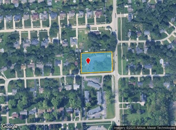
Property Record
51611 Mound Rd, Shelby Township, MI 48316
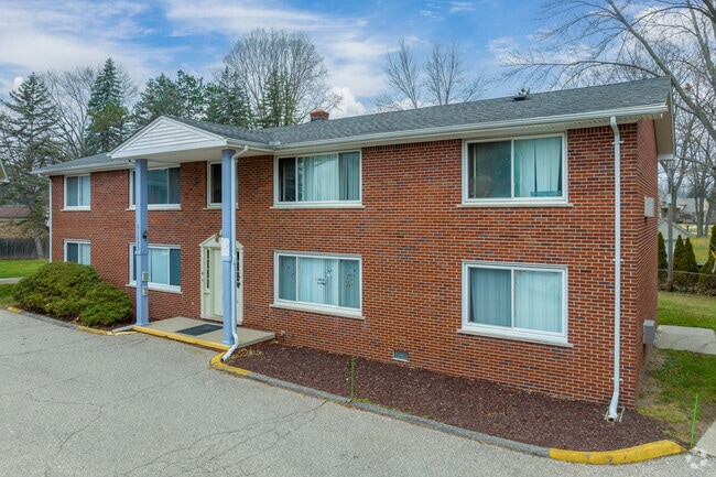
This Property Is For Sale
NEARBY LISTINGS FOR SALE OR LEASE
-
-
View all Shelby Township listings for sale on LoopNet.com
Property Detail
51611 Mound Rd
Detroit-Warren-Dearborn, MI
Evergreen Acres Sub
23-07-17-426-030
L29 & L30 5/98 COMB OF 07-231-062-00 & 07-231-063-00 EVERGREEN ACRES SUB #1 LOT 62 & 63 LIBER 32 PAGE 28
Commercialnec
Macomb
X
Michigan
26099C0216H
62-63
2025
1.44 AC
2025
Shelby Township-Utica
225500
Detroit
DEMOGRAPHICS near 51611 Mound Rd
1 Mile
3 Mile
5 Mile
2024 Total Population
6,386
59,408
182,345
2029 Population
6,304
58,894
180,467
Pop Growth 2024-2029
(1.28%)
(0.87%)
(1.03%)
Average Age
43
42
42
2024 Total Households
2,447
23,198
72,507
HH Growth 2024-2029
(1.27%)
(0.84%)
(1.07%)
Median Household Inc
$86,718
$88,706
$88,460
Avg Household Size
2.50
2.50
2.50
2024 Avg HH Vehicles
2.00
2.00
2.00
Median Home Value
$283,071
$314,432
$321,274
Median Year Built
1969
1989
1988
Nearby Places
Map Layers
Map Styles
 Street
 Aerial
- Restaurants
- Banks
- Shops
- Fitness
- Groceries
PUBLIC TRANSPORTATION
AIRPORT
Windsor International
DRIVE
WALK
Distance
Windsor International
65 min
39.3 mi
Freight Ports
Port of Toledo
DRIVE
WALK
Distance
Port of Toledo
115 min
89.9 mi
Nearby Properties
Address
Land Use
TOTAL SIZE
Lot Size
Zoning
Address
Land Use
TOTAL SIZE
Lot Size
Zoning
998,316 SF
85.99 AC
CK MAP
Address
Land Use
TOTAL SIZE
Lot Size
Zoning
57.84 AC
AV
Address
Land Use
TOTAL SIZE
Lot Size
Zoning
12.38 AC
R-10
Address
Land Use
TOTAL SIZE
Lot Size
Zoning
332,286 SF
CK MAP
Address
Land Use
TOTAL SIZE
Lot Size
Zoning
371,520 SF
21.91 AC
CK MAP
Address
Land Use
TOTAL SIZE
Lot Size
Zoning
13.61 AC
C-2
Address
Land Use
TOTAL SIZE
Lot Size
Zoning
35.60 AC
R-12
Address
Land Use
TOTAL SIZE
Lot Size
Zoning
257,878 SF
30 AC
Address
Land Use
TOTAL SIZE
Lot Size
Zoning
190,996 SF
33.80 AC
LM
Address
Land Use
TOTAL SIZE
Lot Size
Zoning
29,394 SF
33.83 AC
CK MAP
Address
Land Use
TOTAL SIZE
Lot Size
Zoning
19.47 AC
R-8
Address
Land Use
TOTAL SIZE
Lot Size
Zoning
119.30 AC
Address
Land Use
TOTAL SIZE
Lot Size
Zoning
181,725 SF
CK MAP
Address
Land Use
TOTAL SIZE
Lot Size
Zoning
43.80 AC
Address
Land Use
TOTAL SIZE
Lot Size
Zoning
224,323 SF
22.15 AC
C-3
Address
Land Use
TOTAL SIZE
Lot Size
Zoning
167,747 SF
CK MAP
Address
Land Use
TOTAL SIZE
Lot Size
Zoning
73.49 AC
CK MAP
Address
Land Use
TOTAL SIZE
Lot Size
Zoning
Address
Land Use
TOTAL SIZE
Lot Size
Zoning
10.28 AC
CK MAP
Address
Land Use
TOTAL SIZE
Lot Size
Zoning
9.47 AC
R-9
Address
Land Use
TOTAL SIZE
Lot Size
Zoning
117,856 SF
13.51 AC
C-3
Address
Land Use
TOTAL SIZE
Lot Size
Zoning
234,542 SF
37.18 AC
LM
Address
Land Use
TOTAL SIZE
Lot Size
Zoning
51.98 AC
MHP
Address
Land Use
TOTAL SIZE
Lot Size
Zoning
8.81 AC
C-6
Address
Land Use
TOTAL SIZE
Lot Size
Zoning
121,156 SF
9.40 AC
CK MAP
Address
Land Use
TOTAL SIZE
Lot Size
Zoning
118,844 SF
17.80 AC
C-2
Address
Land Use
TOTAL SIZE
Lot Size
Zoning
134,400 SF
7.55 AC
CK MAP
Address
Land Use
TOTAL SIZE
Lot Size
Zoning
960 SF
18.63 AC
R-8
Address
Land Use
TOTAL SIZE
Lot Size
Zoning
125,426 SF
11.87 AC
R-1-B
The World's #1 Commercial Real Estate Marketplace
Connect with us
© 2026 CoStar Group
The information above has been obtained from sources believed reliable. While we do not doubt its accuracy we have not verified it and make no guarantee, warranty or representation about it. It is your responsibility to independently confirm its accuracy and completeness. Any projections, opinions, assumptions, or estimates used are for example only and do not represent the current or future performance of the property. The value of this transaction to you depends on tax and other factors which should be evaluated by your tax, financial, and legal advisors. You and your advisors should conduct a careful, independent investigation of the property to determine to your satisfaction the suitability of the property for your needs.