Property Record
5168 N 1St St, Alviso, CA 95002
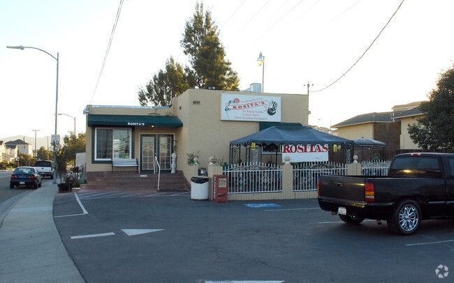

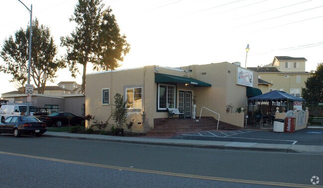
Property Detail
5168 N 1St St
Storebuilding
SANTA CLARA
A(PD)
California
AE The base floodplain where base flood elevations are provided. AE Zones are now used on new format FIRMs instead of A1-A30 Zones.
0.18 AC
2024
North San Jose
2025
South Bay/San Jose
504602
San Jose-Sunnyvale-Santa Clara, CA
1,308 SF
015-43-014
NEARBY LISTINGS FOR SALE OR LEASE
DEMOGRAPHICS near 5168 N 1St St
1 mile
3 mile
5 mile
2025 Total Population
3,957
73,368
249,466
2030 Population
3,910
75,156
256,642
Pop Growth 2025-2030
(1.19%)
+ 2.44%
+ 2.88%
Average Age
39
37
38
2025 Total Households
1,334
28,407
91,426
HH Growth 2025-2030
(0.67%)
+ 2.51%
+ 3.03%
Median Household Inc
$132,228
$191,382
$185,337
Avg Household Size
2.80
2.50
2.60
2025 Avg HH Vehicles
2.00
2.00
2.00
Median Home Value
$301,124
$1,013,850
$1,086,947
Median Year Built
1990
2002
1992
Nearby Places
Map Layers
Map Styles
 Street
 Aerial
Layers
 Traffic
 Biking
Places
Listings with unknown addresses are not visible on the map
- Restaurants
- Banks
- Shops
- Fitness
- Groceries
PUBLIC TRANSPORTATION
COMMUTER RAIL
Great America-Santa Clara (ACE Train - Capitol Corridor Joint Powers Authority, Capitol Corridor - Capitol Corridor Joint Powers Authority)
Drive
Walk
Distance
Great America-Santa Clara (ACE Train - Capitol Corridor Joint Powers Authority, Capitol Corridor - Capitol Corridor Joint Powers Authority)
2 min
1.7 mi
Lawrence Caltrain Station Southbound (Limited - Caltrain (Caltrain), Local Weekday - Caltrain (Caltrain), Local Weekend - Caltrain (Caltrain))
Drive
Walk
Distance
Lawrence Caltrain Station Southbound (Limited - Caltrain (Caltrain), Local Weekday - Caltrain (Caltrain), Local Weekend - Caltrain (Caltrain))
10 min
5.4 mi
AIRPORT
Norman Y Mineta San Jose International
Drive
Walk
Distance
Norman Y Mineta San Jose International
11 min
5.9 mi
San Francisco International
Drive
Walk
Distance
San Francisco International
39 min
30.7 mi
Metro Oakland International
Drive
Walk
Distance
Metro Oakland International
42 min
32.5 mi
Freight Ports
Port of Redwood City
Drive
Walk
Distance
Port of Redwood City
24 min
17.5 mi
Nearby Properties
Address
Land Use
TOTAL SIZE
Lot Size
Zoning
Address
Land Use
TOTAL SIZE
Lot Size
Zoning
553,793 SF
38.06 AC
ML
Address
Land Use
TOTAL SIZE
Lot Size
Zoning
194,597 SF
20.10 AC
I
Address
Land Use
TOTAL SIZE
Lot Size
Zoning
636,145 SF
9.44 AC
IP
Address
Land Use
TOTAL SIZE
Lot Size
Zoning
181,562 SF
16.51 AC
ML
Address
Land Use
TOTAL SIZE
Lot Size
Zoning
818,051 SF
13.81 AC
CP
Address
Land Use
TOTAL SIZE
Lot Size
Zoning
181,709 SF
24.01 AC
MPI
Address
Land Use
TOTAL SIZE
Lot Size
Zoning
81,250 SF
14.73 AC
MPT
Address
Land Use
TOTAL SIZE
Lot Size
Zoning
23.19 AC
MP-I
Address
Land Use
TOTAL SIZE
Lot Size
Zoning
17.25 AC
MPI
Address
Land Use
TOTAL SIZE
Lot Size
Zoning
530,457 SF
6.71 AC
A(PD)
Address
Land Use
TOTAL SIZE
Lot Size
Zoning
107.73 AC
CT
Address
Land Use
TOTAL SIZE
Lot Size
Zoning
208,562 SF
9.10 AC
CP
Address
Land Use
TOTAL SIZE
Lot Size
Zoning
22,400 SF
11.43 AC
MP-TO
Address
Land Use
TOTAL SIZE
Lot Size
Zoning
22.40 AC
PD
Address
Land Use
TOTAL SIZE
Lot Size
Zoning
22.40 AC
PD
Address
Land Use
TOTAL SIZE
Lot Size
Zoning
309,559 SF
5.69 AC
ML
Address
Land Use
TOTAL SIZE
Lot Size
Zoning
577,107 SF
3.65 AC
ML
Address
Land Use
TOTAL SIZE
Lot Size
Zoning
288,259 SF
0.94 AC
MP-TO
Address
Land Use
TOTAL SIZE
Lot Size
Zoning
314,352 SF
0.95 AC
MP-TO
Address
Land Use
TOTAL SIZE
Lot Size
Zoning
423,160 SF
6.24 AC
A(PD)
Address
Land Use
TOTAL SIZE
Lot Size
Zoning
556,649 SF
8.09 AC
IP
Address
Land Use
TOTAL SIZE
Lot Size
Zoning
104,960 SF
10.19 AC
IP
Address
Land Use
TOTAL SIZE
Lot Size
Zoning
605,915 SF
5.36 AC
APD
Address
Land Use
TOTAL SIZE
Lot Size
Zoning
0.97 AC
MP-TO
Address
Land Use
TOTAL SIZE
Lot Size
Zoning
130,306 SF
8.75 AC
ML
Address
Land Use
TOTAL SIZE
Lot Size
Zoning
143,644 SF
20.58 AC
PD-ML
Address
Land Use
TOTAL SIZE
Lot Size
Zoning
289,650 SF
3.85 AC
ML
Address
Land Use
TOTAL SIZE
Lot Size
Zoning
264,556 SF
1 AC
MPTOD
Address
Land Use
TOTAL SIZE
Lot Size
Zoning
264,556 SF
1 AC
MPTOD
Address
Land Use
TOTAL SIZE
Lot Size
Zoning
7.08 AC
IP
The World's #1 Commercial Real Estate Marketplace
Connect with us
© 2026 CoStar Group
The information above has been obtained from sources believed reliable. While we do not doubt its accuracy we have not verified it and make no guarantee, warranty or representation about it. It is your responsibility to independently confirm its accuracy and completeness. Any projections, opinions, assumptions, or estimates used are for example only and do not represent the current or future performance of the property. The value of this transaction to you depends on tax and other factors which should be evaluated by your tax, financial, and legal advisors. You and your advisors should conduct a careful, independent investigation of the property to determine to your satisfaction the suitability of the property for your needs.