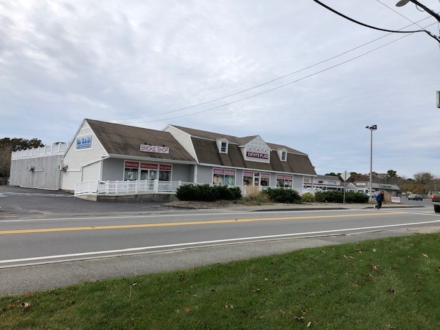
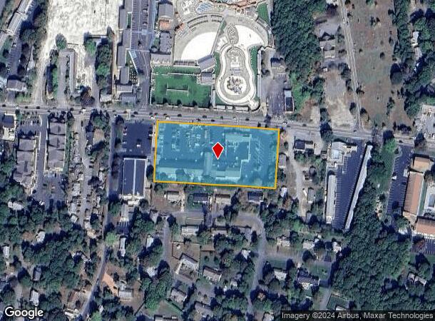
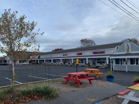
Property Record
517 Route 28, West Yarmouth, MA 02673
Current Lease Availabilities
NEARBY LISTINGS FOR SALE OR LEASE
Property Detail
517 Route 28
Commercialnec
Barnstable
X
Massachusetts
25001C0588J
2.86 AC
2025
Cape Cod
2025
Other Market Areas
012102
Barnstable Town, MA
29,963 SF
YARM-000031-000138-010000
DEMOGRAPHICS near 517 Route 28
1 Mile
3 Mile
5 Mile
2024 Total Population
5,487
24,564
51,949
2029 Population
5,980
25,703
53,768
Pop Growth 2024-2029
+ 8.98%
+ 4.64%
+ 3.50%
Average Age
48
47
48
2024 Total Households
2,597
11,193
23,229
HH Growth 2024-2029
+ 9.09%
+ 4.70%
+ 3.54%
Median Household Inc
$55,294
$65,180
$69,374
Avg Household Size
2.10
2.10
2.10
2024 Avg HH Vehicles
2.00
2.00
2.00
Median Home Value
$497,836
$437,215
$443,614
Median Year Built
1968
1970
1972
Nearby Places
Map Layers
Map Styles
 Street
 Aerial
- Restaurants
- Banks
- Shops
- Fitness
- Groceries
PUBLIC TRANSPORTATION
COMMUTER RAIL
Hyannis (CapeFLYER - Cape Cod Regional Transit Authority)
DRIVE
WALK
Distance
Hyannis (CapeFLYER - Cape Cod Regional Transit Authority)
4 min
2.4 mi
AIRPORT
Nantucket Memorial
DRIVE
WALK
Distance
Nantucket Memorial
154 min
35.8 mi
Martha's Vineyard
DRIVE
WALK
Distance
Martha's Vineyard
110 min
41.2 mi
Freight Ports
Port of New Bedford Harbor
DRIVE
WALK
Distance
Port of New Bedford Harbor
74 min
51.0 mi
Nearby Properties
Address
Land Use
TOTAL SIZE
Lot Size
Zoning
Address
Land Use
TOTAL SIZE
Lot Size
Zoning
221,710 SF
67.02 AC
Address
Land Use
TOTAL SIZE
Lot Size
Zoning
11,698 SF
34.50 AC
Address
Land Use
TOTAL SIZE
Lot Size
Zoning
96,929 SF
9.63 AC
Address
Land Use
TOTAL SIZE
Lot Size
Zoning
110,415 SF
70 AC
Address
Land Use
TOTAL SIZE
Lot Size
Zoning
43.50 AC
IN
Address
Land Use
TOTAL SIZE
Lot Size
Zoning
177,385 SF
39.53 AC
Address
Land Use
TOTAL SIZE
Lot Size
Zoning
106,197 SF
8.13 AC
Address
Land Use
TOTAL SIZE
Lot Size
Zoning
3,738 SF
48.06 AC
R
Address
Land Use
TOTAL SIZE
Lot Size
Zoning
2,264 SF
26.60 AC
Address
Land Use
TOTAL SIZE
Lot Size
Zoning
32,818 SF
3.17 AC
U
Address
Land Use
TOTAL SIZE
Lot Size
Zoning
4,800 SF
414.61 AC
Address
Land Use
TOTAL SIZE
Lot Size
Zoning
7.08 AC
Address
Land Use
TOTAL SIZE
Lot Size
Zoning
5.01 AC
HVB;HD
Address
Land Use
TOTAL SIZE
Lot Size
Zoning
6,047 SF
3.82 AC
Address
Land Use
TOTAL SIZE
Lot Size
Zoning
8.09 AC
Address
Land Use
TOTAL SIZE
Lot Size
Zoning
180,973 SF
11.78 AC
Address
Land Use
TOTAL SIZE
Lot Size
Zoning
35,244 SF
7.70 AC
Address
Land Use
TOTAL SIZE
Lot Size
Zoning
11,017 SF
5.52 AC
Address
Land Use
TOTAL SIZE
Lot Size
Zoning
50,296 SF
5.67 AC
RB
Address
Land Use
TOTAL SIZE
Lot Size
Zoning
1,793 SF
1.32 AC
Address
Land Use
TOTAL SIZE
Lot Size
Zoning
7,134 SF
1.45 AC
Address
Land Use
TOTAL SIZE
Lot Size
Zoning
2,084 SF
20.03 AC
Address
Land Use
TOTAL SIZE
Lot Size
Zoning
2,560 SF
100.38 AC
Address
Land Use
TOTAL SIZE
Lot Size
Zoning
7,172 SF
1.33 AC
Address
Land Use
TOTAL SIZE
Lot Size
Zoning
3.51 AC
R
Address
Land Use
TOTAL SIZE
Lot Size
Zoning
4,683 SF
4.55 AC
Address
Land Use
TOTAL SIZE
Lot Size
Zoning
3.17 AC
Address
Land Use
TOTAL SIZE
Lot Size
Zoning
2,942 SF
130.52 AC
Address
Land Use
TOTAL SIZE
Lot Size
Zoning
789 SF
6.60 AC
Address
Land Use
TOTAL SIZE
Lot Size
Zoning
618 SF
5.82 AC
The World's #1 Commercial Real Estate Marketplace
Connect with us
© 2026 CoStar Group
The information above has been obtained from sources believed reliable. While we do not doubt its accuracy we have not verified it and make no guarantee, warranty or representation about it. It is your responsibility to independently confirm its accuracy and completeness. Any projections, opinions, assumptions, or estimates used are for example only and do not represent the current or future performance of the property. The value of this transaction to you depends on tax and other factors which should be evaluated by your tax, financial, and legal advisors. You and your advisors should conduct a careful, independent investigation of the property to determine to your satisfaction the suitability of the property for your needs.