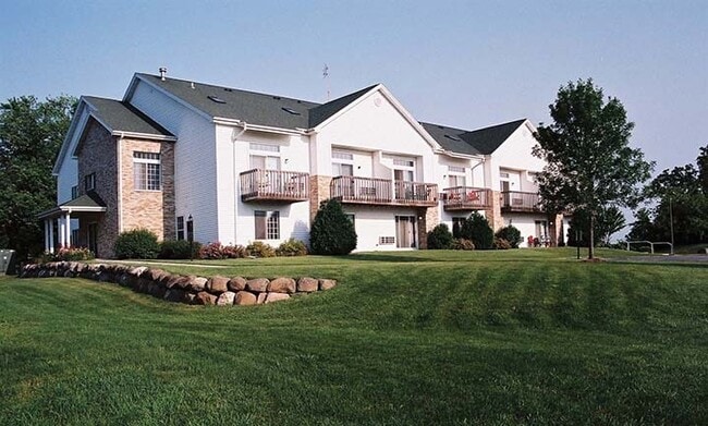
Property Record
517 N Stevenson St, Deforest, WI 53532

NEARBY LISTINGS FOR SALE OR LEASE
Property Detail
517 N Stevenson St
Madison, WI
Certified Surv Map 8595
0910-083-9560-7
LOT 1 CSM 8595 CS47/133&134-6/6/97 F/K/A LOT 2 CSM 8469 CS46/133&134-1/29/97 F/K /A LOT 1 CSM 5408 DESCR AS SEC 8-9-10 PRT SE1/4SW1/4 (1.744 ACRES)
Commercialnec
Dane
X
Wisconsin
55021C0565F
1,2
2024
1.74 AC
2024
Outlying Dane County
013301
Milwaukee/Madison
DEMOGRAPHICS near 517 N Stevenson St
1 Mile
3 Mile
5 Mile
2024 Total Population
5,070
16,723
22,703
2029 Population
5,201
17,437
23,642
Pop Growth 2024-2029
+ 2.58%
+ 4.27%
+ 4.14%
Average Age
39
39
39
2024 Total Households
1,945
6,342
8,527
HH Growth 2024-2029
+ 2.62%
+ 4.35%
+ 4.21%
Median Household Inc
$83,970
$93,146
$99,416
Avg Household Size
2.60
2.60
2.60
2024 Avg HH Vehicles
2.00
2.00
2.00
Median Home Value
$286,105
$319,501
$338,925
Median Year Built
1984
1990
1990
Nearby Places
Map Layers
Map Styles
 Street
 Aerial
- Restaurants
- Banks
- Shops
- Fitness
- Groceries
PUBLIC TRANSPORTATION
AIRPORT
Dane County Regional/Truax Field
DRIVE
WALK
Distance
Dane County Regional/Truax Field
17 min
11.2 mi
Freight Ports
Port Milwaukee
DRIVE
WALK
Distance
Port Milwaukee
99 min
85.3 mi
Nearby Properties
Address
Land Use
TOTAL SIZE
Lot Size
Zoning
Address
Land Use
TOTAL SIZE
Lot Size
Zoning
26.50 AC
Address
Land Use
TOTAL SIZE
Lot Size
Zoning
3.77 AC
Address
Land Use
TOTAL SIZE
Lot Size
Zoning
15.91 AC
Address
Land Use
TOTAL SIZE
Lot Size
Zoning
21.88 AC
Address
Land Use
TOTAL SIZE
Lot Size
Zoning
13.40 AC
Address
Land Use
TOTAL SIZE
Lot Size
Zoning
19.56 AC
Address
Land Use
TOTAL SIZE
Lot Size
Zoning
3.60 AC
Address
Land Use
TOTAL SIZE
Lot Size
Zoning
2.59 AC
Address
Land Use
TOTAL SIZE
Lot Size
Zoning
11.62 AC
Address
Land Use
TOTAL SIZE
Lot Size
Zoning
9.10 AC
Address
Land Use
TOTAL SIZE
Lot Size
Zoning
14.75 AC
Address
Land Use
TOTAL SIZE
Lot Size
Zoning
3.72 AC
R-4
Address
Land Use
TOTAL SIZE
Lot Size
Zoning
38.60 AC
Address
Land Use
TOTAL SIZE
Lot Size
Zoning
11.08 AC
Address
Land Use
TOTAL SIZE
Lot Size
Zoning
1.87 AC
R-4
Address
Land Use
TOTAL SIZE
Lot Size
Zoning
6.31 AC
Address
Land Use
TOTAL SIZE
Lot Size
Zoning
17.93 AC
ETZ
Address
Land Use
TOTAL SIZE
Lot Size
Zoning
1.21 AC
Address
Land Use
TOTAL SIZE
Lot Size
Zoning
4.91 AC
Address
Land Use
TOTAL SIZE
Lot Size
Zoning
Address
Land Use
TOTAL SIZE
Lot Size
Zoning
0.60 AC
Address
Land Use
TOTAL SIZE
Lot Size
Zoning
6.15 AC
Address
Land Use
TOTAL SIZE
Lot Size
Zoning
4.10 AC
Address
Land Use
TOTAL SIZE
Lot Size
Zoning
6.56 AC
Address
Land Use
TOTAL SIZE
Lot Size
Zoning
Address
Land Use
TOTAL SIZE
Lot Size
Zoning
9.38 AC
Address
Land Use
TOTAL SIZE
Lot Size
Zoning
1.32 AC
Address
Land Use
TOTAL SIZE
Lot Size
Zoning
30.80 AC
The World's #1 Commercial Real Estate Marketplace
Connect with us
© 2025 CoStar Group
The information above has been obtained from sources believed reliable. While we do not doubt its accuracy we have not verified it and make no guarantee, warranty or representation about it. It is your responsibility to independently confirm its accuracy and completeness. Any projections, opinions, assumptions, or estimates used are for example only and do not represent the current or future performance of the property. The value of this transaction to you depends on tax and other factors which should be evaluated by your tax, financial, and legal advisors. You and your advisors should conduct a careful, independent investigation of the property to determine to your satisfaction the suitability of the property for your needs.