Property Record
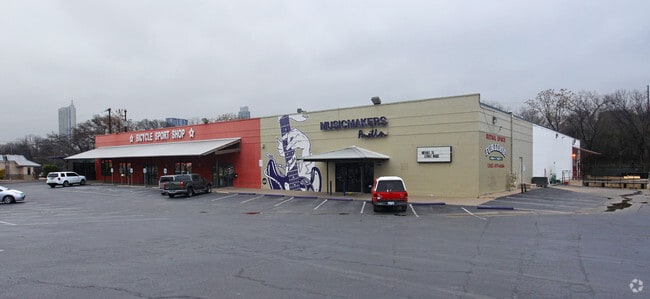
517 S Lamar Blvd, Austin, TX 78704


Property Detail
517 S Lamar Blvd
Austin-Round Rock-San Marcos, TX
LOT 1 LAYNE BOBBY SUBD
101876
Travis
Storebuilding
Texas
AE The base floodplain where base flood elevations are provided. AE Zones are now used on new format FIRMs instead of A1-A30 Zones.
1
2025
1.85 AC
2025
South
001310
Austin
35,026 SF
NEARBY LISTINGS FOR SALE OR LEASE
DEMOGRAPHICS near 517 S Lamar Blvd
1 mile
3 mile
5 mile
2025 Total Population
24,302
185,305
370,972
2030 Population
25,645
195,271
390,573
Pop Growth 2025-2030
+ 5.53%
+ 5.38%
+ 5.28%
Average Age
40
35
36
2025 Total Households
14,768
89,272
170,787
HH Growth 2025-2030
+ 6.16%
+ 6.30%
+ 6.07%
Median Household Inc
$147,995
$92,070
$91,732
Avg Household Size
1.60
1.80
2.00
2025 Avg HH Vehicles
1.00
1.00
2.00
Median Home Value
$1,023,739
$931,149
$793,115
Median Year Built
2009
1999
1995
Nearby Places
Map Layers
Map Styles
 Street
 Aerial
Transit
 Traffic
 Biking
Places
Listings with unknown addresses are not visible on the map
- Restaurants
- Banks
- Shops
- Fitness
- Groceries
PUBLIC TRANSPORTATION
COMMUTER RAIL
Austin (Texas Eagle - Amtrak)
Drive
Walk
Distance
Austin (Texas Eagle - Amtrak)
3 min
17 min
0.9 mi
AIRPORT
Austin-Bergstrom International
Drive
Walk
Distance
Austin-Bergstrom International
26 min
13.0 mi
Freight Ports
Calhoun Port
Drive
Walk
Distance
Calhoun Port
191 min
159.3 mi
SALE & LEASE HISTORY
LISTING DATE
SALE/LEASE

Mar 14, 2018
For Lease
Nearby Properties
Address
Land Use
TOTAL SIZE
Lot Size
Zoning
Address
Land Use
TOTAL SIZE
Lot Size
Zoning
1,008,789 SF
17.50 AC
Address
Land Use
TOTAL SIZE
Lot Size
Zoning
20,550 SF
14.15 AC
Address
Land Use
TOTAL SIZE
Lot Size
Zoning
262 SF
65.06 AC
Address
Land Use
TOTAL SIZE
Lot Size
Zoning
29,594 SF
155.62 AC
Address
Land Use
TOTAL SIZE
Lot Size
Zoning
28.39 AC
Address
Land Use
TOTAL SIZE
Lot Size
Zoning
Address
Land Use
TOTAL SIZE
Lot Size
Zoning
28.62 AC
Address
Land Use
TOTAL SIZE
Lot Size
Zoning
1,156,135 SF
1.74 AC
Address
Land Use
TOTAL SIZE
Lot Size
Zoning
1,003,475 SF
1.84 AC
Address
Land Use
TOTAL SIZE
Lot Size
Zoning
27.17 AC
Address
Land Use
TOTAL SIZE
Lot Size
Zoning
136,900 SF
19.32 AC
Address
Land Use
TOTAL SIZE
Lot Size
Zoning
786,600 SF
1.27 AC
Address
Land Use
TOTAL SIZE
Lot Size
Zoning
24.50 AC
Address
Land Use
TOTAL SIZE
Lot Size
Zoning
9,034 SF
28.69 AC
Address
Land Use
TOTAL SIZE
Lot Size
Zoning
30.96 AC
Address
Land Use
TOTAL SIZE
Lot Size
Zoning
709,300 SF
0.94 AC
Address
Land Use
TOTAL SIZE
Lot Size
Zoning
498,684 SF
61.86 AC
Address
Land Use
TOTAL SIZE
Lot Size
Zoning
18.52 AC
Address
Land Use
TOTAL SIZE
Lot Size
Zoning
47.20 AC
Address
Land Use
TOTAL SIZE
Lot Size
Zoning
1,400,000 SF
3.07 AC
Address
Land Use
TOTAL SIZE
Lot Size
Zoning
789,220 SF
14.34 AC
Address
Land Use
TOTAL SIZE
Lot Size
Zoning
35,041 SF
28.65 AC
Address
Land Use
TOTAL SIZE
Lot Size
Zoning
21 AC
Address
Land Use
TOTAL SIZE
Lot Size
Zoning
999,200 SF
25 AC
Address
Land Use
TOTAL SIZE
Lot Size
Zoning
513,567 SF
1.78 AC
Address
Land Use
TOTAL SIZE
Lot Size
Zoning
500,511 SF
0.82 AC
Address
Land Use
TOTAL SIZE
Lot Size
Zoning
609,613 SF
1.31 AC
Address
Land Use
TOTAL SIZE
Lot Size
Zoning
24.06 AC
Address
Land Use
TOTAL SIZE
Lot Size
Zoning
826,478 SF
1.75 AC
The World's #1 Commercial Real Estate Marketplace
Connect with us
© 2026 CoStar Group
The information above has been obtained from sources believed reliable. While we do not doubt its accuracy we have not verified it and make no guarantee, warranty or representation about it. It is your responsibility to independently confirm its accuracy and completeness. Any projections, opinions, assumptions, or estimates used are for example only and do not represent the current or future performance of the property. The value of this transaction to you depends on tax and other factors which should be evaluated by your tax, financial, and legal advisors. You and your advisors should conduct a careful, independent investigation of the property to determine to your satisfaction the suitability of the property for your needs.