Property Record
517 Ward Ave, Chesterfield, NJ 08515
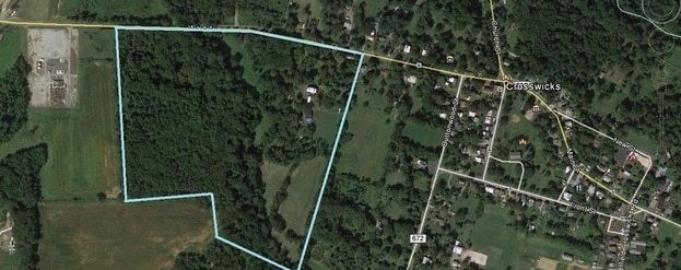

Property Detail
517 Ward Ave
07-00107-0000-00012
BURLINGTON
Farms
New Jersey
AG
12
A Areas with a 1% annual chance of flooding and a 26% chance of flooding over the life of a 30-year mortgage.
3 AC
2025
South Burlington County
2026
Philadelphia
704302
Philadelphia-Camden-Wilmington, PA-NJ-DE-MD
5,612 SF
NEARBY LISTINGS FOR SALE OR LEASE
-
-
-
-
-
-
No Photo
-
View all Chesterfield listings for sale on LoopNet.com
DEMOGRAPHICS near 517 Ward Ave
1 mile
3 mile
5 mile
2025 Total Population
4,113
31,230
81,444
2030 Population
4,197
32,005
83,661
Pop Growth 2025-2030
+ 2.04%
+ 2.48%
+ 2.72%
Average Age
35
41
42
2025 Total Households
953
10,902
30,763
HH Growth 2025-2030
+ 2.52%
+ 2.71%
+ 2.84%
Median Household Inc
$171,568
$115,753
$109,322
Avg Household Size
3.20
2.60
2.50
2025 Avg HH Vehicles
2.00
2.00
2.00
Median Home Value
$593,627
$394,370
$385,182
Median Year Built
2002
1969
1972
Nearby Places
Map Layers
Map Styles
 Street
 Aerial
Layers
 Traffic
 Biking
Places
Listings with unknown addresses are not visible on the map
- Restaurants
- Banks
- Shops
- Fitness
- Groceries
PUBLIC TRANSPORTATION
COMMUTER RAIL
Trenton Transit Center (Njt) (Northeast Corridor Line - NJ Transit Commuter Rail (NJ Transit), R7 - NJ Transit Commuter Rail (NJ Transit), River LINE - NJ Transit Commuter Rail (NJ Transit))
Drive
Walk
Distance
Trenton Transit Center (Njt) (Northeast Corridor Line - NJ Transit Commuter Rail (NJ Transit), R7 - NJ Transit Commuter Rail (NJ Transit), River LINE - NJ Transit Commuter Rail (NJ Transit))
17 min
8.5 mi
Trenton Transit Center (Trenton Line - SEPTA)
Drive
Walk
Distance
Trenton Transit Center (Trenton Line - SEPTA)
15 min
9.1 mi
AIRPORT
Trenton Mercer
Drive
Walk
Distance
Trenton Mercer
26 min
14.9 mi
Freight Ports
Port of Philadelphia
Drive
Walk
Distance
Port of Philadelphia
47 min
33.7 mi
Nearby Properties
Address
Land Use
TOTAL SIZE
Lot Size
Zoning
Address
Land Use
TOTAL SIZE
Lot Size
Zoning
561.91 AC
AG
Address
Land Use
TOTAL SIZE
Lot Size
Zoning
31.05 AC
Address
Land Use
TOTAL SIZE
Lot Size
Zoning
30.94 AC
Address
Land Use
TOTAL SIZE
Lot Size
Zoning
51.10 AC
Address
Land Use
TOTAL SIZE
Lot Size
Zoning
392,050 SF
45.57 AC
Address
Land Use
TOTAL SIZE
Lot Size
Zoning
Address
Land Use
TOTAL SIZE
Lot Size
Zoning
134,000 SF
117.90 AC
AR
Address
Land Use
TOTAL SIZE
Lot Size
Zoning
3,040 SF
47.99 AC
Address
Land Use
TOTAL SIZE
Lot Size
Zoning
32.71 AC
HC
Address
Land Use
TOTAL SIZE
Lot Size
Zoning
263,232 SF
39.16 AC
CI
Address
Land Use
TOTAL SIZE
Lot Size
Zoning
2,350 SF
8.80 AC
PVD2
Address
Land Use
TOTAL SIZE
Lot Size
Zoning
Address
Land Use
TOTAL SIZE
Lot Size
Zoning
Address
Land Use
TOTAL SIZE
Lot Size
Zoning
122,941 SF
55.49 AC
RD
Address
Land Use
TOTAL SIZE
Lot Size
Zoning
15,096 SF
21.76 AC
AT
Address
Land Use
TOTAL SIZE
Lot Size
Zoning
25.32 AC
RD
Address
Land Use
TOTAL SIZE
Lot Size
Zoning
Address
Land Use
TOTAL SIZE
Lot Size
Zoning
9.61 AC
R1
Address
Land Use
TOTAL SIZE
Lot Size
Zoning
57,718 SF
9.32 AC
HC
Address
Land Use
TOTAL SIZE
Lot Size
Zoning
Address
Land Use
TOTAL SIZE
Lot Size
Zoning
18,427 SF
6.71 AC
HC
Address
Land Use
TOTAL SIZE
Lot Size
Zoning
51,000 SF
6.78 AC
Address
Land Use
TOTAL SIZE
Lot Size
Zoning
9.40 AC
R2
Address
Land Use
TOTAL SIZE
Lot Size
Zoning
4.12 AC
Address
Land Use
TOTAL SIZE
Lot Size
Zoning
Address
Land Use
TOTAL SIZE
Lot Size
Zoning
Address
Land Use
TOTAL SIZE
Lot Size
Zoning
86,620 SF
5.62 AC
Address
Land Use
TOTAL SIZE
Lot Size
Zoning
56,681 SF
6.93 AC
HC
Address
Land Use
TOTAL SIZE
Lot Size
Zoning
11,064 SF
5.50 AC
AT
Address
Land Use
TOTAL SIZE
Lot Size
Zoning
11.43 AC
The World's #1 Commercial Real Estate Marketplace
Connect with us
© 2026 CoStar Group
The information above has been obtained from sources believed reliable. While we do not doubt its accuracy we have not verified it and make no guarantee, warranty or representation about it. It is your responsibility to independently confirm its accuracy and completeness. Any projections, opinions, assumptions, or estimates used are for example only and do not represent the current or future performance of the property. The value of this transaction to you depends on tax and other factors which should be evaluated by your tax, financial, and legal advisors. You and your advisors should conduct a careful, independent investigation of the property to determine to your satisfaction the suitability of the property for your needs.