Property Record
5170 Vine Hill Rd, Excelsior, MN 55331


NEARBY LISTINGS FOR SALE OR LEASE
-
-
View all Excelsior listings for sale on LoopNet.com
Property Detail
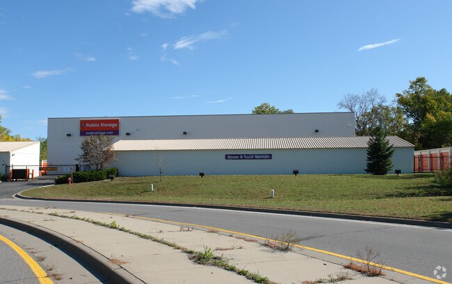
5170 Vine Hill Rd
Minneapolis-St. Paul-Bloomington, MN-WI
Vine Hill
25-117-23-41-0045
LOT 015 A VINE HILL S 106 FT OF E 180 FT OF W 330 FT OF LOT 15 AND THAT PART OF W 132.4 FT OF E 330 FT LOT 15 LYING SLY OF A LINE DESC AS BEG AT A PT IN E LINE T IRREGULAR
Industrialgeneral
Hennepin
X
Minnesota
27019C0117D
15
2024
2.60 AC
2024
I-394 Corridor
027503
Minneapolis/St Paul
DEMOGRAPHICS near 5170 Vine Hill Rd
1 Mile
3 Mile
5 Mile
2024 Total Population
5,264
44,528
105,520
2029 Population
5,161
44,289
105,861
Pop Growth 2024-2029
(1.96%)
(0.54%)
+ 0.32%
Average Age
43
43
43
2024 Total Households
2,036
17,095
41,730
HH Growth 2024-2029
(2.11%)
(0.71%)
+ 0.25%
Median Household Inc
$132,067
$130,562
$122,693
Avg Household Size
2.50
2.50
2.50
2024 Avg HH Vehicles
2.00
2.00
2.00
Median Home Value
$506,410
$467,264
$473,087
Median Year Built
1978
1979
1982
Nearby Places
Map Layers
Map Styles
 Street
 Aerial
- Restaurants
- Banks
- Shops
- Fitness
- Groceries
PUBLIC TRANSPORTATION
AIRPORT
Minneapolis-St Paul International/Wold-Chamberlain
DRIVE
WALK
Distance
Minneapolis-St Paul International/Wold-Chamberlain
29 min
20.0 mi
Freight Ports
Port Milwaukee
DRIVE
WALK
Distance
Port Milwaukee
397 min
353.8 mi
Nearby Properties
Address
Land Use
TOTAL SIZE
Lot Size
Zoning
Address
Land Use
TOTAL SIZE
Lot Size
Zoning
46,726 SF
2.65 AC
PUD
Address
Land Use
TOTAL SIZE
Lot Size
Zoning
3.82 AC
Address
Land Use
TOTAL SIZE
Lot Size
Zoning
7.06 AC
PUD
Address
Land Use
TOTAL SIZE
Lot Size
Zoning
7,209 SF
2.53 AC
B1
Address
Land Use
TOTAL SIZE
Lot Size
Zoning
1.85 AC
Address
Land Use
TOTAL SIZE
Lot Size
Zoning
29,091 SF
34.94 AC
PUD
Address
Land Use
TOTAL SIZE
Lot Size
Zoning
7.82 AC
R4
Address
Land Use
TOTAL SIZE
Lot Size
Zoning
17.67 AC
R4
Address
Land Use
TOTAL SIZE
Lot Size
Zoning
9.29 AC
R4
Address
Land Use
TOTAL SIZE
Lot Size
Zoning
88,948 SF
10.14 AC
B2
Address
Land Use
TOTAL SIZE
Lot Size
Zoning
14.04 AC
R4
Address
Land Use
TOTAL SIZE
Lot Size
Zoning
38,825 SF
5.38 AC
B3
Address
Land Use
TOTAL SIZE
Lot Size
Zoning
1,000 SF
14 AC
Address
Land Use
TOTAL SIZE
Lot Size
Zoning
12,993 SF
2.22 AC
R5
Address
Land Use
TOTAL SIZE
Lot Size
Zoning
Address
Land Use
TOTAL SIZE
Lot Size
Zoning
Address
Land Use
TOTAL SIZE
Lot Size
Zoning
1.67 AC
Address
Land Use
TOTAL SIZE
Lot Size
Zoning
123,472 SF
9.07 AC
B2
Address
Land Use
TOTAL SIZE
Lot Size
Zoning
6.52 AC
Address
Land Use
TOTAL SIZE
Lot Size
Zoning
3.20 AC
Address
Land Use
TOTAL SIZE
Lot Size
Zoning
28,134 SF
2.70 AC
PUD
Address
Land Use
TOTAL SIZE
Lot Size
Zoning
62,862 SF
7.91 AC
B2
Address
Land Use
TOTAL SIZE
Lot Size
Zoning
21,208 SF
3.59 AC
B1
Address
Land Use
TOTAL SIZE
Lot Size
Zoning
5.84 AC
R4
Address
Land Use
TOTAL SIZE
Lot Size
Zoning
16,986 SF
1.77 AC
PUD
Address
Land Use
TOTAL SIZE
Lot Size
Zoning
2.10 AC
Address
Land Use
TOTAL SIZE
Lot Size
Zoning
Address
Land Use
TOTAL SIZE
Lot Size
Zoning
19,405 SF
3.57 AC
B3
Address
Land Use
TOTAL SIZE
Lot Size
Zoning
36,885 SF
3.56 AC
PUD
The World's #1 Commercial Real Estate Marketplace
Connect with us
© 2025 CoStar Group
The information above has been obtained from sources believed reliable. While we do not doubt its accuracy we have not verified it and make no guarantee, warranty or representation about it. It is your responsibility to independently confirm its accuracy and completeness. Any projections, opinions, assumptions, or estimates used are for example only and do not represent the current or future performance of the property. The value of this transaction to you depends on tax and other factors which should be evaluated by your tax, financial, and legal advisors. You and your advisors should conduct a careful, independent investigation of the property to determine to your satisfaction the suitability of the property for your needs.