Property Record
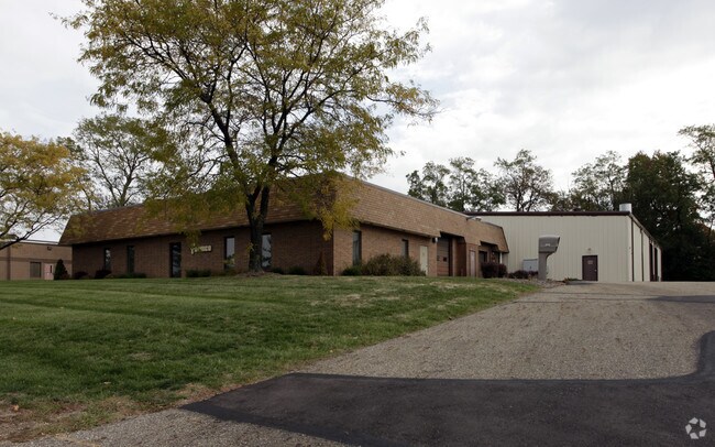
5175 Stoneham Rd, North Canton, OH 44720


NEARBY LISTINGS FOR SALE OR LEASE
Property Detail
5175 Stoneham Rd
Cleveland
Akcan Indust Park
Akron, OH
TR 36 LOT SE E OF STONEHAME RD & W OF COUNTY LINE
29-00034
Summit
Lightindustrial
Ohio
2023
se
2025
1.21 AC
532999
Akron
16,750 SF
DEMOGRAPHICS near 5175 Stoneham Rd
1 Mile
3 Mile
5 Mile
2024 Total Population
2,459
30,779
91,212
2029 Population
2,466
30,542
90,314
Pop Growth 2024-2029
+ 0.28%
(0.77%)
(0.98%)
Average Age
40
42
42
2024 Total Households
1,048
13,028
37,711
HH Growth 2024-2029
+ 0.29%
(0.79%)
(0.98%)
Median Household Inc
$93,749
$79,091
$79,738
Avg Household Size
2.40
2.30
2.40
2024 Avg HH Vehicles
2.00
2.00
2.00
Median Home Value
$270,325
$225,778
$228,458
Median Year Built
1987
1980
1978
Nearby Places
Map Layers
Map Styles
 Street
 Aerial
- Restaurants
- Banks
- Shops
- Fitness
- Groceries
PUBLIC TRANSPORTATION
AIRPORT
Akron-Canton Regional
DRIVE
WALK
Distance
Akron-Canton Regional
5 min
1.7 mi
Nearby Properties
Address
Land Use
TOTAL SIZE
Lot Size
Zoning
Address
Land Use
TOTAL SIZE
Lot Size
Zoning
223,734 SF
1,140.33 AC
Address
Land Use
TOTAL SIZE
Lot Size
Zoning
494,965 SF
15.48 AC
Address
Land Use
TOTAL SIZE
Lot Size
Zoning
103,786 SF
8.77 AC
Address
Land Use
TOTAL SIZE
Lot Size
Zoning
367,640 SF
35.46 AC
Address
Land Use
TOTAL SIZE
Lot Size
Zoning
296,562 SF
36.07 AC
Address
Land Use
TOTAL SIZE
Lot Size
Zoning
356,083 SF
32.10 AC
Address
Land Use
TOTAL SIZE
Lot Size
Zoning
415,636 SF
91.33 AC
Address
Land Use
TOTAL SIZE
Lot Size
Zoning
1,247.97 AC
Address
Land Use
TOTAL SIZE
Lot Size
Zoning
150,620 SF
18.25 AC
Address
Land Use
TOTAL SIZE
Lot Size
Zoning
106,867 SF
13.43 AC
Address
Land Use
TOTAL SIZE
Lot Size
Zoning
103,786 SF
8.51 AC
Address
Land Use
TOTAL SIZE
Lot Size
Zoning
Address
Land Use
TOTAL SIZE
Lot Size
Zoning
218,864 SF
11.84 AC
Address
Land Use
TOTAL SIZE
Lot Size
Zoning
160,650 SF
17.26 AC
Address
Land Use
TOTAL SIZE
Lot Size
Zoning
155,328 SF
22.08 AC
Address
Land Use
TOTAL SIZE
Lot Size
Zoning
255,406 SF
25.19 AC
Address
Land Use
TOTAL SIZE
Lot Size
Zoning
50,062 SF
8.51 AC
Address
Land Use
TOTAL SIZE
Lot Size
Zoning
106,416 SF
18.99 AC
Address
Land Use
TOTAL SIZE
Lot Size
Zoning
129,322 SF
7 AC
Address
Land Use
TOTAL SIZE
Lot Size
Zoning
465,350 SF
7.95 AC
Address
Land Use
TOTAL SIZE
Lot Size
Zoning
31.58 AC
Address
Land Use
TOTAL SIZE
Lot Size
Zoning
81,901 SF
7.14 AC
Address
Land Use
TOTAL SIZE
Lot Size
Zoning
155,112 SF
8.55 AC
Address
Land Use
TOTAL SIZE
Lot Size
Zoning
67,597 SF
10.36 AC
Address
Land Use
TOTAL SIZE
Lot Size
Zoning
113,866 SF
10.68 AC
Address
Land Use
TOTAL SIZE
Lot Size
Zoning
121,154 SF
9.45 AC
Address
Land Use
TOTAL SIZE
Lot Size
Zoning
54,010 SF
10.64 AC
Address
Land Use
TOTAL SIZE
Lot Size
Zoning
61,261 SF
10.02 AC
Address
Land Use
TOTAL SIZE
Lot Size
Zoning
216,321 SF
13.34 AC
Address
Land Use
TOTAL SIZE
Lot Size
Zoning
96,386 SF
3.53 AC
The World's #1 Commercial Real Estate Marketplace
Connect with us
© 2026 CoStar Group
The information above has been obtained from sources believed reliable. While we do not doubt its accuracy we have not verified it and make no guarantee, warranty or representation about it. It is your responsibility to independently confirm its accuracy and completeness. Any projections, opinions, assumptions, or estimates used are for example only and do not represent the current or future performance of the property. The value of this transaction to you depends on tax and other factors which should be evaluated by your tax, financial, and legal advisors. You and your advisors should conduct a careful, independent investigation of the property to determine to your satisfaction the suitability of the property for your needs.