Property Record
5178 Wake Forest Rd, Durham, NC 27703
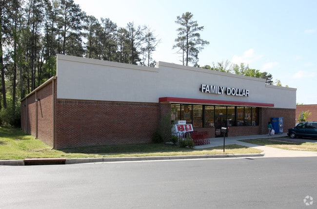


Property Detail
5178 Wake Forest Rd
166185
RAVENSTONE DEVELOPMENT/TR #04/LT#03 FAMILY DOLLAR PL:000174-000278
Storebuilding
Durham
CC(D)
North Carolina
B and X Area of moderate flood hazard, usually the area between the limits of the 100-year and 500-year floods.
3
2025
0.94 AC
2025
South Durham
001808
Raleigh/Durham
9,180 SF
Durham-Chapel Hill, NC
NEARBY LISTINGS FOR SALE OR LEASE
-
-
View all Durham listings for sale on LoopNet.com
DEMOGRAPHICS near 5178 Wake Forest Rd
1 mile
3 mile
5 mile
2025 Total Population
4,532
30,224
95,868
2030 Population
4,838
32,132
102,503
Pop Growth 2025-2030
+ 6.75%
+ 6.31%
+ 6.92%
Average Age
39
40
39
2025 Total Households
1,668
11,573
38,460
HH Growth 2025-2030
+ 7.07%
+ 6.61%
+ 7.32%
Median Household Inc
$140,071
$110,893
$101,504
Avg Household Size
2.60
2.50
2.40
2025 Avg HH Vehicles
2.00
2.00
2.00
Median Home Value
$436,170
$389,144
$408,406
Median Year Built
2009
2007
2004
Nearby Places
Map Layers
Map Styles
 Street
 Aerial
Transit
 Traffic
 Biking
Places
Listings with unknown addresses are not visible on the map
- Restaurants
- Banks
- Shops
- Fitness
- Groceries
PUBLIC TRANSPORTATION
COMMUTER RAIL
Drive
Walk
Distance
15 min
6.8 mi
AIRPORT
Raleigh-Durham International
Drive
Walk
Distance
Raleigh-Durham International
19 min
10.4 mi
Nearby Properties
Address
Land Use
TOTAL SIZE
Lot Size
Zoning
Address
Land Use
TOTAL SIZE
Lot Size
Zoning
21.29 AC
CG(D)
Address
Land Use
TOTAL SIZE
Lot Size
Zoning
28,632 SF
23.64 AC
PDR 3.990
Address
Land Use
TOTAL SIZE
Lot Size
Zoning
13.70 AC
CG(D)
Address
Land Use
TOTAL SIZE
Lot Size
Zoning
12.33 AC
IP
Address
Land Use
TOTAL SIZE
Lot Size
Zoning
61,242 SF
8.59 AC
CC(D)
Address
Land Use
TOTAL SIZE
Lot Size
Zoning
53.25 AC
PDR 5.949
Address
Land Use
TOTAL SIZE
Lot Size
Zoning
131,114 SF
48.95 AC
RR
Address
Land Use
TOTAL SIZE
Lot Size
Zoning
80,330 SF
34.58 AC
RR
Address
Land Use
TOTAL SIZE
Lot Size
Zoning
53.96 AC
PDR 5.949
Address
Land Use
TOTAL SIZE
Lot Size
Zoning
181.12 AC
PDR 2.883
Address
Land Use
TOTAL SIZE
Lot Size
Zoning
98.34 AC
PDR 3.950
Address
Land Use
TOTAL SIZE
Lot Size
Zoning
82,777 SF
15.72 AC
RR,RS-20
Address
Land Use
TOTAL SIZE
Lot Size
Zoning
42.14 AC
PDR 4.680
Address
Land Use
TOTAL SIZE
Lot Size
Zoning
59,825 SF
9.03 AC
CC
Address
Land Use
TOTAL SIZE
Lot Size
Zoning
129.62 AC
PDR 3.551
Address
Land Use
TOTAL SIZE
Lot Size
Zoning
13,824 SF
3.55 AC
SPLIT
Address
Land Use
TOTAL SIZE
Lot Size
Zoning
215.61 AC
RR
Address
Land Use
TOTAL SIZE
Lot Size
Zoning
43.11 AC
PDR MH
Address
Land Use
TOTAL SIZE
Lot Size
Zoning
51,110 SF
0.86 AC
CG
Address
Land Use
TOTAL SIZE
Lot Size
Zoning
82.12 AC
PDR 2.903
Address
Land Use
TOTAL SIZE
Lot Size
Zoning
12,040 SF
1.79 AC
CN
Address
Land Use
TOTAL SIZE
Lot Size
Zoning
260.12 AC
RR
Address
Land Use
TOTAL SIZE
Lot Size
Zoning
56,905 SF
4.17 AC
IL(D)
Address
Land Use
TOTAL SIZE
Lot Size
Zoning
36,232 SF
12.28 AC
PDR 0.000
Address
Land Use
TOTAL SIZE
Lot Size
Zoning
108.04 AC
RR
Address
Land Use
TOTAL SIZE
Lot Size
Zoning
47.50 AC
PDR 3.850
Address
Land Use
TOTAL SIZE
Lot Size
Zoning
17,105 SF
36.53 AC
RR
Address
Land Use
TOTAL SIZE
Lot Size
Zoning
25,001 SF
3.90 AC
PDR 1.630
Address
Land Use
TOTAL SIZE
Lot Size
Zoning
43.28 AC
RR
Address
Land Use
TOTAL SIZE
Lot Size
Zoning
83.38 AC
PDR 3.220
The World's #1 Commercial Real Estate Marketplace
Connect with us
© 2026 CoStar Group
The information above has been obtained from sources believed reliable. While we do not doubt its accuracy we have not verified it and make no guarantee, warranty or representation about it. It is your responsibility to independently confirm its accuracy and completeness. Any projections, opinions, assumptions, or estimates used are for example only and do not represent the current or future performance of the property. The value of this transaction to you depends on tax and other factors which should be evaluated by your tax, financial, and legal advisors. You and your advisors should conduct a careful, independent investigation of the property to determine to your satisfaction the suitability of the property for your needs.