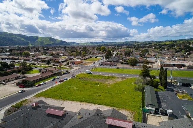
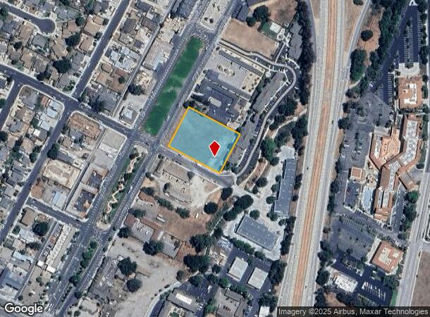
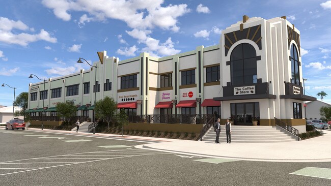
Property Record
518 Avenue Of The Flags, Buellton, CA 93427

NEARBY LISTINGS FOR SALE OR LEASE
Property Detail
518 Avenue Of The Flags
Santa Maria-Santa Barbara, CA
San Carlos De Jonata Rho
137-170-006
S C DE JONATA M10 S7 TR LOT 63B
Commercialnec
Santa Barbara
AE
California
06083C1052G
63b
2024
1.22 AC
2025
Central SB County
001912
Santa Barbara/Sta Maria/Goleta
DEMOGRAPHICS near 518 Avenue Of The Flags
1 Mile
3 Mile
5 Mile
2024 Total Population
4,723
7,062
13,020
2029 Population
4,616
6,873
12,680
Pop Growth 2024-2029
(2.27%)
(2.68%)
(2.61%)
Average Age
41
42
44
2024 Total Households
1,770
2,673
5,052
HH Growth 2024-2029
(2.32%)
(2.84%)
(2.75%)
Median Household Inc
$106,396
$106,425
$111,634
Avg Household Size
2.70
2.60
2.50
2024 Avg HH Vehicles
2.00
2.00
2.00
Median Home Value
$691,386
$741,174
$840,945
Median Year Built
1996
1990
1984
Nearby Places
- Restaurants
- Banks
- Shops
- Fitness
- Groceries
PUBLIC TRANSPORTATION
AIRPORT
Santa Barbara Municipal
DRIVE
WALK
Distance
Santa Barbara Municipal
56 min
36.7 mi
Freight Ports
The Port of Hueneme
DRIVE
WALK
Distance
The Port of Hueneme
104 min
83.3 mi
SALE & LEASE HISTORY
LISTING DATE
SALE/LEASE

Oct 01, 2019
For Sale
May 27, 2020
For Sale
Mar 28, 2019
For Sale
Nearby Properties
Address
Land Use
TOTAL SIZE
Lot Size
Zoning
Address
Land Use
TOTAL SIZE
Lot Size
Zoning
2.11 AC
Address
Land Use
TOTAL SIZE
Lot Size
Zoning
4.21 AC
Address
Land Use
TOTAL SIZE
Lot Size
Zoning
3.63 AC
Address
Land Use
TOTAL SIZE
Lot Size
Zoning
3.19 AC
AGI40
Address
Land Use
TOTAL SIZE
Lot Size
Zoning
1.54 AC
Address
Land Use
TOTAL SIZE
Lot Size
Zoning
3.06 AC
Address
Land Use
TOTAL SIZE
Lot Size
Zoning
3,086 SF
68.19 AC
AGII40
Address
Land Use
TOTAL SIZE
Lot Size
Zoning
50,439 SF
3.30 AC
Address
Land Use
TOTAL SIZE
Lot Size
Zoning
Address
Land Use
TOTAL SIZE
Lot Size
Zoning
137,419 SF
5.12 AC
Address
Land Use
TOTAL SIZE
Lot Size
Zoning
1.04 AC
Address
Land Use
TOTAL SIZE
Lot Size
Zoning
2,110 SF
3.01 AC
Address
Land Use
TOTAL SIZE
Lot Size
Zoning
0.79 AC
Address
Land Use
TOTAL SIZE
Lot Size
Zoning
2.07 AC
Address
Land Use
TOTAL SIZE
Lot Size
Zoning
2.35 AC
Address
Land Use
TOTAL SIZE
Lot Size
Zoning
1.57 AC
Address
Land Use
TOTAL SIZE
Lot Size
Zoning
2.11 AC
Address
Land Use
TOTAL SIZE
Lot Size
Zoning
8.99 AC
Address
Land Use
TOTAL SIZE
Lot Size
Zoning
3,282 SF
62.61 AC
AGII40
Address
Land Use
TOTAL SIZE
Lot Size
Zoning
35.61 AC
AGI40
Address
Land Use
TOTAL SIZE
Lot Size
Zoning
208.02 AC
AGII100
Address
Land Use
TOTAL SIZE
Lot Size
Zoning
2.45 AC
Address
Land Use
TOTAL SIZE
Lot Size
Zoning
14,227 SF
2.32 AC
Address
Land Use
TOTAL SIZE
Lot Size
Zoning
0.25 AC
Address
Land Use
TOTAL SIZE
Lot Size
Zoning
0.77 AC
Address
Land Use
TOTAL SIZE
Lot Size
Zoning
21,903 SF
1 AC
Address
Land Use
TOTAL SIZE
Lot Size
Zoning
157.22 AC
AGII100
Address
Land Use
TOTAL SIZE
Lot Size
Zoning
2.70 AC
Address
Land Use
TOTAL SIZE
Lot Size
Zoning
275.96 AC
AGII100
Address
Land Use
TOTAL SIZE
Lot Size
Zoning
44.87 AC
AGI20
The World's #1 Commercial Real Estate Marketplace
Connect with us
© 2025 CoStar Group
The information above has been obtained from sources believed reliable. While we do not doubt its accuracy we have not verified it and make no guarantee, warranty or representation about it. It is your responsibility to independently confirm its accuracy and completeness. Any projections, opinions, assumptions, or estimates used are for example only and do not represent the current or future performance of the property. The value of this transaction to you depends on tax and other factors which should be evaluated by your tax, financial, and legal advisors. You and your advisors should conduct a careful, independent investigation of the property to determine to your satisfaction the suitability of the property for your needs.