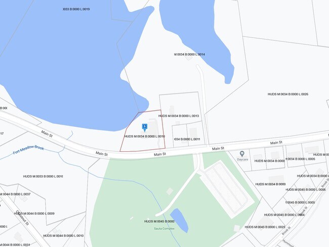
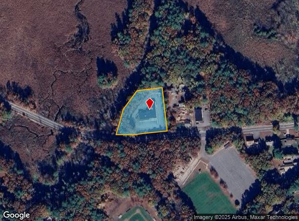
Property Record
518 Main St, Hudson, MA 01749
NEARBY LISTINGS FOR SALE OR LEASE
Property Detail
518 Main St
HUDS-000034-000000-000010
Middlesex
Manufacturinglight
Massachusetts
AE
10
25017C0344F
1.42 AC
2025
Concord/Maynard
2025
Boston
322100
Boston-Cambridge-Newton, MA-NH
6,400 SF
DEMOGRAPHICS near 518 Main St
1 Mile
3 Mile
5 Mile
2024 Total Population
1,636
35,525
88,496
2029 Population
1,618
35,164
87,576
Pop Growth 2024-2029
(1.10%)
(1.02%)
(1.04%)
Average Age
43
42
42
2024 Total Households
582
14,093
34,563
HH Growth 2024-2029
(1.37%)
(1.09%)
(1.13%)
Median Household Inc
$158,397
$101,852
$109,115
Avg Household Size
2.70
2.50
2.50
2024 Avg HH Vehicles
3.00
2.00
2.00
Median Home Value
$659,218
$474,160
$497,843
Median Year Built
1987
1976
1972
Nearby Places
Map Layers
Map Styles
 Street
 Aerial
- Restaurants
- Banks
- Shops
- Fitness
- Groceries
PUBLIC TRANSPORTATION
COMMUTER RAIL
South Acton (Fitchburg/South Acton Line - Massachusetts Bay Transportation Authority Commuter Rail (Purple Line))
DRIVE
WALK
Distance
South Acton (Fitchburg/South Acton Line - Massachusetts Bay Transportation Authority Commuter Rail (Purple Line))
19 min
7.7 mi
AIRPORT
Worcester Regional
DRIVE
WALK
Distance
Worcester Regional
39 min
24.0 mi
General Edward Lawrence Logan International
DRIVE
WALK
Distance
General Edward Lawrence Logan International
52 min
31.1 mi
Freight Ports
Port of Boston
DRIVE
WALK
Distance
Port of Boston
51 min
29.4 mi
Nearby Properties
Address
Land Use
TOTAL SIZE
Lot Size
Zoning
Address
Land Use
TOTAL SIZE
Lot Size
Zoning
284,231 SF
62.04 AC
A2
Address
Land Use
TOTAL SIZE
Lot Size
Zoning
23,890 SF
36.39 AC
A3
Address
Land Use
TOTAL SIZE
Lot Size
Zoning
54.67 AC
LI
Address
Land Use
TOTAL SIZE
Lot Size
Zoning
4,188 SF
23.20 AC
B
Address
Land Use
TOTAL SIZE
Lot Size
Zoning
267,805 SF
30.74 AC
A2
Address
Land Use
TOTAL SIZE
Lot Size
Zoning
14.80 AC
M6
Address
Land Use
TOTAL SIZE
Lot Size
Zoning
121,434 SF
21.35 AC
SA8
Address
Land Use
TOTAL SIZE
Lot Size
Zoning
22.74 AC
A1
Address
Land Use
TOTAL SIZE
Lot Size
Zoning
9.66 AC
A1
Address
Land Use
TOTAL SIZE
Lot Size
Zoning
21.17 AC
A1
Address
Land Use
TOTAL SIZE
Lot Size
Zoning
85,958 SF
13.52 AC
A3
Address
Land Use
TOTAL SIZE
Lot Size
Zoning
46.82 AC
RC
Address
Land Use
TOTAL SIZE
Lot Size
Zoning
215,936 SF
15.63 AC
I
Address
Land Use
TOTAL SIZE
Lot Size
Zoning
196,145 SF
10.18 AC
LI
Address
Land Use
TOTAL SIZE
Lot Size
Zoning
16.84 AC
M5
Address
Land Use
TOTAL SIZE
Lot Size
Zoning
71.89 AC
RR
Address
Land Use
TOTAL SIZE
Lot Size
Zoning
3.58 AC
B
Address
Land Use
TOTAL SIZE
Lot Size
Zoning
9.90 AC
C12
Address
Land Use
TOTAL SIZE
Lot Size
Zoning
75,542 SF
3.23 AC
SB
Address
Land Use
TOTAL SIZE
Lot Size
Zoning
116,597 SF
11.29 AC
B
Address
Land Use
TOTAL SIZE
Lot Size
Zoning
148.66 AC
M6
Address
Land Use
TOTAL SIZE
Lot Size
Zoning
16.51 AC
SA7
Address
Land Use
TOTAL SIZE
Lot Size
Zoning
102,380 SF
12.22 AC
LI
Address
Land Use
TOTAL SIZE
Lot Size
Zoning
104,752 SF
7.54 AC
C11
Address
Land Use
TOTAL SIZE
Lot Size
Zoning
112,548 SF
1 AC
Address
Land Use
TOTAL SIZE
Lot Size
Zoning
136,650 SF
21.06 AC
M6
Address
Land Use
TOTAL SIZE
Lot Size
Zoning
105,560 SF
4.62 AC
B
Address
Land Use
TOTAL SIZE
Lot Size
Zoning
93,315 SF
13 AC
B
Address
Land Use
TOTAL SIZE
Lot Size
Zoning
990.40 AC
RC
Address
Land Use
TOTAL SIZE
Lot Size
Zoning
122.98 AC
SA8
The World's #1 Commercial Real Estate Marketplace
Connect with us
© 2026 CoStar Group
The information above has been obtained from sources believed reliable. While we do not doubt its accuracy we have not verified it and make no guarantee, warranty or representation about it. It is your responsibility to independently confirm its accuracy and completeness. Any projections, opinions, assumptions, or estimates used are for example only and do not represent the current or future performance of the property. The value of this transaction to you depends on tax and other factors which should be evaluated by your tax, financial, and legal advisors. You and your advisors should conduct a careful, independent investigation of the property to determine to your satisfaction the suitability of the property for your needs.