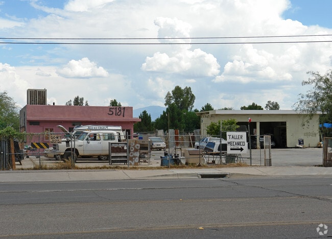
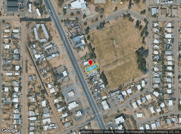
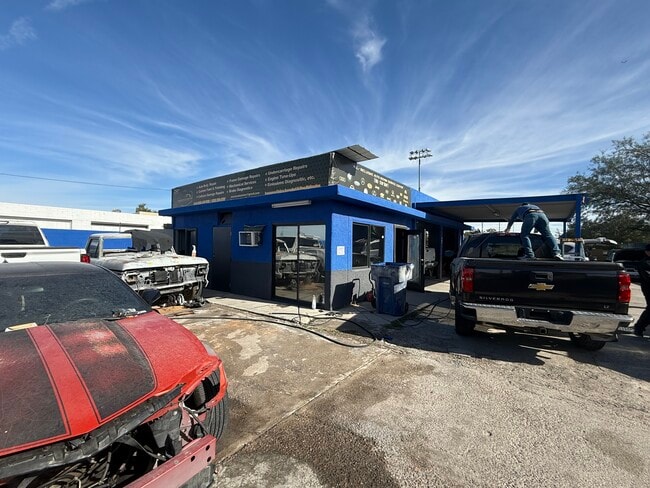
Property Record
5181 S Nogales Hwy, Tucson, AZ 85706
This Property Is For Sale
NEARBY LISTINGS FOR SALE OR LEASE
Property Detail
5181 S Nogales Hwy
Tucson, AZ
Rodeo Resub
137-03-0800
RODEO RESUB LOT 9 BLK 3
Storageyardjunkautowreckingsalvage
Pima
X
Arizona
04019C2287L
9
2025
0.21 AC
2025
South Tucson
003802
Tucson
1,050 SF
DEMOGRAPHICS near 5181 S Nogales Hwy
1 Mile
3 Mile
5 Mile
2024 Total Population
16,717
104,639
180,431
2029 Population
17,218
107,757
186,092
Pop Growth 2024-2029
+ 3.00%
+ 2.98%
+ 3.14%
Average Age
36
36
36
2024 Total Households
5,920
35,471
64,981
HH Growth 2024-2029
+ 3.02%
+ 2.93%
+ 3.16%
Median Household Inc
$39,422
$43,049
$46,294
Avg Household Size
2.70
2.80
2.60
2024 Avg HH Vehicles
2.00
2.00
2.00
Median Home Value
$119,074
$134,709
$160,770
Median Year Built
1980
1980
1978
Nearby Places
Map Layers
Map Styles
 Street
 Aerial
- Restaurants
- Banks
- Shops
- Fitness
- Groceries
PUBLIC TRANSPORTATION
COMMUTER RAIL
DRIVE
WALK
Distance
11 min
5.7 mi
AIRPORT
Tucson International
DRIVE
WALK
Distance
Tucson International
10 min
4.1 mi
Nearby Properties
Address
Land Use
TOTAL SIZE
Lot Size
Zoning
Address
Land Use
TOTAL SIZE
Lot Size
Zoning
806,459 SF
180.96 AC
R1
Address
Land Use
TOTAL SIZE
Lot Size
Zoning
475,707 SF
107.59 AC
Address
Land Use
TOTAL SIZE
Lot Size
Zoning
1,207,845 SF
78.85 AC
Address
Land Use
TOTAL SIZE
Lot Size
Zoning
544,787 SF
84.11 AC
CI1
Address
Land Use
TOTAL SIZE
Lot Size
Zoning
55,730 SF
4.25 AC
C2
Address
Land Use
TOTAL SIZE
Lot Size
Zoning
297,624 SF
36.54 AC
R2
Address
Land Use
TOTAL SIZE
Lot Size
Zoning
189,299 SF
10.17 AC
Address
Land Use
TOTAL SIZE
Lot Size
Zoning
413,807 SF
514.76 AC
CI2
Address
Land Use
TOTAL SIZE
Lot Size
Zoning
200,511 SF
19.37 AC
Address
Land Use
TOTAL SIZE
Lot Size
Zoning
51,655 SF
6.42 AC
I1
Address
Land Use
TOTAL SIZE
Lot Size
Zoning
36,766 SF
3.05 AC
C2
Address
Land Use
TOTAL SIZE
Lot Size
Zoning
298,989 SF
21.76 AC
Address
Land Use
TOTAL SIZE
Lot Size
Zoning
220,812 SF
193.24 AC
R1
Address
Land Use
TOTAL SIZE
Lot Size
Zoning
355,555 SF
38.97 AC
R2
Address
Land Use
TOTAL SIZE
Lot Size
Zoning
229,320 SF
25.85 AC
Address
Land Use
TOTAL SIZE
Lot Size
Zoning
183,196 SF
36.82 AC
R2
Address
Land Use
TOTAL SIZE
Lot Size
Zoning
55,470 SF
4.13 AC
Address
Land Use
TOTAL SIZE
Lot Size
Zoning
91.34 AC
Address
Land Use
TOTAL SIZE
Lot Size
Zoning
5,953 SF
3.89 AC
Address
Land Use
TOTAL SIZE
Lot Size
Zoning
316,226 SF
56.55 AC
I1
Address
Land Use
TOTAL SIZE
Lot Size
Zoning
103,230 SF
15.64 AC
C3
Address
Land Use
TOTAL SIZE
Lot Size
Zoning
141,501 SF
10.33 AC
I1
Address
Land Use
TOTAL SIZE
Lot Size
Zoning
190,597 SF
16.65 AC
Address
Land Use
TOTAL SIZE
Lot Size
Zoning
147,919 SF
7.04 AC
RH
Address
Land Use
TOTAL SIZE
Lot Size
Zoning
141,984 SF
51 AC
PI
Address
Land Use
TOTAL SIZE
Lot Size
Zoning
134,776 SF
15.07 AC
I1
Address
Land Use
TOTAL SIZE
Lot Size
Zoning
33.99 AC
CI1
Address
Land Use
TOTAL SIZE
Lot Size
Zoning
30,000 SF
4.34 AC
I1
Address
Land Use
TOTAL SIZE
Lot Size
Zoning
14,838 SF
43.80 AC
TH
Address
Land Use
TOTAL SIZE
Lot Size
Zoning
185,564 SF
8.50 AC
The World's #1 Commercial Real Estate Marketplace
Connect with us
© 2026 CoStar Group
The information above has been obtained from sources believed reliable. While we do not doubt its accuracy we have not verified it and make no guarantee, warranty or representation about it. It is your responsibility to independently confirm its accuracy and completeness. Any projections, opinions, assumptions, or estimates used are for example only and do not represent the current or future performance of the property. The value of this transaction to you depends on tax and other factors which should be evaluated by your tax, financial, and legal advisors. You and your advisors should conduct a careful, independent investigation of the property to determine to your satisfaction the suitability of the property for your needs.