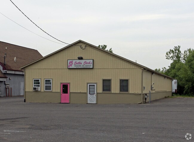
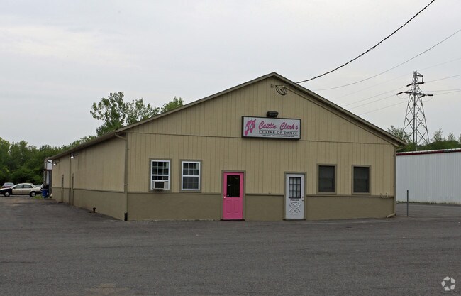
Property Record
519 Horan Rd, Syracuse, NY 13219

NEARBY LISTINGS FOR SALE OR LEASE
Property Detail
519 Horan Rd
312089-015-000-0003-004-002-0000
FL 24
Storesoffices
Onondaga
AE
New York
36067C0211F
4.002
2025
4.15 AC
2024
W Outer Onondaga County
012700
Syracuse
5,040 SF
Syracuse, NY
DEMOGRAPHICS near 519 Horan Rd
1 Mile
3 Mile
5 Mile
2024 Total Population
7,949
43,626
147,692
2029 Population
7,862
42,427
144,357
Pop Growth 2024-2029
(1.09%)
(2.75%)
(2.26%)
Average Age
41
42
39
2024 Total Households
3,390
19,065
62,225
HH Growth 2024-2029
(1.42%)
(2.97%)
(2.26%)
Median Household Inc
$63,805
$66,970
$53,909
Avg Household Size
2.30
2.20
2.20
2024 Avg HH Vehicles
2.00
2.00
1.00
Median Home Value
$145,463
$159,228
$152,958
Median Year Built
1956
1957
1955
Nearby Places
- Restaurants
- Banks
- Shops
- Fitness
- Groceries
PUBLIC TRANSPORTATION
COMMUTER RAIL
DRIVE
WALK
Distance
2 min
20 min
1.0 mi
DRIVE
WALK
Distance
11 min
6.3 mi
AIRPORT
Syracuse Hancock International
DRIVE
WALK
Distance
Syracuse Hancock International
19 min
11.0 mi
Nearby Properties
Address
Land Use
TOTAL SIZE
Lot Size
Zoning
Address
Land Use
TOTAL SIZE
Lot Size
Zoning
57,011 SF
22.53 AC
22
Address
Land Use
TOTAL SIZE
Lot Size
Zoning
52,800 SF
691.95 AC
06 - INDUS
Address
Land Use
TOTAL SIZE
Lot Size
Zoning
256,000 SF
44.31 AC
08 - GOVER
Address
Land Use
TOTAL SIZE
Lot Size
Zoning
6,106 SF
32.71 AC
06
Address
Land Use
TOTAL SIZE
Lot Size
Zoning
22,692 SF
28.07 AC
03 - MULTI
Address
Land Use
TOTAL SIZE
Lot Size
Zoning
23,650 SF
146.50 AC
06 - INDUS
Address
Land Use
TOTAL SIZE
Lot Size
Zoning
216,079 SF
17.57 AC
06 - INDUS
Address
Land Use
TOTAL SIZE
Lot Size
Zoning
270,834 SF
29.38 AC
05 - COMME
Address
Land Use
TOTAL SIZE
Lot Size
Zoning
58,012 SF
21.64 AC
02 - SINGL
Address
Land Use
TOTAL SIZE
Lot Size
Zoning
97,439 SF
24.52 AC
05 - COMME
Address
Land Use
TOTAL SIZE
Lot Size
Zoning
10,200 SF
5.96 AC
03 - MULTI
Address
Land Use
TOTAL SIZE
Lot Size
Zoning
205,018 SF
18.15 AC
05 - COMME
Address
Land Use
TOTAL SIZE
Lot Size
Zoning
127,391 SF
11.68 AC
05 - COMME
Address
Land Use
TOTAL SIZE
Lot Size
Zoning
42,189 SF
8.60 AC
02 - SINGL
Address
Land Use
TOTAL SIZE
Lot Size
Zoning
147,250 SF
0.50 AC
02 - SINGL
Address
Land Use
TOTAL SIZE
Lot Size
Zoning
121,941 SF
30.34 AC
08 - GOVER
Address
Land Use
TOTAL SIZE
Lot Size
Zoning
104,592 SF
20.41 AC
08 - GOVER
Address
Land Use
TOTAL SIZE
Lot Size
Zoning
65,027 SF
262.57 AC
06 - INDUS
Address
Land Use
TOTAL SIZE
Lot Size
Zoning
106,338 SF
7.70 AC
05 - COMME
Address
Land Use
TOTAL SIZE
Lot Size
Zoning
12,325 SF
16.12 AC
07 - MIXED
Address
Land Use
TOTAL SIZE
Lot Size
Zoning
157,675 SF
12.88 AC
Address
Land Use
TOTAL SIZE
Lot Size
Zoning
254,436 SF
21.94 AC
06 - INDUS
Address
Land Use
TOTAL SIZE
Lot Size
Zoning
66,402 SF
24.19 AC
07 - MIXED
Address
Land Use
TOTAL SIZE
Lot Size
Zoning
138,735 SF
13.81 AC
05 - COMME
Address
Land Use
TOTAL SIZE
Lot Size
Zoning
78,545 SF
8.55 AC
05 - COMME
Address
Land Use
TOTAL SIZE
Lot Size
Zoning
13,032 SF
7.63 AC
Address
Land Use
TOTAL SIZE
Lot Size
Zoning
15,060 SF
3.10 AC
05 - COMME
Address
Land Use
TOTAL SIZE
Lot Size
Zoning
49,606 SF
8.46 AC
22
Address
Land Use
TOTAL SIZE
Lot Size
Zoning
2,624 SF
252.09 AC
06 - INDUS
Address
Land Use
TOTAL SIZE
Lot Size
Zoning
114,396 SF
9.98 AC
05 - COMME
The World's #1 Commercial Real Estate Marketplace
Connect with us
© 2025 CoStar Group
The information above has been obtained from sources believed reliable. While we do not doubt its accuracy we have not verified it and make no guarantee, warranty or representation about it. It is your responsibility to independently confirm its accuracy and completeness. Any projections, opinions, assumptions, or estimates used are for example only and do not represent the current or future performance of the property. The value of this transaction to you depends on tax and other factors which should be evaluated by your tax, financial, and legal advisors. You and your advisors should conduct a careful, independent investigation of the property to determine to your satisfaction the suitability of the property for your needs.