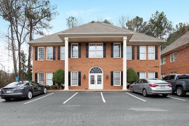
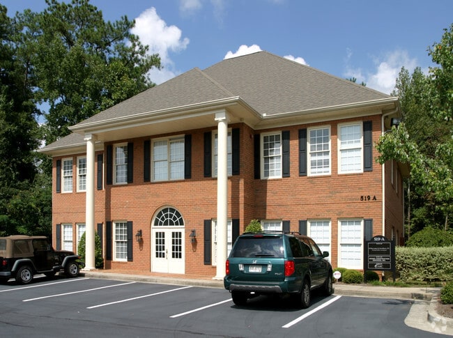
Property Record
Johnson Ferry Rd, , GA

Current Lease Availabilities
NEARBY LISTINGS FOR SALE OR LEASE
Property Detail
Johnson Ferry Rd
Atlanta-Sandy Springs-Roswell, GA
Cobb
01-0070-0-118-0
Georgia
Residentialcommonelementscondominiumcorporation
Cumberland/Galleria
X
Atlanta
13121C0133G
DEMOGRAPHICS near Johnson Ferry Rd
1 Mile
3 Mile
5 Mile
2024 Total Population
8,357
62,705
219,104
2029 Population
8,409
63,294
221,678
Pop Growth 2024-2029
+ 0.62%
+ 0.94%
+ 1.17%
Average Age
43
41
40
2024 Total Households
3,075
23,665
91,171
HH Growth 2024-2029
+ 0.55%
+ 0.88%
+ 1.23%
Median Household Inc
$120,598
$137,297
$105,357
Avg Household Size
2.70
2.60
2.30
2024 Avg HH Vehicles
2.00
2.00
2.00
Median Home Value
$650,307
$577,114
$496,859
Median Year Built
1984
1981
1984
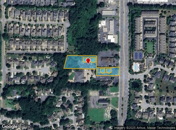
Nearby Places
Map Layers
Map Styles
 Street
 Aerial
- Restaurants
- Banks
- Shops
- Fitness
- Groceries
PUBLIC TRANSPORTATION
AIRPORT
Hartsfield - Jackson Atlanta International
DRIVE
WALK
Distance
Hartsfield - Jackson Atlanta International
42 min
28.0 mi
Freight Ports
Georgia Ports - Savannah
DRIVE
WALK
Distance
Georgia Ports - Savannah
305 min
267.3 mi
Nearby Properties
Address
Land Use
TOTAL SIZE
Lot Size
Zoning
Address
Land Use
TOTAL SIZE
Lot Size
Zoning
12,342,500 SF
125.51 AC
AC
Address
Land Use
TOTAL SIZE
Lot Size
Zoning
258,955 SF
29.70 AC
CRC/LRO
Address
Land Use
TOTAL SIZE
Lot Size
Zoning
416,113 SF
28.12 AC
RM-12
Address
Land Use
TOTAL SIZE
Lot Size
Zoning
3,714,740 SF
45.91 AC
A1
Address
Land Use
TOTAL SIZE
Lot Size
Zoning
647,376 SF
22.43 AC
AC
Address
Land Use
TOTAL SIZE
Lot Size
Zoning
279,518 SF
7.70 AC
C1
Address
Land Use
TOTAL SIZE
Lot Size
Zoning
287,388 SF
44.90 AC
ACOND
Address
Land Use
TOTAL SIZE
Lot Size
Zoning
4,124,136 SF
19.85 AC
AC
Address
Land Use
TOTAL SIZE
Lot Size
Zoning
269,200 SF
18.70 AC
A0
Address
Land Use
TOTAL SIZE
Lot Size
Zoning
1,957,333 SF
19.86 AC
AC
Address
Land Use
TOTAL SIZE
Lot Size
Zoning
2,928,960 SF
22.67 AC
AC
Address
Land Use
TOTAL SIZE
Lot Size
Zoning
2,557,920 SF
14.04 AC
AC
Address
Land Use
TOTAL SIZE
Lot Size
Zoning
3,406 SF
23.20 AC
R20
Address
Land Use
TOTAL SIZE
Lot Size
Zoning
152,152 SF
19.36 AC
AC
Address
Land Use
TOTAL SIZE
Lot Size
Zoning
79,435 SF
8.36 AC
C1
Address
Land Use
TOTAL SIZE
Lot Size
Zoning
166,048 SF
20.29 AC
GC
Address
Land Use
TOTAL SIZE
Lot Size
Zoning
194,453 SF
17.71 AC
CRC/WS
Address
Land Use
TOTAL SIZE
Lot Size
Zoning
24.85 AC
R3
Address
Land Use
TOTAL SIZE
Lot Size
Zoning
2,317,668 SF
12.23 AC
AC
Address
Land Use
TOTAL SIZE
Lot Size
Zoning
149,187 SF
13.69 AC
C1
Address
Land Use
TOTAL SIZE
Lot Size
Zoning
37.92 AC
R2
Address
Land Use
TOTAL SIZE
Lot Size
Zoning
2,325,104 SF
13.50 AC
AO
Address
Land Use
TOTAL SIZE
Lot Size
Zoning
152,191 SF
9.63 AC
RSL
Address
Land Use
TOTAL SIZE
Lot Size
Zoning
119,776 SF
11.17 AC
NS/WS
Address
Land Use
TOTAL SIZE
Lot Size
Zoning
92,787 SF
11.69 AC
CRC/NS
Address
Land Use
TOTAL SIZE
Lot Size
Zoning
135,035 SF
12.51 AC
OIC
Address
Land Use
TOTAL SIZE
Lot Size
Zoning
106,968 SF
0.77 AC
PSC
Address
Land Use
TOTAL SIZE
Lot Size
Zoning
1,576 SF
3.24 AC
RSL
Address
Land Use
TOTAL SIZE
Lot Size
Zoning
84,299 SF
13.83 AC
GC
Address
Land Use
TOTAL SIZE
Lot Size
Zoning
67,397 SF
7.59 AC
NS
The World's #1 Commercial Real Estate Marketplace
Connect with us
© 2025 CoStar Group
The information above has been obtained from sources believed reliable. While we do not doubt its accuracy we have not verified it and make no guarantee, warranty or representation about it. It is your responsibility to independently confirm its accuracy and completeness. Any projections, opinions, assumptions, or estimates used are for example only and do not represent the current or future performance of the property. The value of this transaction to you depends on tax and other factors which should be evaluated by your tax, financial, and legal advisors. You and your advisors should conduct a careful, independent investigation of the property to determine to your satisfaction the suitability of the property for your needs.