Property Record
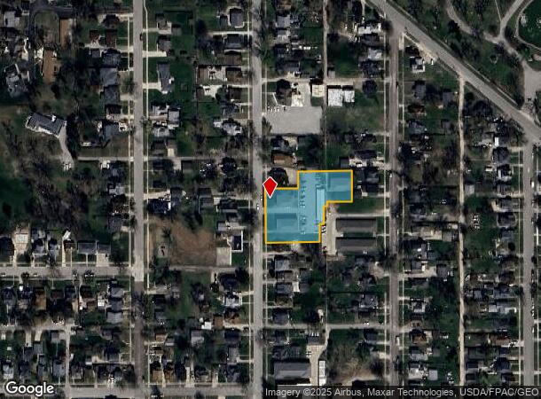
521 N 3Rd St, Marshalltown, IA 50158
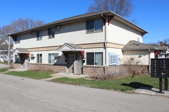
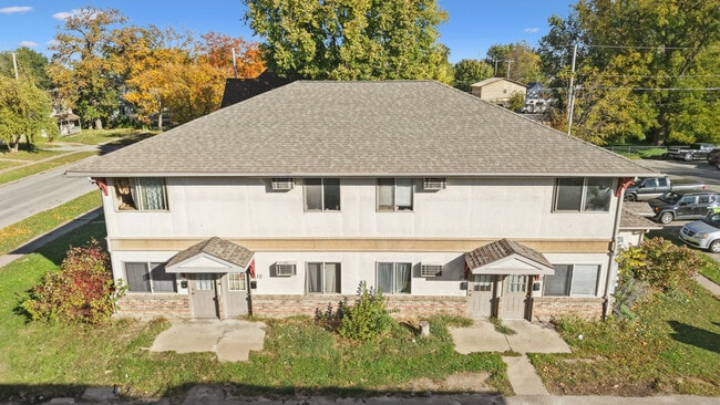
This Property Is For Sale
NEARBY LISTINGS FOR SALE OR LEASE
-
-
View all Marshalltown listings for sale on LoopNet.com
Property Detail
521 N 3Rd St
Marshalltown, IA
Ansons First Addition
8418-26-176-051
LOTS 7 & 8 SE NW & LOT 3/9 SE NW EX E 15' THERE OF &
Apartment
Marshall
X
Iowa
19127C0170C
7,8
2024
0.99 AC
2025
Fort Dodge/Ames
950600
Other Market Areas
4,752 SF
DEMOGRAPHICS near 521 N 3Rd St
1 Mile
3 Mile
5 Mile
2024 Total Population
9,161
25,865
29,113
2029 Population
9,204
25,707
28,920
Pop Growth 2024-2029
+ 0.47%
(0.61%)
(0.66%)
Average Age
36
39
39
2024 Total Households
3,439
9,622
10,944
HH Growth 2024-2029
+ 0.41%
(0.65%)
(0.70%)
Median Household Inc
$49,336
$58,691
$60,404
Avg Household Size
2.50
2.50
2.50
2024 Avg HH Vehicles
2.00
2.00
2.00
Median Home Value
$66,970
$100,852
$108,506
Median Year Built
1947
1956
1957
Nearby Places
- Restaurants
- Banks
- Shops
- Fitness
- Groceries
Nearby Properties
Address
Land Use
TOTAL SIZE
Lot Size
Zoning
Address
Land Use
TOTAL SIZE
Lot Size
Zoning
2,220 SF
14.83 AC
M1
Address
Land Use
TOTAL SIZE
Lot Size
Zoning
936,185 SF
40.27 AC
M2
Address
Land Use
TOTAL SIZE
Lot Size
Zoning
157.52 AC
R2
Address
Land Use
TOTAL SIZE
Lot Size
Zoning
234,288 SF
50.35 AC
R2
Address
Land Use
TOTAL SIZE
Lot Size
Zoning
240,519 SF
6.64 AC
M2
Address
Land Use
TOTAL SIZE
Lot Size
Zoning
273 SF
19.07 AC
M2
Address
Land Use
TOTAL SIZE
Lot Size
Zoning
72,270 SF
69.27 AC
M2
Address
Land Use
TOTAL SIZE
Lot Size
Zoning
9,404 SF
9.64 AC
Address
Land Use
TOTAL SIZE
Lot Size
Zoning
54,958 SF
Address
Land Use
TOTAL SIZE
Lot Size
Zoning
72,270 SF
Address
Land Use
TOTAL SIZE
Lot Size
Zoning
138,437 SF
3.66 AC
PUD
Address
Land Use
TOTAL SIZE
Lot Size
Zoning
31,698 SF
17.40 AC
R2A
Address
Land Use
TOTAL SIZE
Lot Size
Zoning
71,822 SF
8.58 AC
CC
Address
Land Use
TOTAL SIZE
Lot Size
Zoning
19,896 SF
9.63 AC
Address
Land Use
TOTAL SIZE
Lot Size
Zoning
108,735 SF
2.42 AC
Address
Land Use
TOTAL SIZE
Lot Size
Zoning
76,696 SF
6.09 AC
R3
Address
Land Use
TOTAL SIZE
Lot Size
Zoning
33,676 SF
3.12 AC
R4
Address
Land Use
TOTAL SIZE
Lot Size
Zoning
7,776 SF
7.89 AC
Address
Land Use
TOTAL SIZE
Lot Size
Zoning
32,845 SF
6.70 AC
Address
Land Use
TOTAL SIZE
Lot Size
Zoning
792 SF
49.12 AC
M2
Address
Land Use
TOTAL SIZE
Lot Size
Zoning
9,275 SF
7.08 AC
Address
Land Use
TOTAL SIZE
Lot Size
Zoning
3,400 SF
26.06 AC
R2
Address
Land Use
TOTAL SIZE
Lot Size
Zoning
218,434 SF
9.96 AC
M1
Address
Land Use
TOTAL SIZE
Lot Size
Zoning
98,048 SF
6.82 AC
Address
Land Use
TOTAL SIZE
Lot Size
Zoning
73,648 SF
2.35 AC
OP
Address
Land Use
TOTAL SIZE
Lot Size
Zoning
102,153 SF
2.30 AC
CBD
Address
Land Use
TOTAL SIZE
Lot Size
Zoning
300,734 SF
11.07 AC
M2
Address
Land Use
TOTAL SIZE
Lot Size
Zoning
25,423 SF
6.44 AC
CC
Address
Land Use
TOTAL SIZE
Lot Size
Zoning
57,530 SF
8.36 AC
M2
The World's #1 Commercial Real Estate Marketplace
Connect with us
© 2025 CoStar Group
The information above has been obtained from sources believed reliable. While we do not doubt its accuracy we have not verified it and make no guarantee, warranty or representation about it. It is your responsibility to independently confirm its accuracy and completeness. Any projections, opinions, assumptions, or estimates used are for example only and do not represent the current or future performance of the property. The value of this transaction to you depends on tax and other factors which should be evaluated by your tax, financial, and legal advisors. You and your advisors should conduct a careful, independent investigation of the property to determine to your satisfaction the suitability of the property for your needs.