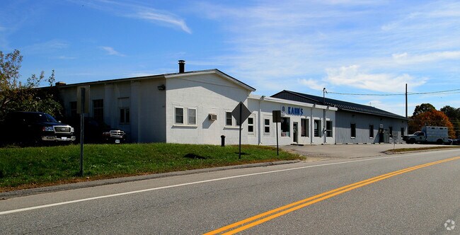
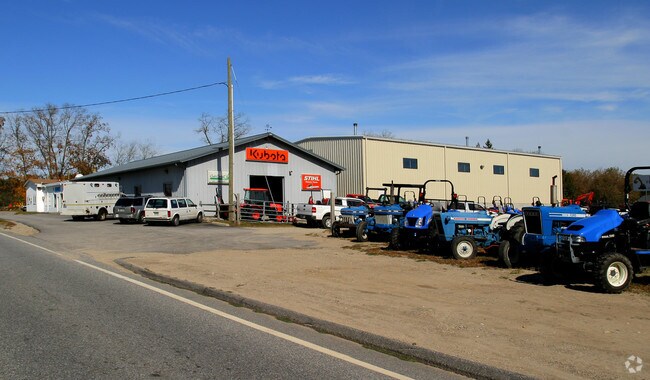
Property Record
519 Pond Rd, North Franklin, CT 06254
NEARBY LISTINGS FOR SALE OR LEASE
Property Detail
519 Pond Rd
Commercialnec
New London
X
Connecticut
09015C0325F
13.47 AC
2025
NE New London/Norwich
2025
Hartford
712100
Norwich-New London-Willimantic, CT
6,302 SF
FRAN-000012-000000-000050
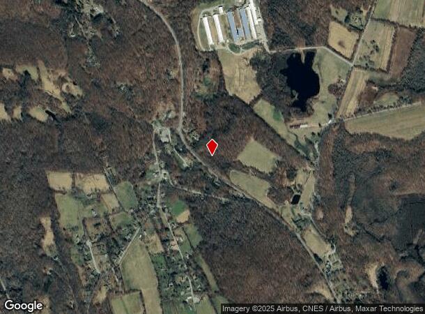
DEMOGRAPHICS near 519 Pond Rd
1 Mile
3 Mile
5 Mile
2024 Total Population
273
3,056
10,696
2029 Population
268
3,030
10,566
Pop Growth 2024-2029
(1.83%)
(0.85%)
(1.22%)
Average Age
45
45
43
2024 Total Households
109
1,215
4,208
HH Growth 2024-2029
(1.83%)
(0.82%)
(1.26%)
Median Household Inc
$95,535
$79,330
$76,553
Avg Household Size
2.40
2.40
2.50
2024 Avg HH Vehicles
2.00
2.00
2.00
Median Home Value
$283,783
$274,088
$254,616
Median Year Built
1968
1963
1964
Nearby Places
Map Layers
Map Styles
 Street
 Aerial
- Restaurants
- Banks
- Shops
- Fitness
- Groceries
Nearby Properties
Address
Land Use
TOTAL SIZE
Lot Size
Zoning
Address
Land Use
TOTAL SIZE
Lot Size
Zoning
2,544 SF
184.20 AC
R-2
Address
Land Use
TOTAL SIZE
Lot Size
Zoning
57,050 SF
17.60 AC
R120
Address
Land Use
TOTAL SIZE
Lot Size
Zoning
136,074 SF
8.51 AC
BP
Address
Land Use
TOTAL SIZE
Lot Size
Zoning
219,698 SF
14 AC
BP
Address
Land Use
TOTAL SIZE
Lot Size
Zoning
11.90 AC
BV
Address
Land Use
TOTAL SIZE
Lot Size
Zoning
73,470 SF
13.11 AC
BP
Address
Land Use
TOTAL SIZE
Lot Size
Zoning
11.87 AC
C-2
Address
Land Use
TOTAL SIZE
Lot Size
Zoning
17,424 SF
14.07 AC
IND
Address
Land Use
TOTAL SIZE
Lot Size
Zoning
49,378 SF
6.34 AC
BP
Address
Land Use
TOTAL SIZE
Lot Size
Zoning
112 AC
R080
Address
Land Use
TOTAL SIZE
Lot Size
Zoning
41,250 SF
7.96 AC
BP
Address
Land Use
TOTAL SIZE
Lot Size
Zoning
9.83 AC
BP
Address
Land Use
TOTAL SIZE
Lot Size
Zoning
12.02 AC
C-2
Address
Land Use
TOTAL SIZE
Lot Size
Zoning
31.05 AC
Address
Land Use
TOTAL SIZE
Lot Size
Zoning
Address
Land Use
TOTAL SIZE
Lot Size
Zoning
6.37 AC
HC
Address
Land Use
TOTAL SIZE
Lot Size
Zoning
98,652 SF
325 AC
R080
Address
Land Use
TOTAL SIZE
Lot Size
Zoning
55,872 SF
10.11 AC
BP
Address
Land Use
TOTAL SIZE
Lot Size
Zoning
11,272 SF
88 AC
R-80
Address
Land Use
TOTAL SIZE
Lot Size
Zoning
14,100 SF
4.30 AC
BP
Address
Land Use
TOTAL SIZE
Lot Size
Zoning
324.70 AC
PRDD
Address
Land Use
TOTAL SIZE
Lot Size
Zoning
45,721 SF
9.48 AC
BP
Address
Land Use
TOTAL SIZE
Lot Size
Zoning
2.40 AC
I
Address
Land Use
TOTAL SIZE
Lot Size
Zoning
82 AC
I-80
Address
Land Use
TOTAL SIZE
Lot Size
Zoning
34,094 SF
6.73 AC
I-80
Address
Land Use
TOTAL SIZE
Lot Size
Zoning
10,606 SF
11.74 AC
I-80
Address
Land Use
TOTAL SIZE
Lot Size
Zoning
20,000 SF
BP
Address
Land Use
TOTAL SIZE
Lot Size
Zoning
9,100 SF
5.44 AC
C-2
Address
Land Use
TOTAL SIZE
Lot Size
Zoning
72,752 SF
55.58 AC
BP
Address
Land Use
TOTAL SIZE
Lot Size
Zoning
51,200 SF
4.01 AC
I-30
The World's #1 Commercial Real Estate Marketplace
Connect with us
© 2026 CoStar Group
The information above has been obtained from sources believed reliable. While we do not doubt its accuracy we have not verified it and make no guarantee, warranty or representation about it. It is your responsibility to independently confirm its accuracy and completeness. Any projections, opinions, assumptions, or estimates used are for example only and do not represent the current or future performance of the property. The value of this transaction to you depends on tax and other factors which should be evaluated by your tax, financial, and legal advisors. You and your advisors should conduct a careful, independent investigation of the property to determine to your satisfaction the suitability of the property for your needs.