Property Record
519 Spring St, Naugatuck, CT 06770
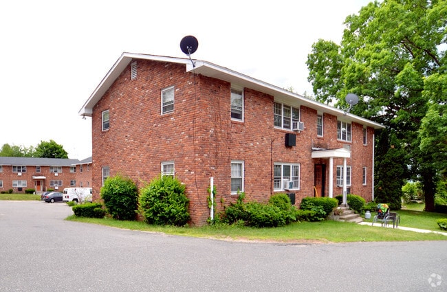

Property Detail
519 Spring St
NAUG-000000F-W001143
Naugatuck Vly
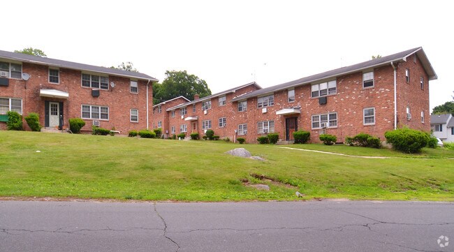
Apartmenthouse100plusunits
Connecticut
R15
6410
B and X Area of moderate flood hazard, usually the area between the limits of the 100-year and 500-year floods.
5.40 AC
2025
Seymour/Naugatuck/Ansonia
2025
Westchester/So Connecticut
345100
New Haven, CT
NEARBY LISTINGS FOR SALE OR LEASE
-
-
View all Naugatuck listings for sale on LoopNet.com
DEMOGRAPHICS near 519 Spring St
1 mile
3 mile
5 mile
2025 Total Population
7,181
63,764
155,576
2030 Population
7,411
65,271
159,471
Pop Growth 2025-2030
+ 3.20%
+ 2.36%
+ 2.50%
Average Age
41
40
40
2025 Total Households
3,026
25,134
60,683
HH Growth 2025-2030
+ 3.14%
+ 2.34%
+ 2.54%
Median Household Inc
$73,360
$70,158
$64,412
Avg Household Size
2.30
2.50
2.50
2025 Avg HH Vehicles
2.00
2.00
2.00
Median Home Value
$193,558
$249,967
$256,854
Median Year Built
1975
1960
1960
Nearby Places
Map Layers
Map Styles
 Street
 Aerial
Transit
 Traffic
 Biking
Places
Listings with unknown addresses are not visible on the map
- Restaurants
- Banks
- Shops
- Fitness
- Groceries
PUBLIC TRANSPORTATION
COMMUTER RAIL
Naugatuck Station (New Haven Line - Metro-North Commuter Railroad Company (Metro-North))
Drive
Walk
Distance
Naugatuck Station (New Haven Line - Metro-North Commuter Railroad Company (Metro-North))
4 min
1.7 mi
Waterbury Station (New Haven Line - Metro-North Commuter Railroad Company (Metro-North))
Drive
Walk
Distance
Waterbury Station (New Haven Line - Metro-North Commuter Railroad Company (Metro-North))
9 min
4.6 mi
AIRPORT
Tweed/New Haven
Drive
Walk
Distance
Tweed/New Haven
42 min
25.2 mi
Freight Ports
Port of New Haven
Drive
Walk
Distance
Port of New Haven
37 min
22.3 mi
Nearby Properties
Address
Land Use
TOTAL SIZE
Lot Size
Zoning
Address
Land Use
TOTAL SIZE
Lot Size
Zoning
16.10 AC
CO
Address
Land Use
TOTAL SIZE
Lot Size
Zoning
156,279 SF
12.13 AC
RL
Address
Land Use
TOTAL SIZE
Lot Size
Zoning
29.92 AC
IG
Address
Land Use
TOTAL SIZE
Lot Size
Zoning
149,058 SF
31.04 AC
RS-12
Address
Land Use
TOTAL SIZE
Lot Size
Zoning
182,949 SF
9.10 AC
RS
Address
Land Use
TOTAL SIZE
Lot Size
Zoning
88,350 SF
9.50 AC
RS
Address
Land Use
TOTAL SIZE
Lot Size
Zoning
36.10 AC
RS
Address
Land Use
TOTAL SIZE
Lot Size
Zoning
49,768 SF
4.35 AC
CO
Address
Land Use
TOTAL SIZE
Lot Size
Zoning
45,605 SF
2.48 AC
RH
Address
Land Use
TOTAL SIZE
Lot Size
Zoning
17,181 SF
18.82 AC
R30
Address
Land Use
TOTAL SIZE
Lot Size
Zoning
268,279 SF
52.80 AC
RA1
Address
Land Use
TOTAL SIZE
Lot Size
Zoning
26.40 AC
RS-12
Address
Land Use
TOTAL SIZE
Lot Size
Zoning
419,566 SF
0.35 AC
CBD
Address
Land Use
TOTAL SIZE
Lot Size
Zoning
63,288 SF
2.60 AC
RH
Address
Land Use
TOTAL SIZE
Lot Size
Zoning
74,579 SF
1.02 AC
CBD
Address
Land Use
TOTAL SIZE
Lot Size
Zoning
14,607 SF
9.24 AC
R8
Address
Land Use
TOTAL SIZE
Lot Size
Zoning
167,266 SF
1.85 AC
CBD
Address
Land Use
TOTAL SIZE
Lot Size
Zoning
1.30 AC
CBD
Address
Land Use
TOTAL SIZE
Lot Size
Zoning
Address
Land Use
TOTAL SIZE
Lot Size
Zoning
7.15 AC
RM
Address
Land Use
TOTAL SIZE
Lot Size
Zoning
105,480 SF
11.70 AC
CA
Address
Land Use
TOTAL SIZE
Lot Size
Zoning
13,440 SF
15.60 AC
RA1
Address
Land Use
TOTAL SIZE
Lot Size
Zoning
8.24 AC
Address
Land Use
TOTAL SIZE
Lot Size
Zoning
21.65 AC
Address
Land Use
TOTAL SIZE
Lot Size
Zoning
112,055 SF
14.19 AC
RA1
Address
Land Use
TOTAL SIZE
Lot Size
Zoning
12,764 SF
1.93 AC
CA
Address
Land Use
TOTAL SIZE
Lot Size
Zoning
122,356 SF
1.25 AC
CBD
Address
Land Use
TOTAL SIZE
Lot Size
Zoning
13,114 SF
7.70 AC
Address
Land Use
TOTAL SIZE
Lot Size
Zoning
181,728 SF
1.92 AC
CBD
The World's #1 Commercial Real Estate Marketplace
Connect with us
© 2026 CoStar Group
The information above has been obtained from sources believed reliable. While we do not doubt its accuracy we have not verified it and make no guarantee, warranty or representation about it. It is your responsibility to independently confirm its accuracy and completeness. Any projections, opinions, assumptions, or estimates used are for example only and do not represent the current or future performance of the property. The value of this transaction to you depends on tax and other factors which should be evaluated by your tax, financial, and legal advisors. You and your advisors should conduct a careful, independent investigation of the property to determine to your satisfaction the suitability of the property for your needs.