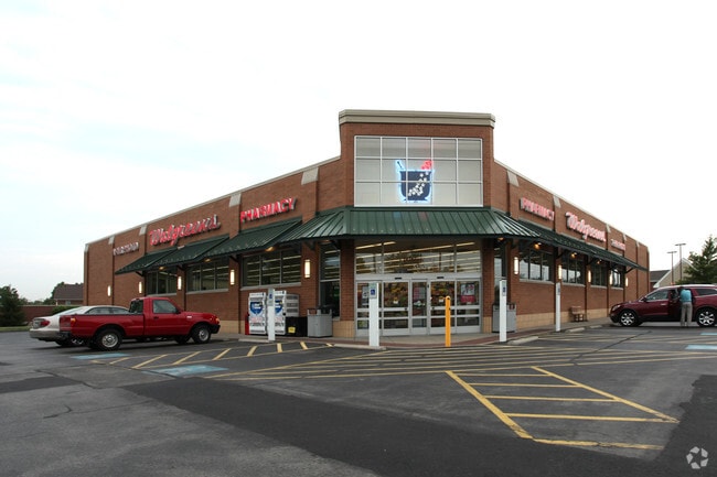
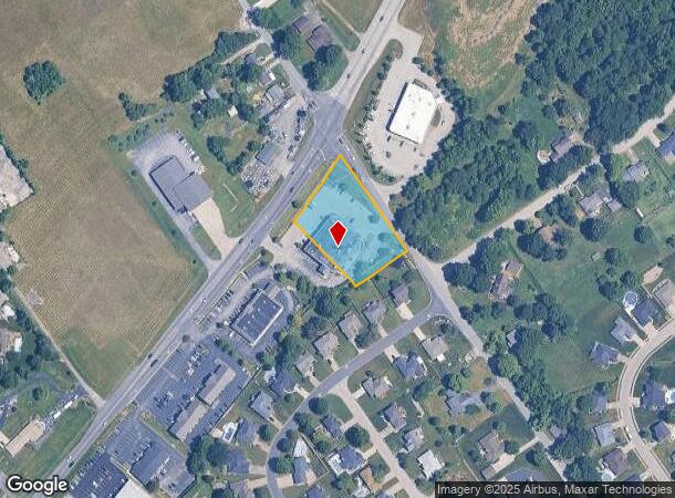
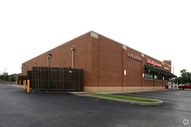
Property Record
5190 Charlestown Rd, New Albany, IN 47150
NEARBY LISTINGS FOR SALE OR LEASE
Property Detail
5190 Charlestown Rd
Louisville-Jefferson County, KY-IN
Meyer Highland Farms
22-05-08-600-352.000-007
P 600 PRT LTS 18 & 19 0.9159 AC & P 600 PRT LTS 18 & 19 1.0012 AC. #1 5
Storebuilding
Floyd
X
Indiana
18019C0257E
18-19
2024
1.92 AC
2024
Outlying Floyd County
071005
Louisville
14,426 SF
DEMOGRAPHICS near 5190 Charlestown Rd
1 Mile
3 Mile
5 Mile
2024 Total Population
7,028
34,187
92,052
2029 Population
7,284
35,639
96,177
Pop Growth 2024-2029
+ 3.64%
+ 4.25%
+ 4.48%
Average Age
41
41
41
2024 Total Households
2,558
13,447
37,158
HH Growth 2024-2029
+ 3.79%
+ 4.42%
+ 4.48%
Median Household Inc
$95,158
$67,045
$65,356
Avg Household Size
2.70
2.40
2.40
2024 Avg HH Vehicles
2.00
2.00
2.00
Median Home Value
$254,473
$207,537
$185,238
Median Year Built
1997
1991
1984
Nearby Places
Map Layers
Map Styles
 Street
 Aerial
- Restaurants
- Banks
- Shops
- Fitness
- Groceries
PUBLIC TRANSPORTATION
AIRPORT
Louisville Muhammad Ali International
DRIVE
WALK
Distance
Louisville Muhammad Ali International
28 min
17.7 mi
Freight Ports
Port of Toledo
DRIVE
WALK
Distance
Port of Toledo
357 min
308.1 mi
Nearby Properties
Address
Land Use
TOTAL SIZE
Lot Size
Zoning
Address
Land Use
TOTAL SIZE
Lot Size
Zoning
662,942 SF
77.29 AC
Address
Land Use
TOTAL SIZE
Lot Size
Zoning
3,452 SF
13.22 AC
Address
Land Use
TOTAL SIZE
Lot Size
Zoning
4,402 SF
9.99 AC
Address
Land Use
TOTAL SIZE
Lot Size
Zoning
27,360 SF
10.17 AC
Address
Land Use
TOTAL SIZE
Lot Size
Zoning
136,949 SF
36.89 AC
Address
Land Use
TOTAL SIZE
Lot Size
Zoning
21,540 SF
9.35 AC
Address
Land Use
TOTAL SIZE
Lot Size
Zoning
84,873 SF
15.71 AC
Address
Land Use
TOTAL SIZE
Lot Size
Zoning
3,116 SF
16.22 AC
Address
Land Use
TOTAL SIZE
Lot Size
Zoning
56,775 SF
5.30 AC
Address
Land Use
TOTAL SIZE
Lot Size
Zoning
11,695 SF
18.33 AC
Address
Land Use
TOTAL SIZE
Lot Size
Zoning
1,679 SF
7.87 AC
Address
Land Use
TOTAL SIZE
Lot Size
Zoning
75,560 SF
8.18 AC
Address
Land Use
TOTAL SIZE
Lot Size
Zoning
173,121 SF
15.82 AC
Address
Land Use
TOTAL SIZE
Lot Size
Zoning
204,750 SF
26.96 AC
Address
Land Use
TOTAL SIZE
Lot Size
Zoning
76,929 SF
10.03 AC
Address
Land Use
TOTAL SIZE
Lot Size
Zoning
58,884 SF
7.92 AC
Address
Land Use
TOTAL SIZE
Lot Size
Zoning
81,000 SF
44.74 AC
Address
Land Use
TOTAL SIZE
Lot Size
Zoning
43,204 SF
6.95 AC
Address
Land Use
TOTAL SIZE
Lot Size
Zoning
2,300 SF
15.14 AC
Address
Land Use
TOTAL SIZE
Lot Size
Zoning
27,039 SF
3.35 AC
Address
Land Use
TOTAL SIZE
Lot Size
Zoning
67,471 SF
7 AC
Address
Land Use
TOTAL SIZE
Lot Size
Zoning
80,812 SF
10.05 AC
Address
Land Use
TOTAL SIZE
Lot Size
Zoning
3,760 SF
3.05 AC
Address
Land Use
TOTAL SIZE
Lot Size
Zoning
44,144 SF
6.26 AC
Address
Land Use
TOTAL SIZE
Lot Size
Zoning
135,844 SF
17.41 AC
Address
Land Use
TOTAL SIZE
Lot Size
Zoning
124,880 SF
10.06 AC
Address
Land Use
TOTAL SIZE
Lot Size
Zoning
17,572 SF
9.25 AC
Address
Land Use
TOTAL SIZE
Lot Size
Zoning
27,132 SF
4.27 AC
Address
Land Use
TOTAL SIZE
Lot Size
Zoning
56,496 SF
7.28 AC
Address
Land Use
TOTAL SIZE
Lot Size
Zoning
26,390 SF
2.24 AC
The World's #1 Commercial Real Estate Marketplace
Connect with us
© 2025 CoStar Group
The information above has been obtained from sources believed reliable. While we do not doubt its accuracy we have not verified it and make no guarantee, warranty or representation about it. It is your responsibility to independently confirm its accuracy and completeness. Any projections, opinions, assumptions, or estimates used are for example only and do not represent the current or future performance of the property. The value of this transaction to you depends on tax and other factors which should be evaluated by your tax, financial, and legal advisors. You and your advisors should conduct a careful, independent investigation of the property to determine to your satisfaction the suitability of the property for your needs.