Property Record
5191 Maple Dr, Pleasant Hill, IA 50327


Property Detail
5191 Maple Dr
221-00193102002
-EX PARCELS A & B E 106F W 116F N 160F & -EX N 160F- E 87F W 97F LOT 2 & ALL LOTS 3 & 4 HURDS HICKORY HEIGHTS PLAT 8
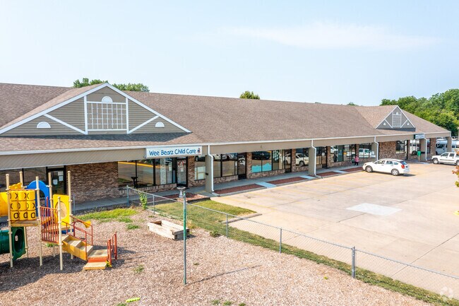
Regionalshoppingcenterormallwithanchorstore
Polk
C-1
Iowa
B and X Area of moderate flood hazard, usually the area between the limits of the 100-year and 500-year floods.
2,3,4
2024
2.08 AC
2025
Northeast
010803
Des Moines
12,000 SF
Des Moines-West Des Moines, IA
NEARBY LISTINGS FOR SALE OR LEASE
-
-
View all Pleasant Hill listings for lease on LoopNet.com
DEMOGRAPHICS near 5191 Maple Dr
1 mile
3 mile
5 mile
2025 Total Population
7,145
38,762
99,470
2030 Population
7,463
40,349
103,585
Pop Growth 2025-2030
+ 4.45%
+ 4.09%
+ 4.14%
Average Age
41
39
39
2025 Total Households
2,857
14,984
37,697
HH Growth 2025-2030
+ 4.45%
+ 4.14%
+ 4.27%
Median Household Inc
$83,711
$70,614
$68,657
Avg Household Size
2.50
2.50
2.50
2025 Avg HH Vehicles
2.00
2.00
2.00
Median Home Value
$287,930
$237,023
$225,964
Median Year Built
1994
1978
1978
Nearby Places
Map Layers
Map Styles
 Street
 Aerial
Layers
 Traffic
 Biking
Places
Listings with unknown addresses are not visible on the map
- Restaurants
- Banks
- Shops
- Fitness
- Groceries
PUBLIC TRANSPORTATION
AIRPORT
Des Moines International
Drive
Walk
Distance
Des Moines International
25 min
12.1 mi
Freight Ports
Port Milwaukee
Drive
Walk
Distance
Port Milwaukee
411 min
370.3 mi
SALE & LEASE HISTORY
LISTING DATE
SALE/LEASE

Jun 07, 2018
For Lease
Nearby Properties
Address
Land Use
TOTAL SIZE
Lot Size
Zoning
Address
Land Use
TOTAL SIZE
Lot Size
Zoning
350,879 SF
16.14 AC
Address
Land Use
TOTAL SIZE
Lot Size
Zoning
475,929 SF
49.86 AC
M2
Address
Land Use
TOTAL SIZE
Lot Size
Zoning
320,429 SF
22.34 AC
R3
Address
Land Use
TOTAL SIZE
Lot Size
Zoning
129,276 SF
7.63 AC
Address
Land Use
TOTAL SIZE
Lot Size
Zoning
175,854 SF
22.81 AC
Address
Land Use
TOTAL SIZE
Lot Size
Zoning
155,276 SF
6.66 AC
R-4
Address
Land Use
TOTAL SIZE
Lot Size
Zoning
201,072 SF
26.81 AC
Address
Land Use
TOTAL SIZE
Lot Size
Zoning
47,267 SF
22.69 AC
R-4
Address
Land Use
TOTAL SIZE
Lot Size
Zoning
126,830 SF
6.53 AC
Address
Land Use
TOTAL SIZE
Lot Size
Zoning
39,936 SF
4.62 AC
R-4
Address
Land Use
TOTAL SIZE
Lot Size
Zoning
45,004 SF
5.68 AC
Address
Land Use
TOTAL SIZE
Lot Size
Zoning
65,079 SF
6.19 AC
R-2
Address
Land Use
TOTAL SIZE
Lot Size
Zoning
70,148 SF
5.52 AC
Address
Land Use
TOTAL SIZE
Lot Size
Zoning
89,286 SF
14.49 AC
R1-60
Address
Land Use
TOTAL SIZE
Lot Size
Zoning
31,544 SF
9.38 AC
R1-80
Address
Land Use
TOTAL SIZE
Lot Size
Zoning
123,059 SF
27.23 AC
M2
Address
Land Use
TOTAL SIZE
Lot Size
Zoning
51,023 SF
5.49 AC
R160
Address
Land Use
TOTAL SIZE
Lot Size
Zoning
64,734 SF
4.48 AC
Address
Land Use
TOTAL SIZE
Lot Size
Zoning
71,730 SF
6.39 AC
I-2
Address
Land Use
TOTAL SIZE
Lot Size
Zoning
99,200 SF
7 AC
I-2
Address
Land Use
TOTAL SIZE
Lot Size
Zoning
62,467 SF
4.60 AC
Address
Land Use
TOTAL SIZE
Lot Size
Zoning
1,326 SF
5.15 AC
I-3
Address
Land Use
TOTAL SIZE
Lot Size
Zoning
56,281 SF
5.80 AC
C-1
Address
Land Use
TOTAL SIZE
Lot Size
Zoning
83,294 SF
8.25 AC
PUD
Address
Land Use
TOTAL SIZE
Lot Size
Zoning
16.80 AC
M-1
Address
Land Use
TOTAL SIZE
Lot Size
Zoning
38,172 SF
3.27 AC
C-2
Address
Land Use
TOTAL SIZE
Lot Size
Zoning
49,708 SF
7.33 AC
R-3
Address
Land Use
TOTAL SIZE
Lot Size
Zoning
54,876 SF
7.05 AC
I-2
Address
Land Use
TOTAL SIZE
Lot Size
Zoning
67,602 SF
3.71 AC
R-3
Address
Land Use
TOTAL SIZE
Lot Size
Zoning
2,368 SF
19.47 AC
I-3
The World's #1 Commercial Real Estate Marketplace
Connect with us
© 2026 CoStar Group
The information above has been obtained from sources believed reliable. While we do not doubt its accuracy we have not verified it and make no guarantee, warranty or representation about it. It is your responsibility to independently confirm its accuracy and completeness. Any projections, opinions, assumptions, or estimates used are for example only and do not represent the current or future performance of the property. The value of this transaction to you depends on tax and other factors which should be evaluated by your tax, financial, and legal advisors. You and your advisors should conduct a careful, independent investigation of the property to determine to your satisfaction the suitability of the property for your needs.