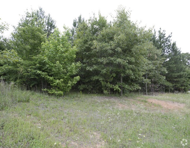
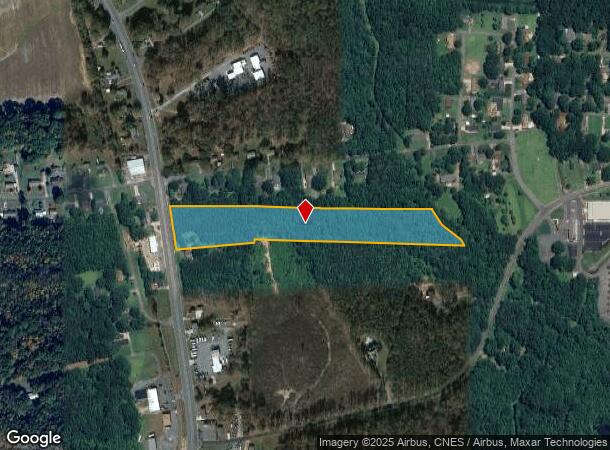
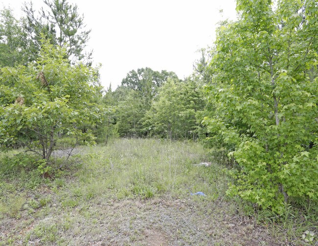
Property Record
52 Highway Byp N, Albemarle, NC 28001
NEARBY LISTINGS FOR SALE OR LEASE
Property Detail
52 Highway Byp N
6640-03-34-1635
VAC US 52 HWY N 664013024
Vacantlandnec
Stanly
AE
North Carolina
3710664000J
9.12 AC
2025
Stanly County
2025
Charlotte
931203
Albemarle, NC
DEMOGRAPHICS near 52 Highway Byp N
1 Mile
3 Mile
5 Mile
2024 Total Population
1,372
7,787
25,004
2029 Population
1,466
8,331
26,888
Pop Growth 2024-2029
+ 6.85%
+ 6.99%
+ 7.53%
Average Age
42
43
42
2024 Total Households
526
3,047
10,020
HH Growth 2024-2029
+ 6.84%
+ 7.02%
+ 7.63%
Median Household Inc
$60,085
$58,440
$49,402
Avg Household Size
2.50
2.40
2.30
2024 Avg HH Vehicles
2.00
2.00
2.00
Median Home Value
$165,322
$169,052
$161,665
Median Year Built
1964
1966
1965
Nearby Places
Map Layers
Map Styles
 Street
 Aerial
- Restaurants
- Banks
- Shops
- Fitness
- Groceries
PUBLIC TRANSPORTATION
AIRPORT
Concord-Padgett Regional
DRIVE
WALK
Distance
Concord-Padgett Regional
58 min
37.9 mi
Freight Ports
Port of Wilmington
DRIVE
WALK
Distance
Port of Wilmington
229 min
182.0 mi
SALE & LEASE HISTORY
LISTING DATE
SALE/LEASE

Jun 26, 2018
For Sale
Nearby Properties
Address
Land Use
TOTAL SIZE
Lot Size
Zoning
Address
Land Use
TOTAL SIZE
Lot Size
Zoning
232,921 SF
16.84 AC
MULTIPLE
Address
Land Use
TOTAL SIZE
Lot Size
Zoning
142,992 SF
13.23 AC
MULTIPLE
Address
Land Use
TOTAL SIZE
Lot Size
Zoning
114,360 SF
27.17 AC
R-10
Address
Land Use
TOTAL SIZE
Lot Size
Zoning
84,302 SF
34.69 AC
R-20
Address
Land Use
TOTAL SIZE
Lot Size
Zoning
47,550 SF
2.89 AC
HMD
Address
Land Use
TOTAL SIZE
Lot Size
Zoning
51,050 SF
28 AC
Address
Land Use
TOTAL SIZE
Lot Size
Zoning
30,778 SF
18.99 AC
MULTIPLE
Address
Land Use
TOTAL SIZE
Lot Size
Zoning
261,488 SF
52.12 AC
MULTIPLE
Address
Land Use
TOTAL SIZE
Lot Size
Zoning
171,000 SF
16.16 AC
M-1
Address
Land Use
TOTAL SIZE
Lot Size
Zoning
13,603 SF
6.37 AC
R-10
Address
Land Use
TOTAL SIZE
Lot Size
Zoning
20,008 SF
3 AC
NBD
Address
Land Use
TOTAL SIZE
Lot Size
Zoning
31,461 SF
10.55 AC
R-8
Address
Land Use
TOTAL SIZE
Lot Size
Zoning
217,589 SF
21.97 AC
MULTIPLE
Address
Land Use
TOTAL SIZE
Lot Size
Zoning
59,923 SF
11.12 AC
RO
Address
Land Use
TOTAL SIZE
Lot Size
Zoning
50,108 SF
11.01 AC
GHBD
Address
Land Use
TOTAL SIZE
Lot Size
Zoning
19,546 SF
4.97 AC
RO
Address
Land Use
TOTAL SIZE
Lot Size
Zoning
48,300 SF
14.40 AC
LID
Address
Land Use
TOTAL SIZE
Lot Size
Zoning
41,207 SF
22.79 AC
HID
Address
Land Use
TOTAL SIZE
Lot Size
Zoning
11,840 SF
25.04 AC
MULTIPLE
Address
Land Use
TOTAL SIZE
Lot Size
Zoning
33,109 SF
3.54 AC
GHBD
Address
Land Use
TOTAL SIZE
Lot Size
Zoning
34,181 SF
1.18 AC
R-8
Address
Land Use
TOTAL SIZE
Lot Size
Zoning
36,920 SF
13.45 AC
M-1
Address
Land Use
TOTAL SIZE
Lot Size
Zoning
11,146 SF
8.12 AC
R-10
Address
Land Use
TOTAL SIZE
Lot Size
Zoning
14,000 SF
5.97 AC
R-20
Address
Land Use
TOTAL SIZE
Lot Size
Zoning
90.25 AC
MULTIPLE
Address
Land Use
TOTAL SIZE
Lot Size
Zoning
8,674 SF
1.93 AC
HMD
Address
Land Use
TOTAL SIZE
Lot Size
Zoning
55,829 SF
11.53 AC
Address
Land Use
TOTAL SIZE
Lot Size
Zoning
6,344 SF
65.34 AC
R-10
Address
Land Use
TOTAL SIZE
Lot Size
Zoning
90,000 SF
12.04 AC
MULTIPLE
Address
Land Use
TOTAL SIZE
Lot Size
Zoning
26,282 SF
1.84 AC
GHBD
The World's #1 Commercial Real Estate Marketplace
Connect with us
© 2025 CoStar Group
The information above has been obtained from sources believed reliable. While we do not doubt its accuracy we have not verified it and make no guarantee, warranty or representation about it. It is your responsibility to independently confirm its accuracy and completeness. Any projections, opinions, assumptions, or estimates used are for example only and do not represent the current or future performance of the property. The value of this transaction to you depends on tax and other factors which should be evaluated by your tax, financial, and legal advisors. You and your advisors should conduct a careful, independent investigation of the property to determine to your satisfaction the suitability of the property for your needs.