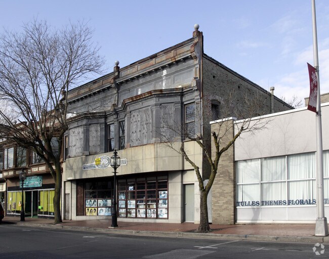
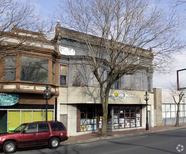
Property Record
52 N Laurel St, Bridgeton, NJ 08302
NEARBY LISTINGS FOR SALE OR LEASE
Property Detail
52 N Laurel St
01-00080-0000-00017
Cumberland
Storemultistory
New Jersey
X
17
34011C0161E
0.12 AC
2024
Vineland/Bridgeton
2025
Philadelphia
020100
Vineland-Bridgeton, NJ
7,690 SF
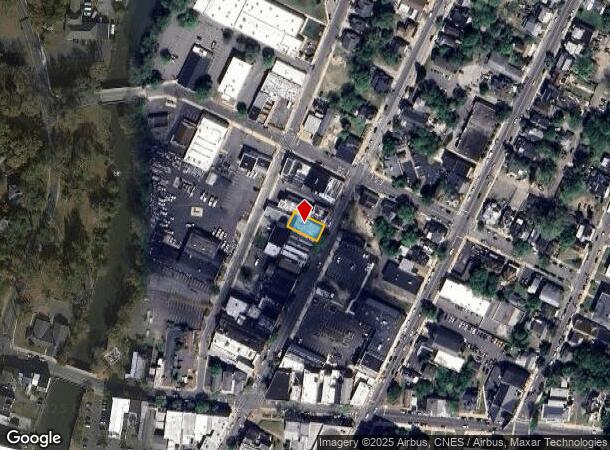
DEMOGRAPHICS near 52 N Laurel St
1 Mile
3 Mile
5 Mile
2024 Total Population
15,684
30,668
38,197
2029 Population
15,341
30,162
37,607
Pop Growth 2024-2029
(2.19%)
(1.65%)
(1.54%)
Average Age
31
35
37
2024 Total Households
4,408
9,592
12,457
HH Growth 2024-2029
(2.29%)
(1.65%)
(1.56%)
Median Household Inc
$41,913
$51,141
$54,792
Avg Household Size
3.40
3.00
2.90
2024 Avg HH Vehicles
1.00
2.00
2.00
Median Home Value
$145,930
$175,496
$187,667
Median Year Built
1955
1961
1963
Nearby Places
Map Layers
Map Styles
 Street
 Aerial
- Restaurants
- Banks
- Shops
- Fitness
- Groceries
PUBLIC TRANSPORTATION
AIRPORT
Philadelphia International
DRIVE
WALK
Distance
Philadelphia International
68 min
41.7 mi
Freight Ports
Port of Wilmington, RI
DRIVE
WALK
Distance
Port of Wilmington, RI
45 min
32.6 mi
Nearby Properties
Address
Land Use
TOTAL SIZE
Lot Size
Zoning
Address
Land Use
TOTAL SIZE
Lot Size
Zoning
83.15 AC
Address
Land Use
TOTAL SIZE
Lot Size
Zoning
3.19 AC
Address
Land Use
TOTAL SIZE
Lot Size
Zoning
52,724 SF
3.32 AC
Address
Land Use
TOTAL SIZE
Lot Size
Zoning
28.60 AC
Address
Land Use
TOTAL SIZE
Lot Size
Zoning
2.71 AC
Address
Land Use
TOTAL SIZE
Lot Size
Zoning
6.20 AC
R1
Address
Land Use
TOTAL SIZE
Lot Size
Zoning
1.73 AC
Address
Land Use
TOTAL SIZE
Lot Size
Zoning
16.23 AC
Address
Land Use
TOTAL SIZE
Lot Size
Zoning
29.17 AC
B2
Address
Land Use
TOTAL SIZE
Lot Size
Zoning
25.91 AC
Address
Land Use
TOTAL SIZE
Lot Size
Zoning
29.38 AC
Address
Land Use
TOTAL SIZE
Lot Size
Zoning
10.70 AC
Address
Land Use
TOTAL SIZE
Lot Size
Zoning
Address
Land Use
TOTAL SIZE
Lot Size
Zoning
11.84 AC
Address
Land Use
TOTAL SIZE
Lot Size
Zoning
13.18 AC
Address
Land Use
TOTAL SIZE
Lot Size
Zoning
12.42 AC
Address
Land Use
TOTAL SIZE
Lot Size
Zoning
22 AC
B2
Address
Land Use
TOTAL SIZE
Lot Size
Zoning
13.67 AC
B2
Address
Land Use
TOTAL SIZE
Lot Size
Zoning
12.95 AC
Address
Land Use
TOTAL SIZE
Lot Size
Zoning
16.54 AC
Address
Land Use
TOTAL SIZE
Lot Size
Zoning
Address
Land Use
TOTAL SIZE
Lot Size
Zoning
97,112 SF
Address
Land Use
TOTAL SIZE
Lot Size
Zoning
Address
Land Use
TOTAL SIZE
Lot Size
Zoning
19.95 AC
Address
Land Use
TOTAL SIZE
Lot Size
Zoning
1.86 AC
Address
Land Use
TOTAL SIZE
Lot Size
Zoning
13.94 AC
Address
Land Use
TOTAL SIZE
Lot Size
Zoning
13.69 AC
Address
Land Use
TOTAL SIZE
Lot Size
Zoning
2.57 AC
Address
Land Use
TOTAL SIZE
Lot Size
Zoning
5.13 AC
Address
Land Use
TOTAL SIZE
Lot Size
Zoning
The World's #1 Commercial Real Estate Marketplace
Connect with us
© 2025 CoStar Group
The information above has been obtained from sources believed reliable. While we do not doubt its accuracy we have not verified it and make no guarantee, warranty or representation about it. It is your responsibility to independently confirm its accuracy and completeness. Any projections, opinions, assumptions, or estimates used are for example only and do not represent the current or future performance of the property. The value of this transaction to you depends on tax and other factors which should be evaluated by your tax, financial, and legal advisors. You and your advisors should conduct a careful, independent investigation of the property to determine to your satisfaction the suitability of the property for your needs.