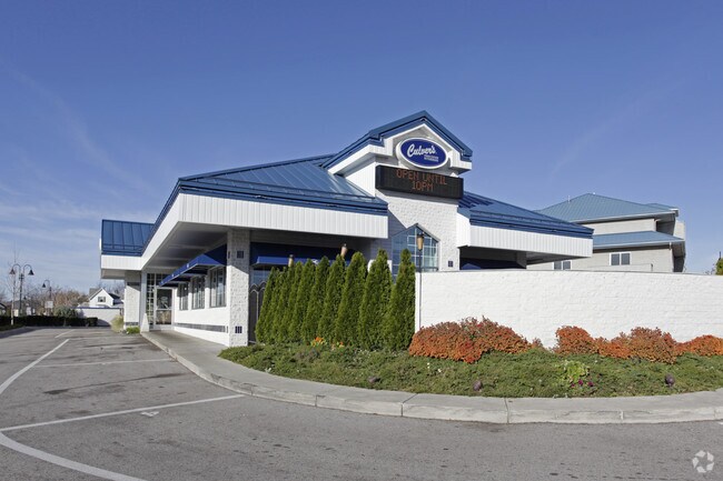
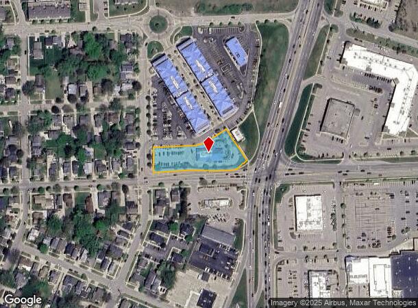
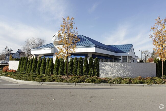
Property Record
520 A Way, Grand Haven, MI 49417
NEARBY LISTINGS FOR SALE OR LEASE
Property Detail
520 A Way
70-03-21-160-003
Condominium Subd
Restaurantdrivein
UNIT 3 THE VILLAGE SITE CONDOMINIUMS, MASTER DEED RECORDED IN OTTAWA COUNTY REGISTER OF DEEDS LIBER 5325 PAGE 27, CONDOMINIUM
X
Ottawa
26139C0078F
Michigan
2024
0.98 AC
2025
Grand Haven/Ferrysburg
020900
West Michigan
4,888 SF
Grand Rapids-Wyoming, MI
DEMOGRAPHICS near 520 A Way
1 Mile
3 Mile
5 Mile
2024 Total Population
6,663
31,543
50,167
2029 Population
7,155
33,565
53,048
Pop Growth 2024-2029
+ 7.38%
+ 6.41%
+ 5.74%
Average Age
43
44
43
2024 Total Households
3,027
14,013
21,193
HH Growth 2024-2029
+ 7.66%
+ 6.54%
+ 5.89%
Median Household Inc
$65,729
$67,946
$73,087
Avg Household Size
2.10
2.20
2.30
2024 Avg HH Vehicles
2.00
2.00
2.00
Median Home Value
$284,901
$285,153
$291,318
Median Year Built
1949
1975
1981
Nearby Places
Map Layers
Map Styles
 Street
 Aerial
- Restaurants
- Banks
- Shops
- Fitness
- Groceries
Nearby Properties
Address
Land Use
TOTAL SIZE
Lot Size
Zoning
Address
Land Use
TOTAL SIZE
Lot Size
Zoning
348,731 SF
40.52 AC
R-4
Address
Land Use
TOTAL SIZE
Lot Size
Zoning
199,740 SF
15 AC
PUD
Address
Land Use
TOTAL SIZE
Lot Size
Zoning
381,476 SF
17.96 AC
I INDU
Address
Land Use
TOTAL SIZE
Lot Size
Zoning
355,785 SF
24.60 AC
I-1
Address
Land Use
TOTAL SIZE
Lot Size
Zoning
188,314 SF
9.72 AC
Address
Land Use
TOTAL SIZE
Lot Size
Zoning
220,630 SF
10.34 AC
PUD
Address
Land Use
TOTAL SIZE
Lot Size
Zoning
184,312 SF
11.47 AC
PUD
Address
Land Use
TOTAL SIZE
Lot Size
Zoning
131,302 SF
4.70 AC
Address
Land Use
TOTAL SIZE
Lot Size
Zoning
191,144 SF
16.60 AC
Address
Land Use
TOTAL SIZE
Lot Size
Zoning
249,728 SF
15.06 AC
Address
Land Use
TOTAL SIZE
Lot Size
Zoning
121,189 SF
8.73 AC
PUD
Address
Land Use
TOTAL SIZE
Lot Size
Zoning
192,833 SF
14.44 AC
I INDU
Address
Land Use
TOTAL SIZE
Lot Size
Zoning
40,251 SF
159.38 AC
PR
Address
Land Use
TOTAL SIZE
Lot Size
Zoning
113,566 SF
6.70 AC
PUD
Address
Land Use
TOTAL SIZE
Lot Size
Zoning
192,641 SF
25.16 AC
Address
Land Use
TOTAL SIZE
Lot Size
Zoning
37,874 SF
20.27 AC
PORT IN
Address
Land Use
TOTAL SIZE
Lot Size
Zoning
202,338 SF
8.95 AC
Address
Land Use
TOTAL SIZE
Lot Size
Zoning
191,989 SF
10.44 AC
Address
Land Use
TOTAL SIZE
Lot Size
Zoning
242,746 SF
36.05 AC
I INDU
Address
Land Use
TOTAL SIZE
Lot Size
Zoning
112,745 SF
10.56 AC
PUD
Address
Land Use
TOTAL SIZE
Lot Size
Zoning
53,682 SF
0.99 AC
Address
Land Use
TOTAL SIZE
Lot Size
Zoning
184,100 SF
9.74 AC
Address
Land Use
TOTAL SIZE
Lot Size
Zoning
90,701 SF
5.65 AC
Address
Land Use
TOTAL SIZE
Lot Size
Zoning
217,995 SF
40.96 AC
PUD
Address
Land Use
TOTAL SIZE
Lot Size
Zoning
125,088 SF
7.24 AC
CBD
Address
Land Use
TOTAL SIZE
Lot Size
Zoning
146,163 SF
13.23 AC
Address
Land Use
TOTAL SIZE
Lot Size
Zoning
143,083 SF
12.25 AC
Address
Land Use
TOTAL SIZE
Lot Size
Zoning
148,413 SF
38.08 AC
Address
Land Use
TOTAL SIZE
Lot Size
Zoning
960 SF
22.46 AC
Address
Land Use
TOTAL SIZE
Lot Size
Zoning
105,179 SF
20.81 AC
I INDU
The World's #1 Commercial Real Estate Marketplace
Connect with us
© 2025 CoStar Group
The information above has been obtained from sources believed reliable. While we do not doubt its accuracy we have not verified it and make no guarantee, warranty or representation about it. It is your responsibility to independently confirm its accuracy and completeness. Any projections, opinions, assumptions, or estimates used are for example only and do not represent the current or future performance of the property. The value of this transaction to you depends on tax and other factors which should be evaluated by your tax, financial, and legal advisors. You and your advisors should conduct a careful, independent investigation of the property to determine to your satisfaction the suitability of the property for your needs.