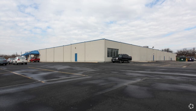
Property Record
520 E 19Th Ave, Kansas City, MO 64116


NEARBY LISTINGS FOR SALE OR LEASE
Property Detail
520 E 19Th Ave
Kansas City, MO-KS
Northtown Devco Subdivision
17-610-00-15-001.00
NORTHTOWN DEVCO SUBDIVISION LTS 1 & 2
Commercialnec
Clay
ARE
Missouri
29095C0139G
1,2
2024
8.06 AC
2025
City of North KC
022100
Kansas City
DEMOGRAPHICS near 520 E 19Th Ave
1 mile
3 mile
5 mile
2024 Total Population
4,911
55,404
202,934
2029 Population
5,179
57,315
208,472
Pop Growth 2024-2029
+ 5.46%
+ 3.45%
+ 2.73%
Average Age
43
37
37
2024 Total Households
2,832
26,686
83,774
HH Growth 2024-2029
+ 5.40%
+ 3.53%
+ 2.99%
Median Household Inc
$40,958
$52,349
$51,191
Avg Household Size
1.70
1.90
2.30
2024 Avg HH Vehicles
1.00
1.00
2.00
Median Home Value
$199,285
$181,078
$154,825
Median Year Built
1978
1967
1962
Nearby Places
Map Layers
Map Styles
 Street
 Aerial
Transit
 Traffic
 Biking
Places
Listings with unknown addresses are not visible on the map
- Restaurants
- Banks
- Shops
- Fitness
- Groceries
PUBLIC TRANSPORTATION
COMMUTER RAIL
Drive
Walk
Distance
12 min
5.5 mi
AIRPORT
Kansas City International
Drive
Walk
Distance
Kansas City International
24 min
16.5 mi
Nearby Properties
Address
Land Use
TOTAL SIZE
Lot Size
Zoning
Address
Land Use
TOTAL SIZE
Lot Size
Zoning
Address
Land Use
TOTAL SIZE
Lot Size
Zoning
8.29 AC
Address
Land Use
TOTAL SIZE
Lot Size
Zoning
846,143 SF
51.25 AC
Address
Land Use
TOTAL SIZE
Lot Size
Zoning
63,748 SF
3.92 AC
Address
Land Use
TOTAL SIZE
Lot Size
Zoning
404,524 SF
5.51 AC
Address
Land Use
TOTAL SIZE
Lot Size
Zoning
215,920 SF
38.28 AC
Address
Land Use
TOTAL SIZE
Lot Size
Zoning
115,627 SF
1.56 AC
Address
Land Use
TOTAL SIZE
Lot Size
Zoning
261,570 SF
1.82 AC
Address
Land Use
TOTAL SIZE
Lot Size
Zoning
Address
Land Use
TOTAL SIZE
Lot Size
Zoning
87,294 SF
0.70 AC
Address
Land Use
TOTAL SIZE
Lot Size
Zoning
4,012,734 SF
574.30 AC
KM3
Address
Land Use
TOTAL SIZE
Lot Size
Zoning
384,543 SF
5.40 AC
Address
Land Use
TOTAL SIZE
Lot Size
Zoning
342,989 SF
1.84 AC
Address
Land Use
TOTAL SIZE
Lot Size
Zoning
238,003 SF
1.74 AC
Address
Land Use
TOTAL SIZE
Lot Size
Zoning
Address
Land Use
TOTAL SIZE
Lot Size
Zoning
296,548 SF
5.09 AC
Address
Land Use
TOTAL SIZE
Lot Size
Zoning
276,233 SF
Address
Land Use
TOTAL SIZE
Lot Size
Zoning
116,228 SF
0.79 AC
Address
Land Use
TOTAL SIZE
Lot Size
Zoning
10.97 AC
Address
Land Use
TOTAL SIZE
Lot Size
Zoning
109,211 SF
0.19 AC
Address
Land Use
TOTAL SIZE
Lot Size
Zoning
243,839 SF
47.82 AC
Address
Land Use
TOTAL SIZE
Lot Size
Zoning
Address
Land Use
TOTAL SIZE
Lot Size
Zoning
229,473 SF
2.38 AC
Address
Land Use
TOTAL SIZE
Lot Size
Zoning
187,460 SF
1.46 AC
Address
Land Use
TOTAL SIZE
Lot Size
Zoning
71,420 SF
0.26 AC
Address
Land Use
TOTAL SIZE
Lot Size
Zoning
Address
Land Use
TOTAL SIZE
Lot Size
Zoning
64,031 SF
0.45 AC
Address
Land Use
TOTAL SIZE
Lot Size
Zoning
295,300 SF
1.50 AC
Address
Land Use
TOTAL SIZE
Lot Size
Zoning
Address
Land Use
TOTAL SIZE
Lot Size
Zoning
46.94 AC
The World's #1 Commercial Real Estate Marketplace
Connect with us
© 2026 CoStar Group
The information above has been obtained from sources believed reliable. While we do not doubt its accuracy we have not verified it and make no guarantee, warranty or representation about it. It is your responsibility to independently confirm its accuracy and completeness. Any projections, opinions, assumptions, or estimates used are for example only and do not represent the current or future performance of the property. The value of this transaction to you depends on tax and other factors which should be evaluated by your tax, financial, and legal advisors. You and your advisors should conduct a careful, independent investigation of the property to determine to your satisfaction the suitability of the property for your needs.