Property Record
520 E Jackson St, Willard, MO 65781
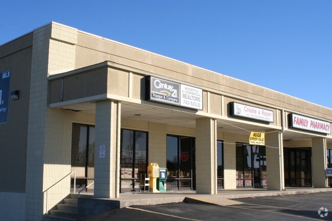

Property Detail
520 E Jackson St
Springfield, MO
3.03A M/L BEG 20 FT E & 19.17 FT N NW COR NW1/4 SW1/4 E 195 FT S 97.53 FT NWLY 117.49 FT TO BEG & BEG 149.92 FT S & 100.4 FT E LOT 16 WILMESHERR PLACE S 115.74 FT E 35.5 FT
07-25-204-030
GREENE
Communitycenter
Missouri
INC
16
B and X Area of moderate flood hazard, usually the area between the limits of the 100-year and 500-year floods.
3.04 AC
2025
Outlying Greene County
2025
Springfield
005002
NEARBY LISTINGS FOR SALE OR LEASE
-
-
View all Willard listings for sale on LoopNet.com
DEMOGRAPHICS near 520 E Jackson St
1 mile
3 mile
5 mile
2025 Total Population
3,516
8,355
12,855
2030 Population
3,634
8,566
13,176
Pop Growth 2025-2030
+ 3.36%
+ 2.53%
+ 2.50%
Average Age
37
38
40
2025 Total Households
1,286
3,114
4,835
HH Growth 2025-2030
+ 3.50%
+ 2.67%
+ 2.65%
Median Household Inc
$87,614
$88,824
$83,875
Avg Household Size
2.70
2.70
2.60
2025 Avg HH Vehicles
2.00
2.00
2.00
Median Home Value
$232,461
$253,930
$266,087
Median Year Built
1986
1990
1989
Nearby Places
Map Layers
Map Styles
 Street
 Aerial
Layers
 Traffic
 Biking
Places
Listings with unknown addresses are not visible on the map
- Restaurants
- Banks
- Shops
- Fitness
- Groceries
PUBLIC TRANSPORTATION
AIRPORT
Springfield-Branson Ntl
Drive
Walk
Distance
Springfield-Branson Ntl
10 min
4.7 mi
Freight Ports
Tulsa Port of Inola
Drive
Walk
Distance
Tulsa Port of Inola
193 min
171.5 mi
Nearby Properties
Address
Land Use
TOTAL SIZE
Lot Size
Zoning
Address
Land Use
TOTAL SIZE
Lot Size
Zoning
10.70 AC
INC
Address
Land Use
TOTAL SIZE
Lot Size
Zoning
7 AC
INC
Address
Land Use
TOTAL SIZE
Lot Size
Zoning
29,400 SF
9.80 AC
PAD
Address
Land Use
TOTAL SIZE
Lot Size
Zoning
5.71 AC
INC
Address
Land Use
TOTAL SIZE
Lot Size
Zoning
49,860 SF
5.34 AC
INC
Address
Land Use
TOTAL SIZE
Lot Size
Zoning
2,733 SF
4.49 AC
INC
Address
Land Use
TOTAL SIZE
Lot Size
Zoning
11,727 SF
129.68 AC
INC
Address
Land Use
TOTAL SIZE
Lot Size
Zoning
2.05 AC
INC.
Address
Land Use
TOTAL SIZE
Lot Size
Zoning
25,046 SF
6.37 AC
INC
Address
Land Use
TOTAL SIZE
Lot Size
Zoning
2 AC
INC
Address
Land Use
TOTAL SIZE
Lot Size
Zoning
24,695 SF
3.36 AC
INC
Address
Land Use
TOTAL SIZE
Lot Size
Zoning
1.62 AC
INC
Address
Land Use
TOTAL SIZE
Lot Size
Zoning
1.19 AC
INC
Address
Land Use
TOTAL SIZE
Lot Size
Zoning
1,335 SF
1.07 AC
INC
Address
Land Use
TOTAL SIZE
Lot Size
Zoning
Address
Land Use
TOTAL SIZE
Lot Size
Zoning
5,090 SF
1.35 AC
INC
Address
Land Use
TOTAL SIZE
Lot Size
Zoning
1,120 SF
135.30 AC
INC
Address
Land Use
TOTAL SIZE
Lot Size
Zoning
Address
Land Use
TOTAL SIZE
Lot Size
Zoning
0.77 AC
INC
Address
Land Use
TOTAL SIZE
Lot Size
Zoning
4,076 SF
1.05 AC
INC
Address
Land Use
TOTAL SIZE
Lot Size
Zoning
7,500 SF
2.16 AC
INC
Address
Land Use
TOTAL SIZE
Lot Size
Zoning
1,960 SF
0.69 AC
INC
Address
Land Use
TOTAL SIZE
Lot Size
Zoning
1.05 AC
Address
Land Use
TOTAL SIZE
Lot Size
Zoning
2,888 SF
4.40 AC
INC
Address
Land Use
TOTAL SIZE
Lot Size
Zoning
0.80 AC
INC
Address
Land Use
TOTAL SIZE
Lot Size
Zoning
6,726 SF
0.98 AC
INC
Address
Land Use
TOTAL SIZE
Lot Size
Zoning
7,920 SF
133 AC
A-1
Address
Land Use
TOTAL SIZE
Lot Size
Zoning
9,200 SF
0.59 AC
INC
Address
Land Use
TOTAL SIZE
Lot Size
Zoning
1.04 AC
INC
The World's #1 Commercial Real Estate Marketplace
Connect with us
© 2026 CoStar Group
The information above has been obtained from sources believed reliable. While we do not doubt its accuracy we have not verified it and make no guarantee, warranty or representation about it. It is your responsibility to independently confirm its accuracy and completeness. Any projections, opinions, assumptions, or estimates used are for example only and do not represent the current or future performance of the property. The value of this transaction to you depends on tax and other factors which should be evaluated by your tax, financial, and legal advisors. You and your advisors should conduct a careful, independent investigation of the property to determine to your satisfaction the suitability of the property for your needs.