Property Record
520 Hardee St, Dallas, GA 30132
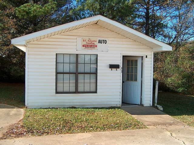

Property Detail
520 Hardee St
Atlanta-Sandy Springs-Roswell, GA
REAL PROPERTY
138.1.4.040.0000
PAULDING
Taxexempt
Georgia
B and X Area of moderate flood hazard, usually the area between the limits of the 100-year and 500-year floods.
345
0
20.91 AC
2025
Kennesaw/Town Center
120301
Atlanta
NEARBY LISTINGS FOR SALE OR LEASE
DEMOGRAPHICS near 520 Hardee St
1 mile
3 mile
5 mile
2025 Total Population
6,296
28,290
71,263
2030 Population
6,902
31,203
78,417
Pop Growth 2025-2030
+ 9.63%
+ 10.30%
+ 10.04%
Average Age
37
38
38
2025 Total Households
2,362
10,310
24,858
HH Growth 2025-2030
+ 9.65%
+ 10.38%
+ 10.11%
Median Household Inc
$74,439
$75,739
$87,650
Avg Household Size
2.70
2.70
2.80
2025 Avg HH Vehicles
2.00
2.00
2.00
Median Home Value
$292,718
$299,649
$313,737
Median Year Built
1999
2001
2000
Nearby Places
Map Layers
Map Styles
 Street
 Aerial
Layers
 Traffic
 Biking
Places
Listings with unknown addresses are not visible on the map
- Restaurants
- Banks
- Shops
- Fitness
- Groceries
Nearby Properties
Address
Land Use
TOTAL SIZE
Lot Size
Zoning
Address
Land Use
TOTAL SIZE
Lot Size
Zoning
83.40 AC
OMI
Address
Land Use
TOTAL SIZE
Lot Size
Zoning
62.35 AC
Address
Land Use
TOTAL SIZE
Lot Size
Zoning
133,468 SF
12.37 AC
MF1
Address
Land Use
TOTAL SIZE
Lot Size
Zoning
Address
Land Use
TOTAL SIZE
Lot Size
Zoning
179,316 SF
13.43 AC
MF1
Address
Land Use
TOTAL SIZE
Lot Size
Zoning
30.44 AC
Address
Land Use
TOTAL SIZE
Lot Size
Zoning
0.44 AC
CBD
Address
Land Use
TOTAL SIZE
Lot Size
Zoning
71,122 SF
30.70 AC
OMI
Address
Land Use
TOTAL SIZE
Lot Size
Zoning
39,290 SF
10.56 AC
R4
Address
Land Use
TOTAL SIZE
Lot Size
Zoning
7.69 AC
Address
Land Use
TOTAL SIZE
Lot Size
Zoning
26,770 SF
3.62 AC
R1
Address
Land Use
TOTAL SIZE
Lot Size
Zoning
42,774 SF
7.61 AC
OMI
Address
Land Use
TOTAL SIZE
Lot Size
Zoning
0.56 AC
Address
Land Use
TOTAL SIZE
Lot Size
Zoning
8.59 AC
Address
Land Use
TOTAL SIZE
Lot Size
Zoning
71,416 SF
8.58 AC
B2
Address
Land Use
TOTAL SIZE
Lot Size
Zoning
128.92 AC
Address
Land Use
TOTAL SIZE
Lot Size
Zoning
62,175 SF
4.39 AC
I1
Address
Land Use
TOTAL SIZE
Lot Size
Zoning
45,560 SF
4.06 AC
OMI
Address
Land Use
TOTAL SIZE
Lot Size
Zoning
57,800 SF
10.48 AC
MF1
Address
Land Use
TOTAL SIZE
Lot Size
Zoning
33,024 SF
5.41 AC
TH
Address
Land Use
TOTAL SIZE
Lot Size
Zoning
7.37 AC
Address
Land Use
TOTAL SIZE
Lot Size
Zoning
63,420 SF
6.49 AC
MF1
Address
Land Use
TOTAL SIZE
Lot Size
Zoning
4,838 SF
3.42 AC
Address
Land Use
TOTAL SIZE
Lot Size
Zoning
91,806 SF
10.75 AC
I2
Address
Land Use
TOTAL SIZE
Lot Size
Zoning
62,098 SF
5.88 AC
DC2
Address
Land Use
TOTAL SIZE
Lot Size
Zoning
76,711 SF
12 AC
I1-0
Address
Land Use
TOTAL SIZE
Lot Size
Zoning
0.43 AC
CBD
Address
Land Use
TOTAL SIZE
Lot Size
Zoning
0.23 AC
CBD
Address
Land Use
TOTAL SIZE
Lot Size
Zoning
55,000 SF
7.01 AC
The World's #1 Commercial Real Estate Marketplace
Connect with us
© 2026 CoStar Group
The information above has been obtained from sources believed reliable. While we do not doubt its accuracy we have not verified it and make no guarantee, warranty or representation about it. It is your responsibility to independently confirm its accuracy and completeness. Any projections, opinions, assumptions, or estimates used are for example only and do not represent the current or future performance of the property. The value of this transaction to you depends on tax and other factors which should be evaluated by your tax, financial, and legal advisors. You and your advisors should conduct a careful, independent investigation of the property to determine to your satisfaction the suitability of the property for your needs.