Property Record
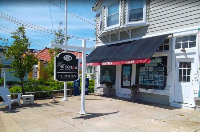
520 Main Ave, Bay Head, NJ 08742

Property Detail
520 Main Ave
03-00057-0000-00012
50X150
Commercialnec
Ocean
B-1
New Jersey
AO River or stream flood hazard areas, and areas with a 1% or greater chance of shallow flooding each year. These areas have a 26% chance of flooding over the life of a 30-year mortgage.
12
2025
0.17 AC
2025
Ocean County
739200
Northern New Jersey
4,672 SF
Lakewood-New Brunswick, NJ
NEARBY LISTINGS FOR SALE OR LEASE
DEMOGRAPHICS near 520 Main Ave
1 mile
3 mile
5 mile
2025 Total Population
5,773
39,499
103,182
2030 Population
6,321
41,199
106,854
Pop Growth 2025-2030
+ 9.49%
+ 4.30%
+ 3.56%
Average Age
47
43
44
2025 Total Households
2,560
15,882
41,499
HH Growth 2025-2030
+ 9.34%
+ 4.20%
+ 3.42%
Median Household Inc
$118,322
$116,675
$116,038
Avg Household Size
2.20
2.40
2.40
2025 Avg HH Vehicles
2.00
2.00
2.00
Median Home Value
$871,694
$652,408
$607,520
Median Year Built
1967
1965
1971
Nearby Places
Map Layers
Map Styles
 Street
 Aerial
Layers
 Traffic
 Biking
Places
Listings with unknown addresses are not visible on the map
- Restaurants
- Banks
- Shops
- Fitness
- Groceries
PUBLIC TRANSPORTATION
TRANSIT/SUBWAY
Bay Head (North Jersey Coast Line - NJ Transit Commuter Rail (NJ Transit))
Drive
Walk
Distance
Bay Head (North Jersey Coast Line - NJ Transit Commuter Rail (NJ Transit))
2 min
13 min
0.7 mi
COMMUTER RAIL
Bay Head (North Jersey Coast Line - NJ Transit Commuter Rail (NJ Transit))
Drive
Walk
Distance
Bay Head (North Jersey Coast Line - NJ Transit Commuter Rail (NJ Transit))
2 min
14 min
0.7 mi
Point Pleasant Beach (North Jersey Coast Line - NJ Transit Commuter Rail (NJ Transit))
Drive
Walk
Distance
Point Pleasant Beach (North Jersey Coast Line - NJ Transit Commuter Rail (NJ Transit))
3 min
1.8 mi
Freight Ports
New York Container Terminal
Drive
Walk
Distance
New York Container Terminal
67 min
51.4 mi
SALE & LEASE HISTORY
LISTING DATE
SALE/LEASE

Apr 07, 2023
For Lease
Nearby Properties
Address
Land Use
TOTAL SIZE
Lot Size
Zoning
Address
Land Use
TOTAL SIZE
Lot Size
Zoning
50.10 AC
C
Address
Land Use
TOTAL SIZE
Lot Size
Zoning
117 AC
RR1
Address
Land Use
TOTAL SIZE
Lot Size
Zoning
11,900 SF
30.98 AC
R-1A
Address
Land Use
TOTAL SIZE
Lot Size
Zoning
5,000 SF
22.50 AC
CONREC
Address
Land Use
TOTAL SIZE
Lot Size
Zoning
35,639 SF
99.30 AC
SF20
Address
Land Use
TOTAL SIZE
Lot Size
Zoning
3,792 SF
7.64 AC
R-1A
Address
Land Use
TOTAL SIZE
Lot Size
Zoning
63,136 SF
10.31 AC
R-1A
Address
Land Use
TOTAL SIZE
Lot Size
Zoning
18,058 SF
6.09 AC
R-50
Address
Land Use
TOTAL SIZE
Lot Size
Zoning
2,408 SF
4.84 AC
B-2
Address
Land Use
TOTAL SIZE
Lot Size
Zoning
21 AC
ROS
Address
Land Use
TOTAL SIZE
Lot Size
Zoning
5,798 SF
1.10 AC
RC
Address
Land Use
TOTAL SIZE
Lot Size
Zoning
2.73 AC
RC
Address
Land Use
TOTAL SIZE
Lot Size
Zoning
40.43 AC
SF20
Address
Land Use
TOTAL SIZE
Lot Size
Zoning
17,450 SF
7.50 AC
HR
Address
Land Use
TOTAL SIZE
Lot Size
Zoning
1,140 SF
14 AC
GC
Address
Land Use
TOTAL SIZE
Lot Size
Zoning
1,976 SF
8.42 AC
R50
Address
Land Use
TOTAL SIZE
Lot Size
Zoning
3,185 SF
2.90 AC
C
Address
Land Use
TOTAL SIZE
Lot Size
Zoning
7,988 SF
4.55 AC
W
Address
Land Use
TOTAL SIZE
Lot Size
Zoning
3.05 AC
HC
Address
Land Use
TOTAL SIZE
Lot Size
Zoning
86,484 SF
7.25 AC
GC
Address
Land Use
TOTAL SIZE
Lot Size
Zoning
3,506 SF
1.29 AC
RC
Address
Land Use
TOTAL SIZE
Lot Size
Zoning
1,677 SF
3 AC
R-3A
Address
Land Use
TOTAL SIZE
Lot Size
Zoning
13.76 AC
RC
Address
Land Use
TOTAL SIZE
Lot Size
Zoning
10,003 SF
0.32 AC
PU
Address
Land Use
TOTAL SIZE
Lot Size
Zoning
18,240 SF
1.51 AC
RR3
Address
Land Use
TOTAL SIZE
Lot Size
Zoning
2,335 SF
3.17 AC
RC
Address
Land Use
TOTAL SIZE
Lot Size
Zoning
2.10 AC
ROS
Address
Land Use
TOTAL SIZE
Lot Size
Zoning
19,248 SF
5.75 AC
W
Address
Land Use
TOTAL SIZE
Lot Size
Zoning
5,923 SF
2.45 AC
C0
Address
Land Use
TOTAL SIZE
Lot Size
Zoning
31,412 SF
2.29 AC
RM
The World's #1 Commercial Real Estate Marketplace
Connect with us
© 2026 CoStar Group
The information above has been obtained from sources believed reliable. While we do not doubt its accuracy we have not verified it and make no guarantee, warranty or representation about it. It is your responsibility to independently confirm its accuracy and completeness. Any projections, opinions, assumptions, or estimates used are for example only and do not represent the current or future performance of the property. The value of this transaction to you depends on tax and other factors which should be evaluated by your tax, financial, and legal advisors. You and your advisors should conduct a careful, independent investigation of the property to determine to your satisfaction the suitability of the property for your needs.