Property Record
520 N Maple St, Sycamore, IL 60178
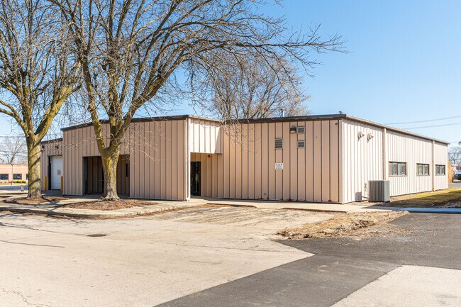

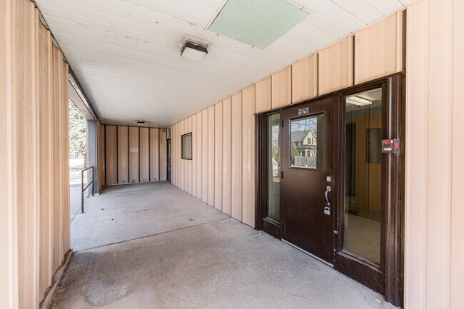

Property Detail
520 N Maple St
Chicago-Naperville-Elgin, IL-IN
LOTS 11, 12, 13 & N 22.60FT LOT 10 - BLK 3 - FACTORY ADDITION
06-32-226-016
DEKALB
Industrialgeneral
Illinois
B and X Area of moderate flood hazard, usually the area between the limits of the 100-year and 500-year floods.
10-13
0
0.53 AC
2024
Central Kane / DuPage
000600
Chicago
8,000 SF
NEARBY LISTINGS FOR SALE OR LEASE
DEMOGRAPHICS near 520 N Maple St
1 mile
3 mile
5 mile
2025 Total Population
7,361
21,304
34,288
2030 Population
7,374
21,370
34,445
Pop Growth 2025-2030
+ 0.18%
+ 0.31%
+ 0.46%
Average Age
40
40
40
2025 Total Households
3,087
8,506
13,554
HH Growth 2025-2030
+ 0.23%
+ 0.34%
+ 0.44%
Median Household Inc
$73,347
$83,588
$77,701
Avg Household Size
2.30
2.50
2.50
2025 Avg HH Vehicles
2.00
2.00
2.00
Median Home Value
$252,784
$262,027
$250,592
Median Year Built
1975
1989
1985
Nearby Places
Map Layers
Map Styles
 Street
 Aerial
Layers
 Traffic
 Biking
Places
Listings with unknown addresses are not visible on the map
- Restaurants
- Banks
- Shops
- Fitness
- Groceries
PUBLIC TRANSPORTATION
AIRPORT
Chicago/Rockford International
Drive
Walk
Distance
Chicago/Rockford International
53 min
35.3 mi
SALE & LEASE HISTORY
LISTING DATE
SALE/LEASE

Mar 20, 2025
For Lease
Mar 20, 2025
For Sale
Nearby Properties
Address
Land Use
TOTAL SIZE
Lot Size
Zoning
Address
Land Use
TOTAL SIZE
Lot Size
Zoning
Address
Land Use
TOTAL SIZE
Lot Size
Zoning
204,828 SF
27.88 AC
Address
Land Use
TOTAL SIZE
Lot Size
Zoning
42,453 SF
13.08 AC
RC2
Address
Land Use
TOTAL SIZE
Lot Size
Zoning
13.48 AC
BC
Address
Land Use
TOTAL SIZE
Lot Size
Zoning
29,732 SF
3.66 AC
Address
Land Use
TOTAL SIZE
Lot Size
Zoning
70,481 SF
7.93 AC
Address
Land Use
TOTAL SIZE
Lot Size
Zoning
16.04 AC
Address
Land Use
TOTAL SIZE
Lot Size
Zoning
143,935 SF
14.20 AC
Address
Land Use
TOTAL SIZE
Lot Size
Zoning
128,192 SF
18.02 AC
Address
Land Use
TOTAL SIZE
Lot Size
Zoning
188,034 SF
33.22 AC
Address
Land Use
TOTAL SIZE
Lot Size
Zoning
16.85 AC
Address
Land Use
TOTAL SIZE
Lot Size
Zoning
5 AC
A1
Address
Land Use
TOTAL SIZE
Lot Size
Zoning
8.41 AC
Address
Land Use
TOTAL SIZE
Lot Size
Zoning
7.03 AC
Address
Land Use
TOTAL SIZE
Lot Size
Zoning
28,011 SF
3.33 AC
Address
Land Use
TOTAL SIZE
Lot Size
Zoning
22,860 SF
27.55 AC
Address
Land Use
TOTAL SIZE
Lot Size
Zoning
127,415 SF
11.90 AC
Address
Land Use
TOTAL SIZE
Lot Size
Zoning
1.46 AC
Address
Land Use
TOTAL SIZE
Lot Size
Zoning
3.63 AC
Address
Land Use
TOTAL SIZE
Lot Size
Zoning
33,876 SF
2.87 AC
A1
Address
Land Use
TOTAL SIZE
Lot Size
Zoning
4.06 AC
Address
Land Use
TOTAL SIZE
Lot Size
Zoning
4.45 AC
Address
Land Use
TOTAL SIZE
Lot Size
Zoning
2.28 AC
Address
Land Use
TOTAL SIZE
Lot Size
Zoning
21,605 SF
16.08 AC
Address
Land Use
TOTAL SIZE
Lot Size
Zoning
127,200 SF
14.41 AC
Address
Land Use
TOTAL SIZE
Lot Size
Zoning
1.56 AC
Address
Land Use
TOTAL SIZE
Lot Size
Zoning
45,152 SF
3.55 AC
Address
Land Use
TOTAL SIZE
Lot Size
Zoning
137,068 SF
14.74 AC
Address
Land Use
TOTAL SIZE
Lot Size
Zoning
1.49 AC
Address
Land Use
TOTAL SIZE
Lot Size
Zoning
2.91 AC
The World's #1 Commercial Real Estate Marketplace
Connect with us
© 2026 CoStar Group
The information above has been obtained from sources believed reliable. While we do not doubt its accuracy we have not verified it and make no guarantee, warranty or representation about it. It is your responsibility to independently confirm its accuracy and completeness. Any projections, opinions, assumptions, or estimates used are for example only and do not represent the current or future performance of the property. The value of this transaction to you depends on tax and other factors which should be evaluated by your tax, financial, and legal advisors. You and your advisors should conduct a careful, independent investigation of the property to determine to your satisfaction the suitability of the property for your needs.