Property Record
520 N Moapa Valley Blvd, Overton, NV 89040
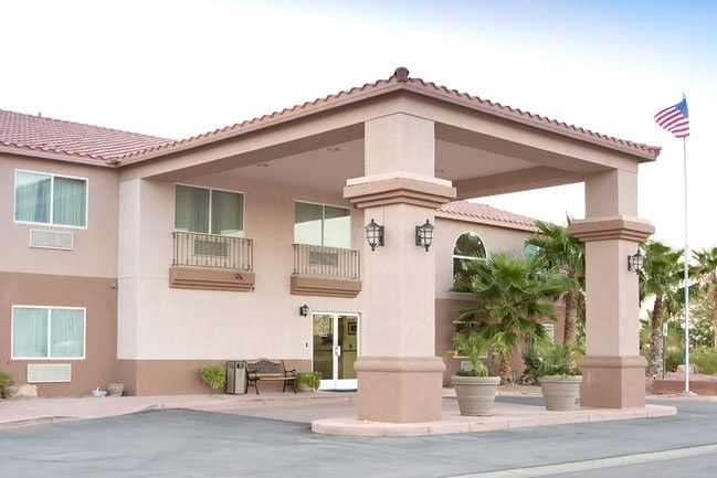


This Property Is For Sale
Property Detail
520 N Moapa Valley Blvd
070-12-401-005
PARCEL MAP FILE 85 PAGE 94 LOT 1
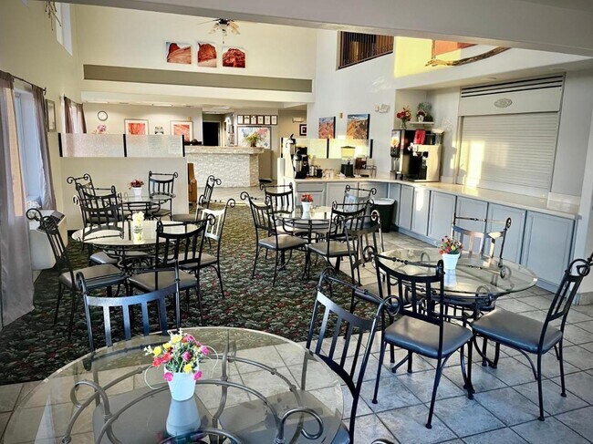
Motel
CLARK
C2
Nevada
C and X Area of minimal flood hazard, usually depicted on FIRMs as above the 500-year flood level.
1
2026
3.07 AC
2026
Las Vegas North
005613
Las Vegas
23,164 SF
Las Vegas-Henderson-North Las Vegas, NV
NEARBY LISTINGS FOR SALE OR LEASE
-
-
View all Overton listings for sale on LoopNet.com
DEMOGRAPHICS near 520 N Moapa Valley Blvd
1 mile
3 mile
5 mile
2025 Total Population
1,218
3,037
4,725
2030 Population
1,203
2,982
4,637
Pop Growth 2025-2030
(1.23%)
(1.81%)
(1.86%)
Average Age
43
42
40
2025 Total Households
484
1,149
1,674
HH Growth 2025-2030
(1.24%)
(1.74%)
(1.79%)
Median Household Inc
$69,499
$82,755
$93,680
Avg Household Size
2.50
2.60
2.80
2025 Avg HH Vehicles
2.00
2.00
2.00
Median Home Value
$327,857
$416,923
$459,852
Median Year Built
1984
1987
1989
Nearby Places
Map Layers
Map Styles
 Street
 Aerial
Layers
 Traffic
 Biking
Places
Listings with unknown addresses are not visible on the map
- Restaurants
- Banks
- Shops
- Fitness
- Groceries
Nearby Properties
Address
Land Use
TOTAL SIZE
Lot Size
Zoning
Address
Land Use
TOTAL SIZE
Lot Size
Zoning
17.62 AC
M1
Address
Land Use
TOTAL SIZE
Lot Size
Zoning
20.77 AC
PF
Address
Land Use
TOTAL SIZE
Lot Size
Zoning
2.15 AC
RU
Address
Land Use
TOTAL SIZE
Lot Size
Zoning
29,437 SF
21.10 AC
M1
Address
Land Use
TOTAL SIZE
Lot Size
Zoning
9,835 SF
2.37 AC
PF
Address
Land Use
TOTAL SIZE
Lot Size
Zoning
25,836 SF
5.51 AC
C2
Address
Land Use
TOTAL SIZE
Lot Size
Zoning
792 SF
2.20 AC
R3
Address
Land Use
TOTAL SIZE
Lot Size
Zoning
16,401 SF
2.40 AC
R3
Address
Land Use
TOTAL SIZE
Lot Size
Zoning
4.86 AC
RU
Address
Land Use
TOTAL SIZE
Lot Size
Zoning
15,992 SF
4.12 AC
RU
Address
Land Use
TOTAL SIZE
Lot Size
Zoning
7,248 SF
1.42 AC
C2
Address
Land Use
TOTAL SIZE
Lot Size
Zoning
8,369 SF
11.75 AC
C2
Address
Land Use
TOTAL SIZE
Lot Size
Zoning
6,512 SF
2.03 AC
CP
Address
Land Use
TOTAL SIZE
Lot Size
Zoning
13,471 SF
3.09 AC
M1
Address
Land Use
TOTAL SIZE
Lot Size
Zoning
8,000 SF
0.65 AC
C2
Address
Land Use
TOTAL SIZE
Lot Size
Zoning
17,344 SF
1.68 AC
R1
Address
Land Use
TOTAL SIZE
Lot Size
Zoning
9,912 SF
0.40 AC
R4
Address
Land Use
TOTAL SIZE
Lot Size
Zoning
20,358 SF
1.96 AC
M1
Address
Land Use
TOTAL SIZE
Lot Size
Zoning
30,000 SF
38.04 AC
PF
Address
Land Use
TOTAL SIZE
Lot Size
Zoning
17,625 SF
1.38 AC
C2
Address
Land Use
TOTAL SIZE
Lot Size
Zoning
65.62 AC
PF
Address
Land Use
TOTAL SIZE
Lot Size
Zoning
4,216 SF
18.48 AC
RU
Address
Land Use
TOTAL SIZE
Lot Size
Zoning
4,004 SF
2.04 AC
CP
Address
Land Use
TOTAL SIZE
Lot Size
Zoning
2,436 SF
0.81 AC
C2
Address
Land Use
TOTAL SIZE
Lot Size
Zoning
16,000 SF
7.96 AC
M1
Address
Land Use
TOTAL SIZE
Lot Size
Zoning
2,372 SF
0.74 AC
C2
Address
Land Use
TOTAL SIZE
Lot Size
Zoning
4,519 SF
0.99 AC
C2
Address
Land Use
TOTAL SIZE
Lot Size
Zoning
4,596 SF
1.99 AC
RU
Address
Land Use
TOTAL SIZE
Lot Size
Zoning
9,254 SF
0.88 AC
PF
The World's #1 Commercial Real Estate Marketplace
Connect with us
© 2026 CoStar Group
The information above has been obtained from sources believed reliable. While we do not doubt its accuracy we have not verified it and make no guarantee, warranty or representation about it. It is your responsibility to independently confirm its accuracy and completeness. Any projections, opinions, assumptions, or estimates used are for example only and do not represent the current or future performance of the property. The value of this transaction to you depends on tax and other factors which should be evaluated by your tax, financial, and legal advisors. You and your advisors should conduct a careful, independent investigation of the property to determine to your satisfaction the suitability of the property for your needs.