Property Record
520 Northridge Park Dr, Rural Hall, NC 27045


NEARBY LISTINGS FOR SALE OR LEASE
Property Detail
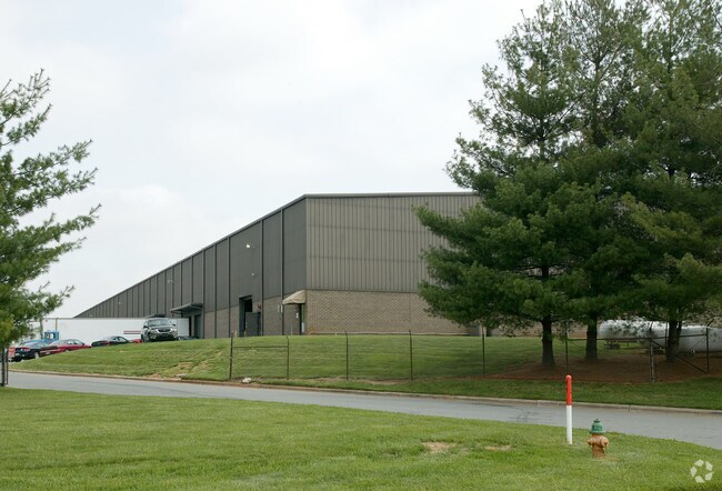
520 Northridge Park Dr
Winston-Salem, NC
Westrock
6910-44-2048
WESTROCK LO:007 BL:4967E BU:1
Commercialnec
Forsyth
X
North Carolina
3710691000J
7
2024
12.41 AC
2025
NW Forsyth County
002808
Greensboro/Winston-Salem
48 SF
DEMOGRAPHICS near 520 Northridge Park Dr
1 Mile
3 Mile
5 Mile
2024 Total Population
2,976
14,585
47,681
2029 Population
3,096
15,290
49,621
Pop Growth 2024-2029
+ 4.03%
+ 4.83%
+ 4.07%
Average Age
40
41
41
2024 Total Households
1,253
6,049
19,689
HH Growth 2024-2029
+ 4.07%
+ 4.81%
+ 4.01%
Median Household Inc
$64,096
$64,941
$58,560
Avg Household Size
2.40
2.40
2.40
2024 Avg HH Vehicles
2.00
2.00
2.00
Median Home Value
$172,185
$175,295
$178,217
Median Year Built
1988
1986
1983
Nearby Places
Map Layers
Map Styles
 Street
 Aerial
- Restaurants
- Banks
- Shops
- Fitness
- Groceries
PUBLIC TRANSPORTATION
AIRPORT
Piedmont Triad International
DRIVE
WALK
Distance
Piedmont Triad International
47 min
29.9 mi
Freight Ports
Virginia Port Authority - Richmond
DRIVE
WALK
Distance
Virginia Port Authority - Richmond
274 min
233.5 mi
SALE & LEASE HISTORY
LISTING DATE
SALE/LEASE

Jan 26, 2024
For Lease
Nearby Properties
Address
Land Use
TOTAL SIZE
Lot Size
Zoning
Address
Land Use
TOTAL SIZE
Lot Size
Zoning
929,306 SF
49.25 AC
LI
Address
Land Use
TOTAL SIZE
Lot Size
Zoning
643,954 SF
57.69 AC
LI
Address
Land Use
TOTAL SIZE
Lot Size
Zoning
469,117 SF
32.68 AC
LI
Address
Land Use
TOTAL SIZE
Lot Size
Zoning
111,873 SF
23.10 AC
RM18
Address
Land Use
TOTAL SIZE
Lot Size
Zoning
525,977 SF
248.96 AC
GI,RS20
Address
Land Use
TOTAL SIZE
Lot Size
Zoning
69,555 SF
18.83 AC
RM12-S
Address
Land Use
TOTAL SIZE
Lot Size
Zoning
95,375 SF
20.15 AC
RS9
Address
Land Use
TOTAL SIZE
Lot Size
Zoning
449,539 SF
24.86 AC
GI
Address
Land Use
TOTAL SIZE
Lot Size
Zoning
54,110 SF
15.08 AC
IP-S
Address
Land Use
TOTAL SIZE
Lot Size
Zoning
97,043 SF
5.27 AC
IP
Address
Land Use
TOTAL SIZE
Lot Size
Zoning
333.30 AC
GI-S
Address
Land Use
TOTAL SIZE
Lot Size
Zoning
261,300 SF
16.99 AC
LI
Address
Land Use
TOTAL SIZE
Lot Size
Zoning
201,096 SF
11.20 AC
LI
Address
Land Use
TOTAL SIZE
Lot Size
Zoning
282,700 SF
20.98 AC
GI
Address
Land Use
TOTAL SIZE
Lot Size
Zoning
250,165 SF
17.41 AC
GI
Address
Land Use
TOTAL SIZE
Lot Size
Zoning
20 AC
HB-S
Address
Land Use
TOTAL SIZE
Lot Size
Zoning
72,636 SF
35.84 AC
IP
Address
Land Use
TOTAL SIZE
Lot Size
Zoning
60,240 SF
5.79 AC
RM12-S
Address
Land Use
TOTAL SIZE
Lot Size
Zoning
24,721 SF
32.13 AC
GI-S,RS20
Address
Land Use
TOTAL SIZE
Lot Size
Zoning
57,759 SF
6.36 AC
HB
Address
Land Use
TOTAL SIZE
Lot Size
Zoning
64,412 SF
8.17 AC
HB,RS9
Address
Land Use
TOTAL SIZE
Lot Size
Zoning
35,109 SF
17.94 AC
RS20
Address
Land Use
TOTAL SIZE
Lot Size
Zoning
85,449 SF
12.90 AC
LI
Address
Land Use
TOTAL SIZE
Lot Size
Zoning
34,513 SF
8.10 AC
RM12
Address
Land Use
TOTAL SIZE
Lot Size
Zoning
42,260 SF
12.92 AC
RM8-S
Address
Land Use
TOTAL SIZE
Lot Size
Zoning
133,110 SF
7.34 AC
GI
Address
Land Use
TOTAL SIZE
Lot Size
Zoning
23,737 SF
5.97 AC
IP
Address
Land Use
TOTAL SIZE
Lot Size
Zoning
100,096 SF
7.53 AC
GI
Address
Land Use
TOTAL SIZE
Lot Size
Zoning
57,100 SF
3.66 AC
LI
The World's #1 Commercial Real Estate Marketplace
Connect with us
© 2026 CoStar Group
The information above has been obtained from sources believed reliable. While we do not doubt its accuracy we have not verified it and make no guarantee, warranty or representation about it. It is your responsibility to independently confirm its accuracy and completeness. Any projections, opinions, assumptions, or estimates used are for example only and do not represent the current or future performance of the property. The value of this transaction to you depends on tax and other factors which should be evaluated by your tax, financial, and legal advisors. You and your advisors should conduct a careful, independent investigation of the property to determine to your satisfaction the suitability of the property for your needs.