Property Record
520 Patrick Henry Dr, Blacksburg, VA 24060


Property Detail
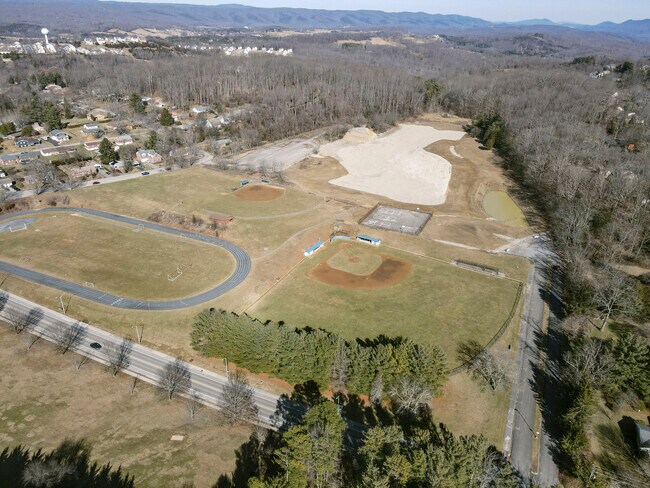
520 Patrick Henry Dr
070649
BBURG HIGH SCHOOL PARCEL 1A
Residentialacreage
Montgomery
R4
Virginia
B and X Area of moderate flood hazard, usually the area between the limits of the 100-year and 500-year floods.
12.90 AC
2025
Apperson-Dickerson
2025
Other Market Areas
020100
Blacksburg-Christiansburg-Radford, VA
211,473 SF
NEARBY LISTINGS FOR SALE OR LEASE
DEMOGRAPHICS near 520 Patrick Henry Dr
1 mile
3 mile
5 mile
2025 Total Population
12,284
34,300
43,861
2030 Population
12,371
34,387
43,974
Pop Growth 2025-2030
+ 0.71%
+ 0.25%
+ 0.26%
Average Age
31
33
35
2025 Total Households
5,225
14,648
18,730
HH Growth 2025-2030
+ 0.61%
+ 0.21%
+ 0.23%
Median Household Inc
$33,909
$47,958
$54,719
Avg Household Size
2.30
2.30
2.30
2025 Avg HH Vehicles
2.00
2.00
2.00
Median Home Value
$465,086
$487,116
$468,158
Median Year Built
1985
1986
1986
Nearby Places
Map Layers
Map Styles
 Street
 Aerial
Transit
 Traffic
 Biking
Places
Listings with unknown addresses are not visible on the map
- Restaurants
- Banks
- Shops
- Fitness
- Groceries
PUBLIC TRANSPORTATION
AIRPORT
Roanoke/Blacksburg Regional (Woodrum Field)
Drive
Walk
Distance
Roanoke/Blacksburg Regional (Woodrum Field)
61 min
35.3 mi
Freight Ports
Virginia Port Authority - Richmond
Drive
Walk
Distance
Virginia Port Authority - Richmond
263 min
219.1 mi
SALE & LEASE HISTORY
LISTING DATE
SALE/LEASE

Feb 10, 2023
For Sale
Nearby Properties
Address
Land Use
TOTAL SIZE
Lot Size
Zoning
Address
Land Use
TOTAL SIZE
Lot Size
Zoning
Address
Land Use
TOTAL SIZE
Lot Size
Zoning
41.51 AC
PR
Address
Land Use
TOTAL SIZE
Lot Size
Zoning
120,948 SF
15.28 AC
RM-48
Address
Land Use
TOTAL SIZE
Lot Size
Zoning
134,784 SF
21.21 AC
PR
Address
Land Use
TOTAL SIZE
Lot Size
Zoning
224,316 SF
6.10 AC
RM48
Address
Land Use
TOTAL SIZE
Lot Size
Zoning
31,178 SF
7.33 AC
RM48
Address
Land Use
TOTAL SIZE
Lot Size
Zoning
3.23 AC
DC
Address
Land Use
TOTAL SIZE
Lot Size
Zoning
47,153 SF
30.90 AC
R&D
Address
Land Use
TOTAL SIZE
Lot Size
Zoning
4,332 SF
24.35 AC
RM-48
Address
Land Use
TOTAL SIZE
Lot Size
Zoning
50,728 SF
14.25 AC
PR
Address
Land Use
TOTAL SIZE
Lot Size
Zoning
125,184 SF
9.12 AC
RM-48
Address
Land Use
TOTAL SIZE
Lot Size
Zoning
7.38 AC
R&D
Address
Land Use
TOTAL SIZE
Lot Size
Zoning
197,024 SF
9.86 AC
PR
Address
Land Use
TOTAL SIZE
Lot Size
Zoning
183,569 SF
8.38 AC
PR
Address
Land Use
TOTAL SIZE
Lot Size
Zoning
33,716 SF
15.72 AC
R&D
Address
Land Use
TOTAL SIZE
Lot Size
Zoning
140,302 SF
1.09 AC
DC
Address
Land Use
TOTAL SIZE
Lot Size
Zoning
7,820 SF
58.14 AC
R&D
Address
Land Use
TOTAL SIZE
Lot Size
Zoning
5.58 AC
MXD
Address
Land Use
TOTAL SIZE
Lot Size
Zoning
150,108 SF
8.19 AC
PR
Address
Land Use
TOTAL SIZE
Lot Size
Zoning
124,356 SF
4.79 AC
RM-48
Address
Land Use
TOTAL SIZE
Lot Size
Zoning
111,728 SF
8.11 AC
PR
Address
Land Use
TOTAL SIZE
Lot Size
Zoning
125,388 SF
5.68 AC
RM-48
Address
Land Use
TOTAL SIZE
Lot Size
Zoning
127,968 SF
5.63 AC
RM-48
Address
Land Use
TOTAL SIZE
Lot Size
Zoning
3.47 AC
MXD
Address
Land Use
TOTAL SIZE
Lot Size
Zoning
106,740 SF
6.04 AC
PR
Address
Land Use
TOTAL SIZE
Lot Size
Zoning
2,336 SF
4.22 AC
R5
Address
Land Use
TOTAL SIZE
Lot Size
Zoning
100,620 SF
5.10 AC
RM-48
Address
Land Use
TOTAL SIZE
Lot Size
Zoning
88,980 SF
5.03 AC
PR
Address
Land Use
TOTAL SIZE
Lot Size
Zoning
51,036 SF
14.21 AC
R&D
Address
Land Use
TOTAL SIZE
Lot Size
Zoning
3,654 SF
3.72 AC
RM-48
The World's #1 Commercial Real Estate Marketplace
Connect with us
© 2026 CoStar Group
The information above has been obtained from sources believed reliable. While we do not doubt its accuracy we have not verified it and make no guarantee, warranty or representation about it. It is your responsibility to independently confirm its accuracy and completeness. Any projections, opinions, assumptions, or estimates used are for example only and do not represent the current or future performance of the property. The value of this transaction to you depends on tax and other factors which should be evaluated by your tax, financial, and legal advisors. You and your advisors should conduct a careful, independent investigation of the property to determine to your satisfaction the suitability of the property for your needs.