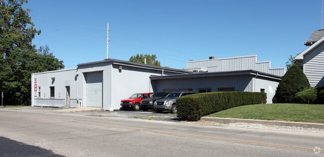
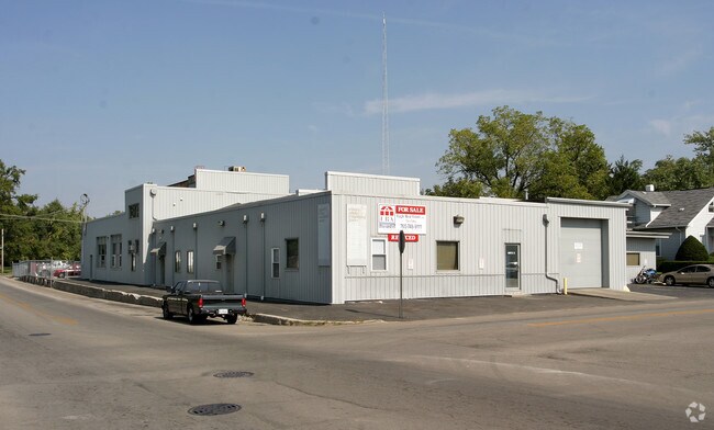
Property Record
520 S Nichols Ave, Muncie, IN 47303

NEARBY LISTINGS FOR SALE OR LEASE
Property Detail
520 S Nichols Ave
18-11-17-212-007.000-003
Westside Add
Apartment
WESTSIDE ADDITION AND VAC ALLEY ADJ 0.0000ACRES STR: 172010 IN: 872-877-890-906-907 OUT:
X
Delaware
18035C0233E
Indiana
2024
0.85 AC
2024
Delaware County
000800
Indianapolis
19,656 SF
Muncie, IN
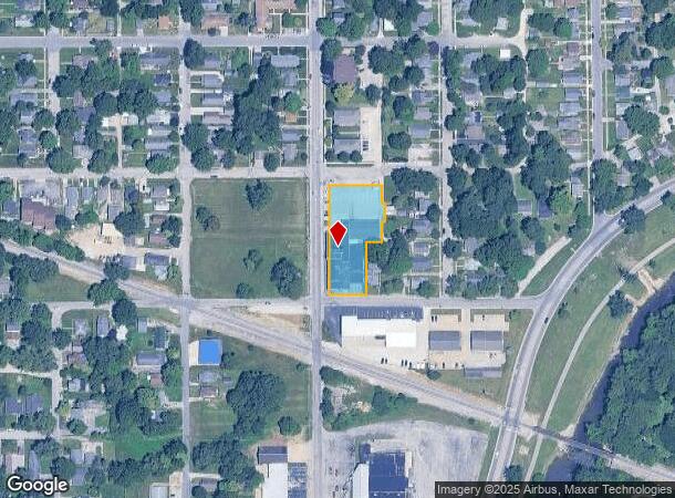
DEMOGRAPHICS near 520 S Nichols Ave
1 Mile
3 Mile
5 Mile
2024 Total Population
10,788
63,664
86,908
2029 Population
10,948
64,029
87,086
Pop Growth 2024-2029
+ 1.48%
+ 0.57%
+ 0.20%
Average Age
36
37
38
2024 Total Households
4,758
25,845
35,429
HH Growth 2024-2029
+ 1.51%
+ 0.62%
+ 0.22%
Median Household Inc
$35,719
$41,843
$47,406
Avg Household Size
2.00
2.10
2.20
2024 Avg HH Vehicles
2.00
2.00
2.00
Median Home Value
$76,414
$93,377
$107,890
Median Year Built
1956
1961
1964
Nearby Places
Map Layers
Map Styles
 Street
 Aerial
- Restaurants
- Banks
- Shops
- Fitness
- Groceries
Nearby Properties
Address
Land Use
TOTAL SIZE
Lot Size
Zoning
Address
Land Use
TOTAL SIZE
Lot Size
Zoning
73.03 AC
Address
Land Use
TOTAL SIZE
Lot Size
Zoning
212,625 SF
34.32 AC
Address
Land Use
TOTAL SIZE
Lot Size
Zoning
37,168 SF
24.56 AC
Address
Land Use
TOTAL SIZE
Lot Size
Zoning
112,553 SF
17.17 AC
Address
Land Use
TOTAL SIZE
Lot Size
Zoning
127,495 SF
25 AC
Address
Land Use
TOTAL SIZE
Lot Size
Zoning
82,160 SF
14.32 AC
Address
Land Use
TOTAL SIZE
Lot Size
Zoning
24,036 SF
7.21 AC
Address
Land Use
TOTAL SIZE
Lot Size
Zoning
2,125 SF
51.91 AC
Address
Land Use
TOTAL SIZE
Lot Size
Zoning
77,145 SF
10.45 AC
Address
Land Use
TOTAL SIZE
Lot Size
Zoning
9,280 SF
19.77 AC
Address
Land Use
TOTAL SIZE
Lot Size
Zoning
17,240 SF
10.56 AC
Address
Land Use
TOTAL SIZE
Lot Size
Zoning
231,752 SF
6.64 AC
Address
Land Use
TOTAL SIZE
Lot Size
Zoning
367,525 SF
1.36 AC
Address
Land Use
TOTAL SIZE
Lot Size
Zoning
170,740 SF
2.30 AC
Address
Land Use
TOTAL SIZE
Lot Size
Zoning
92,340 SF
9.22 AC
Address
Land Use
TOTAL SIZE
Lot Size
Zoning
1,418 SF
0.91 AC
Address
Land Use
TOTAL SIZE
Lot Size
Zoning
181,950 SF
0.45 AC
Address
Land Use
TOTAL SIZE
Lot Size
Zoning
14,594 SF
13.39 AC
Address
Land Use
TOTAL SIZE
Lot Size
Zoning
40,050 SF
9.05 AC
Address
Land Use
TOTAL SIZE
Lot Size
Zoning
5,177 SF
12 AC
Address
Land Use
TOTAL SIZE
Lot Size
Zoning
88,495 SF
8.93 AC
Address
Land Use
TOTAL SIZE
Lot Size
Zoning
54,192 SF
26.57 AC
Address
Land Use
TOTAL SIZE
Lot Size
Zoning
142,628 SF
13.07 AC
Address
Land Use
TOTAL SIZE
Lot Size
Zoning
208,840 SF
14.88 AC
Address
Land Use
TOTAL SIZE
Lot Size
Zoning
699,468 SF
14.73 AC
Address
Land Use
TOTAL SIZE
Lot Size
Zoning
9,000 SF
43.70 AC
Address
Land Use
TOTAL SIZE
Lot Size
Zoning
108,480 SF
2.61 AC
Address
Land Use
TOTAL SIZE
Lot Size
Zoning
Address
Land Use
TOTAL SIZE
Lot Size
Zoning
68,043 SF
1.98 AC
Address
Land Use
TOTAL SIZE
Lot Size
Zoning
40,698 SF
0.99 AC
The World's #1 Commercial Real Estate Marketplace
Connect with us
© 2025 CoStar Group
The information above has been obtained from sources believed reliable. While we do not doubt its accuracy we have not verified it and make no guarantee, warranty or representation about it. It is your responsibility to independently confirm its accuracy and completeness. Any projections, opinions, assumptions, or estimates used are for example only and do not represent the current or future performance of the property. The value of this transaction to you depends on tax and other factors which should be evaluated by your tax, financial, and legal advisors. You and your advisors should conduct a careful, independent investigation of the property to determine to your satisfaction the suitability of the property for your needs.