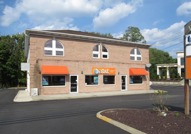
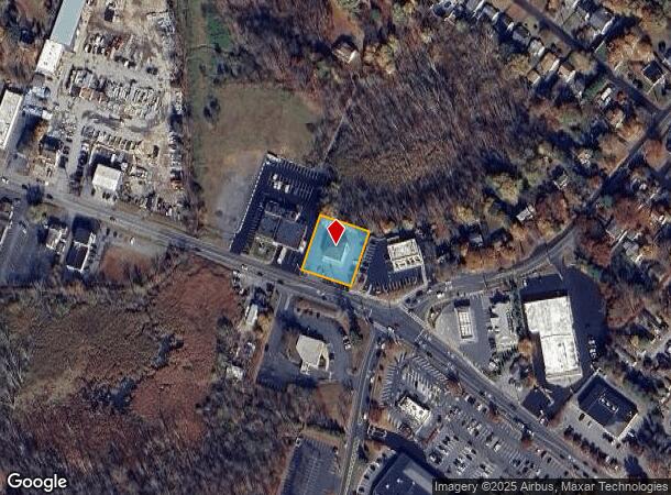
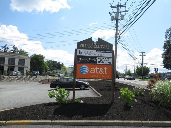
Property Record
520 State Route 17M, Monroe, NY 10950

NEARBY LISTINGS FOR SALE OR LEASE
-
-
-
-
No Photo
-
View all Monroe listings for lease on LoopNet.com
Property Detail
520 State Route 17M
334001-214-000-0001-055.000-0000
Orange
Commercialnec
New York
X
55.00
36071C0483E
0.50 AC
2024
Monroe
2024
Northern New Jersey
014101
New York-Jersey City-White Plains, NY-NJ
5,120 SF
DEMOGRAPHICS near 520 State Route 17M
1 Mile
3 Mile
5 Mile
2024 Total Population
7,156
63,783
82,609
2029 Population
7,295
65,599
84,786
Pop Growth 2024-2029
+ 1.94%
+ 2.85%
+ 2.64%
Average Age
38
28
30
2024 Total Households
2,310
15,416
21,290
HH Growth 2024-2029
+ 1.99%
+ 3.01%
+ 2.70%
Median Household Inc
$104,113
$82,979
$93,588
Avg Household Size
3.00
3.90
3.70
2024 Avg HH Vehicles
2.00
1.00
2.00
Median Home Value
$342,515
$423,403
$399,224
Median Year Built
1977
1991
1987
Nearby Places
- Restaurants
- Banks
- Shops
- Fitness
- Groceries
PUBLIC TRANSPORTATION
COMMUTER RAIL
Harriman (Bergen County/Port Jervis Line - NJ Transit Commuter Rail (NJ Transit), Main/Port Jervis Line - NJ Transit Commuter Rail (NJ Transit))
DRIVE
WALK
Distance
Harriman (Bergen County/Port Jervis Line - NJ Transit Commuter Rail (NJ Transit), Main/Port Jervis Line - NJ Transit Commuter Rail (NJ Transit))
6 min
3.1 mi
AIRPORT
New York Stewart International
DRIVE
WALK
Distance
New York Stewart International
30 min
16.3 mi
Freight Ports
Port Newark Container Terminal
DRIVE
WALK
Distance
Port Newark Container Terminal
1 min
43.6 mi
SALE & LEASE HISTORY
LISTING DATE
SALE/LEASE

Oct 23, 2017
For Lease
May 09, 2017
For Lease
Feb 27, 2024
For Lease
Feb 04, 2019
For Lease
Aug 17, 2021
For Lease
Aug 04, 2017
For Sale
Nearby Properties
Address
Land Use
TOTAL SIZE
Lot Size
Zoning
Address
Land Use
TOTAL SIZE
Lot Size
Zoning
143.60 AC
LIO
Address
Land Use
TOTAL SIZE
Lot Size
Zoning
114.40 AC
Address
Land Use
TOTAL SIZE
Lot Size
Zoning
12 AC
Address
Land Use
TOTAL SIZE
Lot Size
Zoning
235,455 SF
51.70 AC
IB
Address
Land Use
TOTAL SIZE
Lot Size
Zoning
103,290 SF
41.22 AC
RR-1.0AC
Address
Land Use
TOTAL SIZE
Lot Size
Zoning
125,636 SF
19.91 AC
SR-20
Address
Land Use
TOTAL SIZE
Lot Size
Zoning
31,507 SF
10.50 AC
UR-M
Address
Land Use
TOTAL SIZE
Lot Size
Zoning
4.50 AC
Address
Land Use
TOTAL SIZE
Lot Size
Zoning
15.90 AC
Address
Land Use
TOTAL SIZE
Lot Size
Zoning
6.90 AC
Address
Land Use
TOTAL SIZE
Lot Size
Zoning
23,534 SF
6.60 AC
PD
Address
Land Use
TOTAL SIZE
Lot Size
Zoning
39,235 SF
6.40 AC
Address
Land Use
TOTAL SIZE
Lot Size
Zoning
124,928 SF
12.14 AC
GB
Address
Land Use
TOTAL SIZE
Lot Size
Zoning
70,760 SF
17.20 AC
GB
Address
Land Use
TOTAL SIZE
Lot Size
Zoning
91,472 SF
6.42 AC
SR-10
Address
Land Use
TOTAL SIZE
Lot Size
Zoning
88,240 SF
3.02 AC
R-1
Address
Land Use
TOTAL SIZE
Lot Size
Zoning
113,910 SF
15 AC
PD
Address
Land Use
TOTAL SIZE
Lot Size
Zoning
159,857 SF
24.59 AC
LI
Address
Land Use
TOTAL SIZE
Lot Size
Zoning
Address
Land Use
TOTAL SIZE
Lot Size
Zoning
103,908 SF
7.40 AC
I
Address
Land Use
TOTAL SIZE
Lot Size
Zoning
92,868 SF
1.22 AC
PD
Address
Land Use
TOTAL SIZE
Lot Size
Zoning
88,855 SF
5 AC
PD
Address
Land Use
TOTAL SIZE
Lot Size
Zoning
7.60 AC
Address
Land Use
TOTAL SIZE
Lot Size
Zoning
5.20 AC
IB
Address
Land Use
TOTAL SIZE
Lot Size
Zoning
126,112 SF
3.30 AC
R-1
Address
Land Use
TOTAL SIZE
Lot Size
Zoning
15,686 SF
4.60 AC
IB
Address
Land Use
TOTAL SIZE
Lot Size
Zoning
16.80 AC
Address
Land Use
TOTAL SIZE
Lot Size
Zoning
117,855 SF
3.20 AC
PD
Address
Land Use
TOTAL SIZE
Lot Size
Zoning
39,548 SF
13.87 AC
SR-20
Address
Land Use
TOTAL SIZE
Lot Size
Zoning
110,219 SF
10.88 AC
LI
The World's #1 Commercial Real Estate Marketplace
Connect with us
© 2025 CoStar Group
The information above has been obtained from sources believed reliable. While we do not doubt its accuracy we have not verified it and make no guarantee, warranty or representation about it. It is your responsibility to independently confirm its accuracy and completeness. Any projections, opinions, assumptions, or estimates used are for example only and do not represent the current or future performance of the property. The value of this transaction to you depends on tax and other factors which should be evaluated by your tax, financial, and legal advisors. You and your advisors should conduct a careful, independent investigation of the property to determine to your satisfaction the suitability of the property for your needs.