Property Record
520 Upper Chesapeake Dr, Bel Air, MD 21014
Save to a Folder
{{folder.Name}}
{{folder.ListingIds.length}} Properties
{{folder.ListingIds.length}} Property
Create a New Folder
Current Lease Availabilities
Property Detail
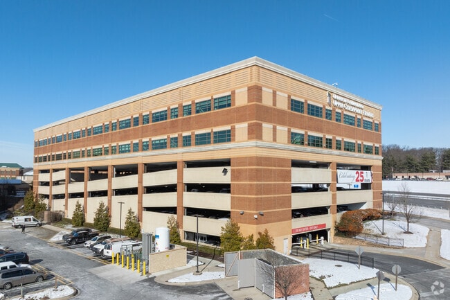
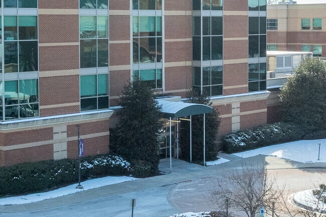
520 Upper Chesapeake Dr
Baltimore-Columbia-Towson, MD
UNIT 4 1.51 AC UPPER CHESAPEAKE DRIVE UPPER CHESA 208/53-54
03-383695
HARFORD
Parkingstructure
Maryland
B and X Area of moderate flood hazard, usually the area between the limits of the 100-year and 500-year floods.
4
2025
1.51 AC
2025
Outlying Harford County
303801
Baltimore
171,596 SF
NEARBY LISTINGS FOR SALE OR LEASE
DEMOGRAPHICS near 520 Upper Chesapeake Dr
1 mile
3 mile
5 mile
2025 Total Population
8,958
66,772
116,694
2030 Population
9,002
66,982
117,189
Pop Growth 2025-2030
+ 0.49%
+ 0.31%
+ 0.42%
Average Age
43
42
41
2025 Total Households
3,447
25,248
43,797
HH Growth 2025-2030
+ 0.55%
+ 0.38%
+ 0.43%
Median Household Inc
$123,547
$118,108
$118,498
Avg Household Size
2.50
2.60
2.60
2025 Avg HH Vehicles
2.00
2.00
2.00
Median Home Value
$469,712
$429,521
$420,093
Median Year Built
1979
1987
1989
Nearby Places
Map Layers
Map Styles
 Street
 Aerial
Layers
 Traffic
 Biking
Places
Listings with unknown addresses are not visible on the map
- Restaurants
- Banks
- Shops
- Fitness
- Groceries
PUBLIC TRANSPORTATION
COMMUTER RAIL
Edgewood Marc Nb (PENN - WASHINGTON - Maryland Transit Administration)
Drive
Walk
Distance
Edgewood Marc Nb (PENN - WASHINGTON - Maryland Transit Administration)
14 min
8.3 mi
AIRPORT
Baltimore/Washington International Thurgood Marshall
Drive
Walk
Distance
Baltimore/Washington International Thurgood Marshall
51 min
36.5 mi
Freight Ports
Port of Baltimore
Drive
Walk
Distance
Port of Baltimore
39 min
27.8 mi
Nearby Properties
Address
Land Use
TOTAL SIZE
Lot Size
Zoning
Address
Land Use
TOTAL SIZE
Lot Size
Zoning
363,713 SF
6.96 AC
B3
Address
Land Use
TOTAL SIZE
Lot Size
Zoning
13,400 SF
37.89 AC
B3
Address
Land Use
TOTAL SIZE
Lot Size
Zoning
270,700 SF
31.09 AC
B3 R3
Address
Land Use
TOTAL SIZE
Lot Size
Zoning
77.35 AC
R2
Address
Land Use
TOTAL SIZE
Lot Size
Zoning
42,087 SF
17.21 AC
B3
Address
Land Use
TOTAL SIZE
Lot Size
Zoning
8,503 SF
20.86 AC
B3
Address
Land Use
TOTAL SIZE
Lot Size
Zoning
197,191 SF
12.94 AC
R2
Address
Land Use
TOTAL SIZE
Lot Size
Zoning
291,027 SF
276 AC
R4
Address
Land Use
TOTAL SIZE
Lot Size
Zoning
5,674 SF
288 AC
R4
Address
Land Use
TOTAL SIZE
Lot Size
Zoning
49,611 SF
49.52 AC
AG
Address
Land Use
TOTAL SIZE
Lot Size
Zoning
161,723 SF
72.26 AC
R1
Address
Land Use
TOTAL SIZE
Lot Size
Zoning
223,629 SF
29.38 AC
M1
Address
Land Use
TOTAL SIZE
Lot Size
Zoning
228 AC
COS
Address
Land Use
TOTAL SIZE
Lot Size
Zoning
55,164 SF
16.22 AC
B2
Address
Land Use
TOTAL SIZE
Lot Size
Zoning
13.02 AC
R3
Address
Land Use
TOTAL SIZE
Lot Size
Zoning
35,698 SF
16.27 AC
B2
Address
Land Use
TOTAL SIZE
Lot Size
Zoning
52,224 SF
10.38 AC
B1
Address
Land Use
TOTAL SIZE
Lot Size
Zoning
12.38 AC
R2
Address
Land Use
TOTAL SIZE
Lot Size
Zoning
43,311 SF
6.76 AC
R3 R4
Address
Land Use
TOTAL SIZE
Lot Size
Zoning
15,010 SF
19.12 AC
B3
Address
Land Use
TOTAL SIZE
Lot Size
Zoning
85,798 SF
1.51 AC
Address
Land Use
TOTAL SIZE
Lot Size
Zoning
101,236 SF
23.52 AC
R1
Address
Land Use
TOTAL SIZE
Lot Size
Zoning
113,276 SF
2.19 AC
B2A
Address
Land Use
TOTAL SIZE
Lot Size
Zoning
31,521 SF
9.72 AC
R3 R4
Address
Land Use
TOTAL SIZE
Lot Size
Zoning
152,130 SF
21.10 AC
B2 B3
Address
Land Use
TOTAL SIZE
Lot Size
Zoning
70,794 SF
9.75 AC
R2
Address
Land Use
TOTAL SIZE
Lot Size
Zoning
1,496 SF
11.55 AC
M1
Address
Land Use
TOTAL SIZE
Lot Size
Zoning
74,842 SF
0.77 AC
B2 B3
Address
Land Use
TOTAL SIZE
Lot Size
Zoning
5.87 AC
R2
Address
Land Use
TOTAL SIZE
Lot Size
Zoning
46,174 SF
5 AC
R2
The World's #1 Commercial Real Estate Marketplace
Connect with us
© 2026 CoStar Group
The information above has been obtained from sources believed reliable. While we do not doubt its accuracy we have not verified it and make no guarantee, warranty or representation about it. It is your responsibility to independently confirm its accuracy and completeness. Any projections, opinions, assumptions, or estimates used are for example only and do not represent the current or future performance of the property. The value of this transaction to you depends on tax and other factors which should be evaluated by your tax, financial, and legal advisors. You and your advisors should conduct a careful, independent investigation of the property to determine to your satisfaction the suitability of the property for your needs.