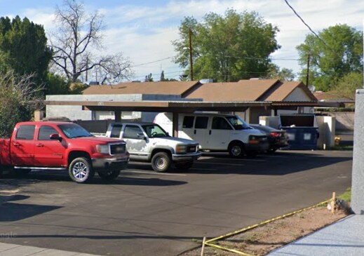
Property Record
520 W Clark St, Mesa, AZ 85201
NEARBY LISTINGS FOR SALE OR LEASE
Property Detail
520 W Clark St
Phoenix-Mesa-Chandler, AZ
Monte Vista Addn Amd
135-59-149A
PT NE4 NE4 DAF BEG SE COR LOT 30 WESTISDE ADD TO MESA TH N 164.5F W 41.5F N 48F TO S LN OF N 992.63F NE4 TH W 105F S 66F E 121.5F S 43.5F W 25F TO W LN LOT 30 TH S ALG SD W LN TO SW COR TH/OF TH E TO SE COR LOT 30 & POB
Apartment
Maricopa
X
Arizona
04013C2265M
30
2025
0.32 AC
2025
Central Mesa
421302
Phoenix
3,080 SF
DEMOGRAPHICS near 520 W Clark St
1 Mile
3 Mile
5 Mile
2024 Total Population
18,294
164,703
363,438
2029 Population
19,871
177,968
392,190
Pop Growth 2024-2029
+ 8.62%
+ 8.05%
+ 7.91%
Average Age
36
35
36
2024 Total Households
7,067
61,718
138,800
HH Growth 2024-2029
+ 8.89%
+ 8.24%
+ 8.22%
Median Household Inc
$42,925
$50,957
$60,079
Avg Household Size
2.40
2.50
2.50
2024 Avg HH Vehicles
1.00
2.00
2.00
Median Home Value
$298,339
$281,890
$326,558
Median Year Built
1979
1979
1981
Nearby Places
Map Layers
Map Styles
 Street
 Aerial
- Restaurants
- Banks
- Shops
- Fitness
- Groceries
PUBLIC TRANSPORTATION
TRANSIT/SUBWAY
Country Club/Main St (Valley Metro Rail - Valley Metro (Phoenix Light Rail))
DRIVE
WALK
Distance
Country Club/Main St (Valley Metro Rail - Valley Metro (Phoenix Light Rail))
1 min
10 min
0.5 mi
Center/Main St (Valley Metro Rail - Valley Metro (Phoenix Light Rail))
DRIVE
WALK
Distance
Center/Main St (Valley Metro Rail - Valley Metro (Phoenix Light Rail))
3 min
19 min
1.0 mi
Alma School/Main St (Valley Metro Rail - Valley Metro (Phoenix Light Rail))
DRIVE
WALK
Distance
Alma School/Main St (Valley Metro Rail - Valley Metro (Phoenix Light Rail))
3 min
20 min
1.0 mi
AIRPORT
Phoenix Sky Harbor International
DRIVE
WALK
Distance
Phoenix Sky Harbor International
19 min
11.8 mi
Phoenix-Mesa Gateway
DRIVE
WALK
Distance
Phoenix-Mesa Gateway
27 min
17.9 mi
Freight Ports
Port of San Diego
DRIVE
WALK
Distance
Port of San Diego
411 min
373.9 mi
Nearby Properties
Address
Land Use
TOTAL SIZE
Lot Size
Zoning
Address
Land Use
TOTAL SIZE
Lot Size
Zoning
439,211 SF
77.92 AC
C-G
Address
Land Use
TOTAL SIZE
Lot Size
Zoning
918,576 SF
22.96 AC
C-N
Address
Land Use
TOTAL SIZE
Lot Size
Zoning
127,962 SF
18.60 AC
I-1
Address
Land Use
TOTAL SIZE
Lot Size
Zoning
805,814 SF
115.19 AC
C-G
Address
Land Use
TOTAL SIZE
Lot Size
Zoning
8.79 AC
PF
Address
Land Use
TOTAL SIZE
Lot Size
Zoning
197,454 SF
18.97 AC
PF
Address
Land Use
TOTAL SIZE
Lot Size
Zoning
377,442 SF
0.21 AC
C-DT
Address
Land Use
TOTAL SIZE
Lot Size
Zoning
267,023 SF
19.58 AC
PEP
Address
Land Use
TOTAL SIZE
Lot Size
Zoning
15,050 SF
1.42 AC
C-G
Address
Land Use
TOTAL SIZE
Lot Size
Zoning
485,625 SF
45.99 AC
PF
Address
Land Use
TOTAL SIZE
Lot Size
Zoning
32,619 SF
2.40 AC
C-G
Address
Land Use
TOTAL SIZE
Lot Size
Zoning
501,927 SF
8.13 AC
GC
Address
Land Use
TOTAL SIZE
Lot Size
Zoning
13,336 SF
1.98 AC
I-2
Address
Land Use
TOTAL SIZE
Lot Size
Zoning
579,506 SF
17.78 AC
PF
Address
Land Use
TOTAL SIZE
Lot Size
Zoning
357,952 SF
33.73 AC
LI
Address
Land Use
TOTAL SIZE
Lot Size
Zoning
418,678 SF
18.63 AC
C-G
Address
Land Use
TOTAL SIZE
Lot Size
Zoning
407,570 SF
6.22 AC
PEP
Address
Land Use
TOTAL SIZE
Lot Size
Zoning
23,030 SF
0.99 AC
M-H
Address
Land Use
TOTAL SIZE
Lot Size
Zoning
454,015 SF
10.03 AC
DB1
Address
Land Use
TOTAL SIZE
Lot Size
Zoning
572,119 SF
22.45 AC
PF
Address
Land Use
TOTAL SIZE
Lot Size
Zoning
344,641 SF
21.43 AC
I-1
Address
Land Use
TOTAL SIZE
Lot Size
Zoning
322,662 SF
9.29 AC
R-6
Address
Land Use
TOTAL SIZE
Lot Size
Zoning
1.46 AC
C-G
Address
Land Use
TOTAL SIZE
Lot Size
Zoning
632,909 SF
5.83 AC
C-G
Address
Land Use
TOTAL SIZE
Lot Size
Zoning
160,533 SF
7.59 AC
GC
Address
Land Use
TOTAL SIZE
Lot Size
Zoning
387,531 SF
18.47 AC
M-H
Address
Land Use
TOTAL SIZE
Lot Size
Zoning
478,411 SF
4.07 AC
CDT
Address
Land Use
TOTAL SIZE
Lot Size
Zoning
1.17 AC
Address
Land Use
TOTAL SIZE
Lot Size
Zoning
247,808 SF
5.85 AC
MU4
Address
Land Use
TOTAL SIZE
Lot Size
Zoning
210,613 SF
15.50 AC
I-1
The World's #1 Commercial Real Estate Marketplace
Connect with us
© 2026 CoStar Group
The information above has been obtained from sources believed reliable. While we do not doubt its accuracy we have not verified it and make no guarantee, warranty or representation about it. It is your responsibility to independently confirm its accuracy and completeness. Any projections, opinions, assumptions, or estimates used are for example only and do not represent the current or future performance of the property. The value of this transaction to you depends on tax and other factors which should be evaluated by your tax, financial, and legal advisors. You and your advisors should conduct a careful, independent investigation of the property to determine to your satisfaction the suitability of the property for your needs.