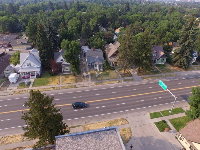
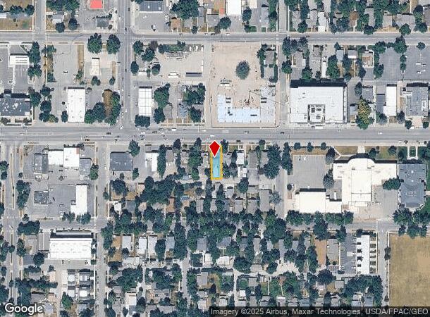
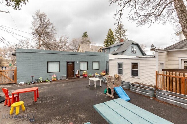
Property Record
520 W Main St, Bozeman, MT 59715
NEARBY LISTINGS FOR SALE OR LEASE
Property Detail
520 W Main St
Bozeman, MT
Story Add
06-0798-12-3-69-38-0000
STORY ADD, S12, T02 S, R05 E, BLOCK E, LOT 8, & W8' LOT 7
Commercialofficeresidentialmixeduse
Gallatin
X
Montana
30031C0816E
7,8
2025
0.11 AC
2025
Bozeman/Yellowstone Country
000800
Other Market Areas
2,043 SF
DEMOGRAPHICS near 520 W Main St
1 Mile
3 Mile
5 Mile
2024 Total Population
15,771
61,927
74,155
2029 Population
17,876
70,694
84,653
Pop Growth 2024-2029
+ 13.35%
+ 14.16%
+ 14.16%
Average Age
35
35
36
2024 Total Households
7,091
25,246
30,195
HH Growth 2024-2029
+ 14.29%
+ 15.09%
+ 15.03%
Median Household Inc
$61,598
$72,603
$80,293
Avg Household Size
2.00
2.30
2.30
2024 Avg HH Vehicles
2.00
2.00
2.00
Median Home Value
$693,335
$612,367
$618,764
Median Year Built
1973
2000
2002
Nearby Places
Map Layers
Map Styles
 Street
 Aerial
- Restaurants
- Banks
- Shops
- Fitness
- Groceries
PUBLIC TRANSPORTATION
AIRPORT
Bozeman Yellowstone International
DRIVE
WALK
Distance
Bozeman Yellowstone International
15 min
10.0 mi
Freight Ports
Port of Everett
DRIVE
WALK
Distance
Port of Everett
745 min
700.4 mi
SALE & LEASE HISTORY
LISTING DATE
SALE/LEASE

Jul 06, 2021
For Sale
Aug 24, 2017
For Sale
Nearby Properties
Address
Land Use
TOTAL SIZE
Lot Size
Zoning
Address
Land Use
TOTAL SIZE
Lot Size
Zoning
175,398 SF
34.43 AC
Address
Land Use
TOTAL SIZE
Lot Size
Zoning
15,099 SF
16.05 AC
Address
Land Use
TOTAL SIZE
Lot Size
Zoning
33,109 SF
9.89 AC
Address
Land Use
TOTAL SIZE
Lot Size
Zoning
67,716 SF
38.83 AC
Address
Land Use
TOTAL SIZE
Lot Size
Zoning
89,441 SF
0.46 AC
6
Address
Land Use
TOTAL SIZE
Lot Size
Zoning
214,283 SF
5.20 AC
Address
Land Use
TOTAL SIZE
Lot Size
Zoning
6,317 SF
9.14 AC
Address
Land Use
TOTAL SIZE
Lot Size
Zoning
23,325 SF
9.82 AC
Address
Land Use
TOTAL SIZE
Lot Size
Zoning
69,093 SF
8.96 AC
BP
Address
Land Use
TOTAL SIZE
Lot Size
Zoning
10,368 SF
6.75 AC
Address
Land Use
TOTAL SIZE
Lot Size
Zoning
8,100 SF
64.73 AC
Address
Land Use
TOTAL SIZE
Lot Size
Zoning
85,290 SF
7.82 AC
Address
Land Use
TOTAL SIZE
Lot Size
Zoning
20,118 SF
7.95 AC
Address
Land Use
TOTAL SIZE
Lot Size
Zoning
81,620 SF
10.65 AC
1
Address
Land Use
TOTAL SIZE
Lot Size
Zoning
85,052 SF
1.26 AC
6
Address
Land Use
TOTAL SIZE
Lot Size
Zoning
69,917 SF
0.68 AC
6
Address
Land Use
TOTAL SIZE
Lot Size
Zoning
259,349 SF
B2
Address
Land Use
TOTAL SIZE
Lot Size
Zoning
96,944 SF
0.44 AC
1
Address
Land Use
TOTAL SIZE
Lot Size
Zoning
149,599 SF
18.41 AC
Address
Land Use
TOTAL SIZE
Lot Size
Zoning
119,732 SF
7.32 AC
Address
Land Use
TOTAL SIZE
Lot Size
Zoning
7,552 SF
8.60 AC
Address
Land Use
TOTAL SIZE
Lot Size
Zoning
90,003 SF
17.01 AC
Address
Land Use
TOTAL SIZE
Lot Size
Zoning
11,639 SF
6.69 AC
Address
Land Use
TOTAL SIZE
Lot Size
Zoning
162,081 SF
4.95 AC
Address
Land Use
TOTAL SIZE
Lot Size
Zoning
19,938 SF
Address
Land Use
TOTAL SIZE
Lot Size
Zoning
90,347 SF
1.74 AC
5
Address
Land Use
TOTAL SIZE
Lot Size
Zoning
27,219 SF
10.11 AC
R3
Address
Land Use
TOTAL SIZE
Lot Size
Zoning
34,198 SF
5.30 AC
Address
Land Use
TOTAL SIZE
Lot Size
Zoning
128,745 SF
4.24 AC
Address
Land Use
TOTAL SIZE
Lot Size
Zoning
162.22 AC
The World's #1 Commercial Real Estate Marketplace
Connect with us
© 2025 CoStar Group
The information above has been obtained from sources believed reliable. While we do not doubt its accuracy we have not verified it and make no guarantee, warranty or representation about it. It is your responsibility to independently confirm its accuracy and completeness. Any projections, opinions, assumptions, or estimates used are for example only and do not represent the current or future performance of the property. The value of this transaction to you depends on tax and other factors which should be evaluated by your tax, financial, and legal advisors. You and your advisors should conduct a careful, independent investigation of the property to determine to your satisfaction the suitability of the property for your needs.