Property Record
520 W Park Rd, Leetsdale, PA 15056
NEARBY LISTINGS FOR SALE OR LEASE
Property Detail
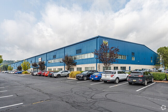
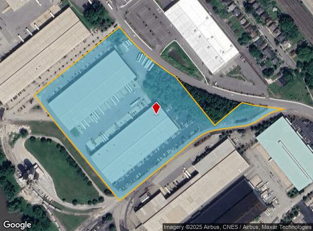
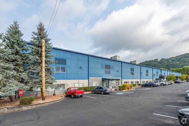
520 W Park Rd
Pittsburgh, PA
Leetsdale Industrial Ii Plan
0704-A-00150-0000-00
LEETSDALE INDUSTRIAL II PLAN NO 8 LOT 801 = 561.56 FRONTING WITH 14 TOTAL BEARINGS
Warehouse
Allegheny
AE
Pennsylvania
42007C0278D
150
2024
12.91 AC
2025
North Pittsburgh
448000
Pittsburgh
DEMOGRAPHICS near 520 W Park Rd
1 Mile
3 Mile
5 Mile
2024 Total Population
3,328
33,475
77,226
2029 Population
3,244
32,706
75,801
Pop Growth 2024-2029
(2.52%)
(2.30%)
(1.85%)
Average Age
42
41
42
2024 Total Households
1,389
13,573
32,956
HH Growth 2024-2029
(2.45%)
(2.42%)
(1.94%)
Median Household Inc
$69,398
$75,862
$70,897
Avg Household Size
2.40
2.30
2.20
2024 Avg HH Vehicles
2.00
2.00
2.00
Median Home Value
$190,531
$199,378
$187,401
Median Year Built
1948
1954
1957
Nearby Places
Map Layers
Map Styles
 Street
 Aerial
- Restaurants
- Banks
- Shops
- Fitness
- Groceries
PUBLIC TRANSPORTATION
AIRPORT
Pittsburgh International
DRIVE
WALK
Distance
Pittsburgh International
20 min
9.0 mi
Freight Ports
Port of Toledo
DRIVE
WALK
Distance
Port of Toledo
249 min
216.4 mi
Nearby Properties
Address
Land Use
TOTAL SIZE
Lot Size
Zoning
Address
Land Use
TOTAL SIZE
Lot Size
Zoning
6.24 AC
Address
Land Use
TOTAL SIZE
Lot Size
Zoning
2,364 SF
17.51 AC
Address
Land Use
TOTAL SIZE
Lot Size
Zoning
32,196 SF
13.61 AC
Address
Land Use
TOTAL SIZE
Lot Size
Zoning
15,134 SF
19.73 AC
Address
Land Use
TOTAL SIZE
Lot Size
Zoning
39.36 AC
Address
Land Use
TOTAL SIZE
Lot Size
Zoning
5.98 AC
Address
Land Use
TOTAL SIZE
Lot Size
Zoning
1,714 SF
64.43 AC
Address
Land Use
TOTAL SIZE
Lot Size
Zoning
22.20 AC
Address
Land Use
TOTAL SIZE
Lot Size
Zoning
11.19 AC
Address
Land Use
TOTAL SIZE
Lot Size
Zoning
8.33 AC
Address
Land Use
TOTAL SIZE
Lot Size
Zoning
65,338 SF
9.65 AC
Address
Land Use
TOTAL SIZE
Lot Size
Zoning
15.02 AC
Address
Land Use
TOTAL SIZE
Lot Size
Zoning
8,578 SF
50.54 AC
Address
Land Use
TOTAL SIZE
Lot Size
Zoning
74,461 SF
4.77 AC
Address
Land Use
TOTAL SIZE
Lot Size
Zoning
Address
Land Use
TOTAL SIZE
Lot Size
Zoning
5.61 AC
Address
Land Use
TOTAL SIZE
Lot Size
Zoning
17.84 AC
Address
Land Use
TOTAL SIZE
Lot Size
Zoning
48.77 AC
Address
Land Use
TOTAL SIZE
Lot Size
Zoning
28.20 AC
Address
Land Use
TOTAL SIZE
Lot Size
Zoning
Address
Land Use
TOTAL SIZE
Lot Size
Zoning
28.42 AC
Address
Land Use
TOTAL SIZE
Lot Size
Zoning
7.68 AC
Address
Land Use
TOTAL SIZE
Lot Size
Zoning
2.29 AC
Address
Land Use
TOTAL SIZE
Lot Size
Zoning
4,746 SF
3.73 AC
Address
Land Use
TOTAL SIZE
Lot Size
Zoning
10.46 AC
Address
Land Use
TOTAL SIZE
Lot Size
Zoning
153.95 AC
Address
Land Use
TOTAL SIZE
Lot Size
Zoning
24,790 SF
15.39 AC
Address
Land Use
TOTAL SIZE
Lot Size
Zoning
0.86 AC
Address
Land Use
TOTAL SIZE
Lot Size
Zoning
44.10 AC
The World's #1 Commercial Real Estate Marketplace
Connect with us
© 2026 CoStar Group
The information above has been obtained from sources believed reliable. While we do not doubt its accuracy we have not verified it and make no guarantee, warranty or representation about it. It is your responsibility to independently confirm its accuracy and completeness. Any projections, opinions, assumptions, or estimates used are for example only and do not represent the current or future performance of the property. The value of this transaction to you depends on tax and other factors which should be evaluated by your tax, financial, and legal advisors. You and your advisors should conduct a careful, independent investigation of the property to determine to your satisfaction the suitability of the property for your needs.