Property Record
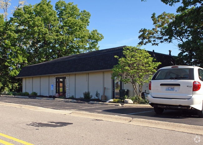
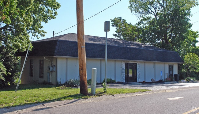
520 Watson Rd, Erlanger, KY 41018
NEARBY LISTINGS FOR SALE OR LEASE
Property Detail
520 Watson Rd
Cincinnati, OH-KY-IN
Kohorst
003-30-01-002.00
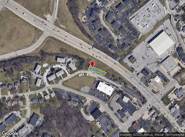
KOHORST PT LOTS 2-3-4 115'X 40.05' X 79.51'X 183.1'X 69.23' CORNER OF DONALDSON & WATSON
Officebuilding
Kenton
X
Kentucky
21037C0025E
2,3
2025
0.16 AC
2025
Cincinnati Intl Airport
064300
Cincinnati/Dayton
1,500 SF
DEMOGRAPHICS near 520 Watson Rd
1 Mile
3 Mile
5 Mile
2024 Total Population
10,680
64,214
138,801
2029 Population
10,944
66,456
143,650
Pop Growth 2024-2029
+ 2.47%
+ 3.49%
+ 3.49%
Average Age
39
40
40
2024 Total Households
4,556
26,326
55,546
HH Growth 2024-2029
+ 2.39%
+ 3.54%
+ 3.56%
Median Household Inc
$54,716
$63,923
$71,092
Avg Household Size
2.30
2.30
2.40
2024 Avg HH Vehicles
2.00
2.00
2.00
Median Home Value
$148,239
$183,364
$202,074
Median Year Built
1969
1975
1980
Nearby Places
Map Layers
Map Styles
 Street
 Aerial
- Restaurants
- Banks
- Shops
- Fitness
- Groceries
PUBLIC TRANSPORTATION
AIRPORT
Cincinnati/Northern Kentucky International
DRIVE
WALK
Distance
Cincinnati/Northern Kentucky International
16 min
5.6 mi
SALE & LEASE HISTORY
LISTING DATE
SALE/LEASE

May 16, 2018
For Sale
Nearby Properties
Address
Land Use
TOTAL SIZE
Lot Size
Zoning
Address
Land Use
TOTAL SIZE
Lot Size
Zoning
Address
Land Use
TOTAL SIZE
Lot Size
Zoning
600 SF
196.95 AC
Address
Land Use
TOTAL SIZE
Lot Size
Zoning
4,150.90 AC
Address
Land Use
TOTAL SIZE
Lot Size
Zoning
82.25 AC
Address
Land Use
TOTAL SIZE
Lot Size
Zoning
43.58 AC
Address
Land Use
TOTAL SIZE
Lot Size
Zoning
Address
Land Use
TOTAL SIZE
Lot Size
Zoning
70.34 AC
Address
Land Use
TOTAL SIZE
Lot Size
Zoning
157.77 AC
Address
Land Use
TOTAL SIZE
Lot Size
Zoning
20.38 AC
Address
Land Use
TOTAL SIZE
Lot Size
Zoning
20.52 AC
Address
Land Use
TOTAL SIZE
Lot Size
Zoning
19.61 AC
Address
Land Use
TOTAL SIZE
Lot Size
Zoning
475,250 SF
37.16 AC
Address
Land Use
TOTAL SIZE
Lot Size
Zoning
13.62 AC
Address
Land Use
TOTAL SIZE
Lot Size
Zoning
1,170 SF
41.17 AC
Address
Land Use
TOTAL SIZE
Lot Size
Zoning
56.94 AC
Address
Land Use
TOTAL SIZE
Lot Size
Zoning
12.85 AC
Address
Land Use
TOTAL SIZE
Lot Size
Zoning
769,604 SF
14 AC
Address
Land Use
TOTAL SIZE
Lot Size
Zoning
Address
Land Use
TOTAL SIZE
Lot Size
Zoning
30.11 AC
Address
Land Use
TOTAL SIZE
Lot Size
Zoning
24.80 AC
Address
Land Use
TOTAL SIZE
Lot Size
Zoning
64,481 SF
16.99 AC
Address
Land Use
TOTAL SIZE
Lot Size
Zoning
177,200 SF
16.27 AC
Address
Land Use
TOTAL SIZE
Lot Size
Zoning
24.28 AC
Address
Land Use
TOTAL SIZE
Lot Size
Zoning
157,520 SF
18.05 AC
Address
Land Use
TOTAL SIZE
Lot Size
Zoning
50,536 SF
34.12 AC
Address
Land Use
TOTAL SIZE
Lot Size
Zoning
57,030 SF
7 AC
Address
Land Use
TOTAL SIZE
Lot Size
Zoning
16,406 SF
223.20 AC
Address
Land Use
TOTAL SIZE
Lot Size
Zoning
Address
Land Use
TOTAL SIZE
Lot Size
Zoning
85,726 SF
15.07 AC
Address
Land Use
TOTAL SIZE
Lot Size
Zoning
78,848 SF
6.82 AC
The World's #1 Commercial Real Estate Marketplace
Connect with us
© 2026 CoStar Group
The information above has been obtained from sources believed reliable. While we do not doubt its accuracy we have not verified it and make no guarantee, warranty or representation about it. It is your responsibility to independently confirm its accuracy and completeness. Any projections, opinions, assumptions, or estimates used are for example only and do not represent the current or future performance of the property. The value of this transaction to you depends on tax and other factors which should be evaluated by your tax, financial, and legal advisors. You and your advisors should conduct a careful, independent investigation of the property to determine to your satisfaction the suitability of the property for your needs.